Kongde on the Map: Where the Ridge Sits in Nepal’s Everest Region
Kongde sits in the Solukhumbu district in eastern Nepal, within the Khumbu Pasang Lhamu rural municipality and inside Sagarmatha National Park, the UNESCO World Heritage area around Everest. To find it on a map, locate Namche Bazaar, the Sherpa capital at 3,440 meters, and look west-southwest. The ridge rises there, directly beneath the walls of Kongde Ri, a peak also spelled Kwangde on older maps and in climbing records.
Kongde lies on the opposite side of the compass from the route most trekkers follow. The Everest Base Camp route leaves Namche heading northeast toward Tengboche and Dingboche, while Kongde stands to the west-southwest, above the Bhote Koshi valley leading up to Thame. Most Base Camp trekkers meet it only as a jagged skyline above Namche’s rooftops or through the windows of Everest View Hotel.
As the crow flies, the distance is surprisingly short: Kongde Ri stands less than ten kilometers from Namche. Walking is another matter. The route first drops to cross the Bhote Koshi, continues up the valley to Thame, the nearest village, and only then climbs to the ridge, which is why reaching Kongde from Namche takes two walking days.
A few anchor points make the map easier to read. Lukla, the gateway airstrip at 2,840 meters, lies downvalley to the south, with Phakding and Namche following along the Dudh Koshi. Thame sits further up the Bhote Koshi valley, and Kongde, at 4,250 meters, stands roughly 800 meters above Namche, facing the Khumbu across the valley. No road reaches it, so almost every visit is made on foot.
Ridge, Lodge, or Peak? Three Things People Mean by “Kongde”
Search for Kongde and the word points to three different things at once, which explains why directions, photographs, and altitudes so often seem to disagree. Sorting them out takes a minute and saves real confusion when planning a trip.
The ridge. In everyday trekking language, Kongde is a high, grassy shelf at 4,250 meters, west-southwest of Namche Bazaar, facing the Khumbu across the valley. It is a place rather than a summit: open ground where the route from Thame arrives after a long climb and where Everest, Lhotse, Ama Dablam, and Thamserku line up on the skyline.
The lodge. On the ridge stands a comfort lodge, effectively the only place to sleep, which is why trekkers often say “staying at Kongde” and mean the building itself. For practical purposes, the lodge is the village: dinner, hot water, a warm room, and the terrace where the view begins at breakfast.
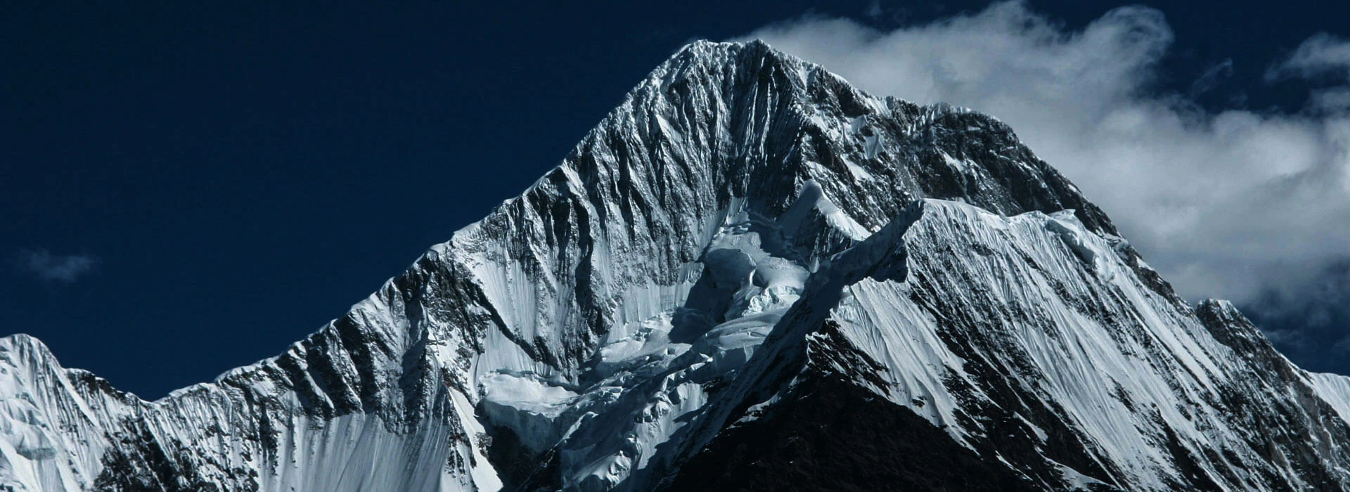
The peak. Above both rises Kongde Ri, also spelled Kwangde Ri, a multi-summit massif whose highest point reaches 6,187 meters in most references. It is classed as a trekking peak on paper, yet it is steep, technical, and demanding, and climbing it takes a permit and real mountaineering skill. Walking to Kongde never involves climbing it; the peak simply stands overhead.
Itineraries add one more name: Farak Ri, the viewpoint above the ridge used for the sunrise hike, at around 5,000 meters. Farak Ri is a walk, not a climb, and it belongs to the ridge rather than to the peak.
A simple decoder helps with the rest of the internet. Read “Kongde trek” as the walk to the ridge and the lodge, “Kongde Ri climb” as a mountaineering expedition, and “Kongde” on its own as the ridge. Keep the three straight, and the map falls into place: the ridge is where the walk ends, the lodge is where you sleep, and the peak is what you look up at.
How Far Is Kongde From Everest? Distances Compared With Base Camp, Namche, and Lukla
Kongde feels remote, yet it sits closer to the busy heart of the Khumbu than most people expect. Measured in a straight line from the Kongde Ri massif, Namche Bazaar lies about 8 kilometers away (5 miles), the Lukla airstrip about 15 kilometers (9 miles), Everest Base Camp about 31 kilometers (19 miles), and the summit of Everest about 35 kilometers (22 miles). The ridge lodge sits within a few kilometers of those figures, a little nearer to Everest than the peak itself.
Straight-line numbers flatter the route because the Khumbu is a landscape of deep valleys and steep ridges. Lukla is under 15 kilometers away as the crow flies, yet walking from the airstrip to Kongde takes four days and about 22 hours of walking, with a rest day in Namche for acclimatization. Namche itself, less than 8 kilometers away, takes two walking days, about 12 hours in total, because the route drops to the Bhote Koshi, runs up the valley to Thame, and only then climbs to the ridge.
Everest Base Camp is a different kind of distance. The walk from Lukla runs more than 60 kilometers one way, and a standard schedule typically reaches Base Camp on about the eighth day on the mountain, while Kongde arrives on the fifth. Altitude tells the same story: Kongde, at 4,250 meters, sits roughly 1,100 meters below Base Camp, about 810 meters above Namche, and 1,410 meters above Lukla.
Distance from Everest does not mean distance from the view. At about 35 kilometers, Everest stays distant but unmistakable from the ridge, framed with Lhotse, Ama Dablam, and Thamserku. A Base Camp trekker gets close to a single mountain, while a Kongde traveler stays back and sees the whole range.
The Road to Kongde Has No Road: Four Walking Days From Lukla
No road reaches Kongde. Every approach begins at Lukla, and the walk to the ridge takes four walking days, with a rest day in Namche Bazaar placed in the middle for acclimatization. Altitude climbs in steady steps, and the scenery changes with each one.
Day 3: Lukla to Phakding, about 3 hours. The flight from Kathmandu takes 35 minutes, though in peak season it departs from Ramechhap after an early drive. From the airstrip at 2,840 meters, the path follows the Dudh Koshi River down to Phakding at 2,610 meters, an easy first walk through pine forest and past prayer walls.
Day 4: Phakding to Namche Bazaar, about 7 hours. The longest climb of the early days. The route passes Monjo, where Sagarmatha National Park begins, crosses the Hillary Suspension Bridge, and ends with a steep ascent into Namche at 3,440 meters, a gain of about 830 meters over the day.
Day 5: Rest day in Namche. A short acclimatization hike of about four hours climbs above town and returns to the same lodge, following the climb-high, sleep-low rule.
Day 6: Namche Bazaar to Thame, about 5 hours. Here the route leaves the Everest Base Camp crowds behind. It drops to the Bhote Koshi, then follows the valley to Thame at 3,735 meters, a net gain of about 295 meters, with a dip and a re-climb along the way.
Day 7: Thame to Kongde, about 7 hours. The hardest day. The route leaves the river and climbs through forest to the ridge at 4,250 meters, a net gain of about 515 meters, finishing at the lodge facing the Khumbu.
By evening on Day 7, the walk has climbed from 2,840 to 4,250 meters in four walking days, never rushing the altitude and never touching a road. What waits at the end is the skyline.
What You Can See From Kongde: A Skyline Guide, Peak by Peak
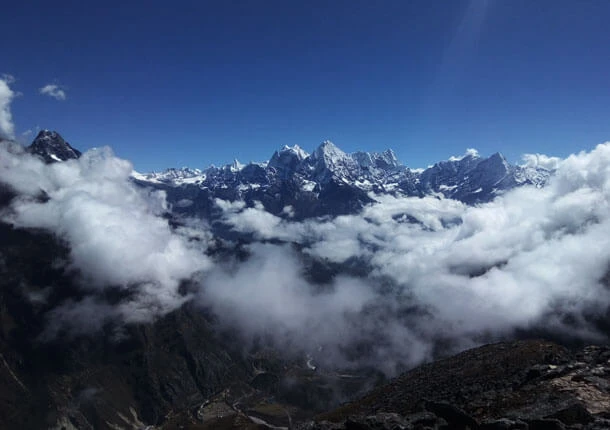
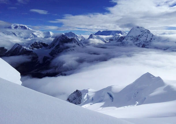
From the lodge terrace and the ridge above it, the Khumbu opens as a map unfolded. Knowing which summit is which turns a wall of white into a set of old acquaintances. Here is the skyline, from the biggest names to the supporting cast.
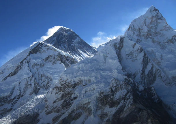
Everest, 8,849 meters. The highest mountain on earth appears as a dark pyramid rising behind the Lhotse-Nuptse wall, often trailing a plume of wind-blown snow from its upper flanks. From Kongde, at roughly 35 kilometers, it reads as one peak in a great crowd rather than the center of the picture, and the crowd around it is what makes the view so striking.
Lhotse, 8,516 meters, and Nuptse, 7,861 meters. The wall in front of Everest. Nuptse’s long, jagged ridge forms the foreground, with Lhotse, the fourth-highest mountain on Earth, standing at its shoulder. Together they act as a screen, and Everest peers over the top.
Ama Dablam, 6,812 meters. The crowd favorite. Its sharp pyramid and outstretched ridges give the mountain its famous profile, and the hanging glacier on its flank, the dablam, gives it its name. From the ridge, it stands almost alone against the sky, as photogenic as its reputation promises.
Thamserku, 6,608 meters, and Kangtega. A long, serrated pair rising across the valley, with a hanging glacier clinging to Kangtega’s face. Their jagged outlines supply the drama that balances Ama Dablam’s elegance.
Cholatse, Taboche, and Kusum Kanguru. The supporting cast, filling the gaps along the skyline. Individually, they would anchor the view in most mountain ranges; here they frame the giants.
Cho Oyu, Makalu, and Gyachung Kang. On the clearest days, operators report distant peaks appearing on the horizon, including two more of the world’s 8,000-meter giants, Cho Oyu and Makalu. Treat them as a bonus rather than a promise.
Kongde Ri, behind you. Turn around, and the massif itself fills the sky, a wall of ice and dark rock with the ridge sitting at its foot.
Early mornings give the clearest air before cloud builds along the valley, and a guide can point out each summit. After a night or two on the ridge, the names start to stick.
A Lake Below the Ridge: Kongde’s Sacred Water
Few mountain stays hold a surprise as quiet as Kongde Lake. Tucked into the high ground around Kongde Ri, it is a small stretch of turquoise water that mirrors the surrounding peaks, and operators who know the area describe it as sacred. Few trekkers on the main Khumbu routes ever hear of it.
In Nepal, high lakes have long carried spiritual weight. Gosaikunda draws Hindu and Buddhist pilgrims every August, and the Gokyo Lakes are revered by both faiths. A lake described as sacred below Kongde Ri belongs to the same tradition, and it fits the mountain above it, which Khumbu settlers have long regarded as holy.
The appeal here is stillness rather than spectacle. On a calm day, the water can hold the snow peaks in reflection, and wind is often the only sound. After the climb to the ridge, the lake offers the opposite of a summit view: something to sit beside rather than something to reach.
Operators include a walk to Kongde Lake during longer stays at Kongde Lodge, and time and weather decide whether it fits a given trip. A guide can say whether the lake is reachable on your dates and which route leads there. As at any sacred lake, walking quietly and keeping the water clean is the right courtesy.
Flying In: How Kathmandu, Lukla, and Ramechhap Fit Into the Journey
Every route to Kongde begins in the air. Lukla’s Tenzing-Hillary Airport, a short runway cut into a mountainside at 2,840 meters, is the gateway to the whole Khumbu, and the journey from Kathmandu follows one of three patterns depending on the season.
Direct from Kathmandu. Outside the busiest months, flights leave Tribhuvan International Airport in the early morning and reach Lukla in roughly 30 to 35 minutes. No road transfer is needed, and the plan runs exactly as written: fly, land, and walk to Phakding the same morning.
Via Ramechhap in peak season. In spring, from mid-March to mid-May, and in autumn, from late September to late November, most Lukla flights depart from Manthali Airport in Ramechhap, about 130 kilometers east of Kathmandu, to ease congestion at Tribhuvan’s single runway. Travelers leave their Kathmandu hotel around 1 to 2 AM, drive 4 to 5 hours along the BP Highway, and board a flight of just 15 to 20 minutes. It makes for a long first morning, yet the walk from Lukla to Phakding is short and gentle, so the schedule recovers by afternoon.
By helicopter. Operators offer charter helicopter flights from Kathmandu to Lukla, weather permitting, which avoids the night drive entirely. Travelers often keep a helicopter as a backup when delays hit, and some itineraries even use one for the final leg to Kongde itself.
Weather rules everything. Lukla flights operate under visual flight rules, so low cloud or strong wind can pause departures for hours or days, and mornings offer the clearest windows. A spare day at the end of the trip, or flexibility on the way out, is the cheapest protection against delays. On the return, the same arrangements run in reverse: a flight from Lukla to Kathmandu or, in peak season, to Ramechhap, followed by the drive back to the capital.
Once the plane touches down on the short mountain runway, the rest of the journey is on foot, with the ridge four walking days away.
What Reaches Kongde and What Does Not: Signal, Power, and Help on the Ridge
Kongde feels like the edge of the map, and in many ways it is, yet the lodge on the ridge is built for the conditions. Kongde Lodge is the highest of the Mountain Lodges of Nepal properties, at around 4,250 meters, with roughly twenty rooms, heated beds, and en-suite bathrooms with hot showers. Knowing what arrives on the ridge and what does not makes packing and planning easier.
Power. The Everest region runs mostly on hydroelectricity and solar panels, and hot water follows the same sources, with solar heaters backed up by gas. On rare days, usually after long cloud cover, hot water may be limited. A power bank is still wise because charging capacity depends on the weather and on how many travelers share the lodge.
Signal. Mobile coverage is dependable around Lukla, Phakding, and Namche Bazaar, then grows weaker and less consistent as the altitude rises. Ncell and Nepal Telecom both work in patches, and many trekkers find Nepal Telecom steadier higher up. At Kongde, the lodge’s Wi-Fi is the realistic connection, and it is worth treating as a bonus rather than a promise, with slower speeds and occasional gaps when the weather turns.
Cash. ATMs are reliable only as far as Namche Bazaar, so carry enough cash from there for bottled drinks, tips, and small extras on the ridge.
Help. No road reaches Kongde, and no hospital stands on the ridge. The safety net is the guide, the lodge staff, and, in serious cases, a helicopter. Evacuation for altitude problems is rare, yet it does happen, which is why a policy covering emergency evacuation is part of the packing list rather than an optional extra.
Almost everything on the ridge arrives on a porter’s back, by helicopter, or from the sun, and the lodge’s comforts reflect the effort. Pack for a place where patience matters as much as gear.
Neighbors on the Ridge: Thame, Khumjung, and Everest View Hotel Within Reach
Kongde has few neighbors, and the nearest is a long day’s walk away: the lodge sits seven or eight hours from the next settlement. Even so, a handful of well-loved places lie within reach on the same journey, each a short detour from Namche Bazaar or Thame.
Thame, seven hours below. The last village before the ridge is a cluster of stone houses at the head of the Bhote Koshi valley, and the overnight stop is on Day 6. Its monastery, its climbing families, and its calm make it the ridge’s true neighbor and the one most travelers remember.
Namche Bazaar, across the valley. The Kongde massif stands directly across the valley from Namche, so the ridge can be spotted from the town’s amphitheater of streets. On Saturday mornings, a weekly market spreads across terraces on the eastern edge of town, with villagers from across the valley trading until about 9 AM, and above Namche, the national park museum tells the story of Sherpa culture and mountaineering history.
Khumjung and Khunde. Both villages sit in a broad, tranquil valley, a world away from Namche’s steep streets. Khumjung holds the Hillary School, founded by Sir Edmund Hillary in 1961, and a monastery said to house a yeti scalp, while neighboring Khunde has the hospital Hillary also helped fund.
Everest View Hotel, 3,880 meters. Opened in 1971 at Syangboche, the hotel was listed by Guinness World Records in 2004 as the world’s highest hotel. Its terrace faces Everest, Lhotse, and Ama Dablam and looks back across the valley toward Kongde Ri. A typical acclimatization hike from Namche reaches Khumjung and the hotel in a morning, making it the easiest introduction to the neighborhood.
Seen together, the neighbors tell a story: a market town, a school village, a hotel above the clouds, and a monastery village at the head of the valley, with Kongde standing alone at the far end. The ridge keeps few neighbors, and Everest, the most famous of them all, appears in the window every morning.
Clearest Months for Finding Kongde on a Cloudless Day
Kongde is a place to look from as much as a place to stand on, so the best months are the ones when the skyline shows. Clear air matters more than warm air here, and the calendar divides neatly into seasons when the ridge opens up and seasons when it hides.
October and November are the sharpest months. The monsoon has washed the haze from the valleys, the air is dry, and the peaks stand against a deep blue sky from dawn onward. Nights at 4,250 meters are cold, yet mornings are usually calm and bright. April and early May come next: warmer days, longer light, and flowering rhododendrons below Namche, with afternoon cloud and haze more common than in autumn, so early starts pay off. September and March are the shoulder months, clearing or warming but less reliable.
December is crisp and quiet, with cold, clear skies and far fewer visitors, though nights on the ridge are harsh. January and February bring deeper cold and snow, and flights to Lukla become less predictable. June to August is the monsoon, when clouds hide the very skyline Kongde is known for.
One habit improves the odds in every season: look early. Cloud tends to build along the valleys as the day warms, so the clearest view of Everest, Lhotse, and Ama Dablam often arrives at sunrise, with the afternoon holding the second-best light. The seasonal picture here stays short on purpose, and the Everest Kongde View trek page covers the same months in more depth, along with packing for the cold.
Once You Know Where Kongde Is, the Khumbu Looks Different
Where is Kongde? The short answer fits in a sentence: a high ridge in Solukhumbu, west-southwest of Namche Bazaar, at 4,250 meters, beneath a 6,187-meter peak of the same name. The longer answer is worth carrying home. Kongde sits on the quiet side of the Everest region’s map, four walking days from the Lukla runway, facing the whole Khumbu across a valley.
Along the way, the map fills in. A short runway cut into a mountainside, a river path to Phakding, the climb to Namche, the stone village of Thame, the ridge, the lodge, the lake below, and a skyline of Everest, Lhotse, Nuptse, Ama Dablam, and Thamserku. Each stop adds a detail that changes how the next one looks.
Most trekkers see Kongde Ri only as a jagged line above Namche’s rooftops and never learn its name. Those who walk to the ridge learn it and see the Khumbu from the other side: the Base Camp route is small and distant, the giants are lined up in the window, and there is a night sky with more stars than seem possible. Once you know where Kongde is, the famous half of the Everest region looks different, and the quiet half begins to feel like a place worth returning to.
Ready to see the ridge for yourself? The full 12 day Kongde itinerary, with daily altitudes, walking times, and lodges, is waiting on the Everest Kongde View trek page.