Where Renjo La Pass Sits and What Makes It So High
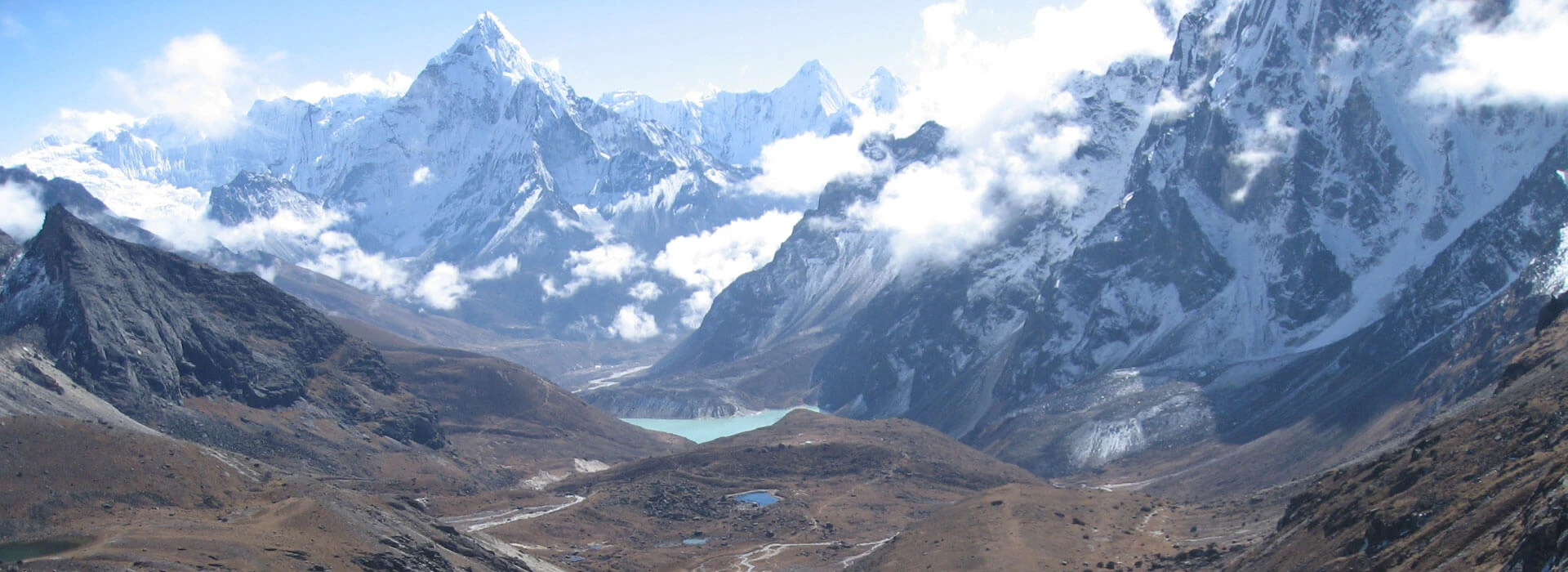
At 5,360m (17,585ft), Renjo La Pass is the highest point in a thin ridge that separates the Gokyo Valley and the far-westerly Bhote Koshi Valley. The pass lies in the Khumbu region of north-eastern Nepal, near the Tibetan border, and bridges the turquoise lake system of Gokyo village and the oldest and most important Sherpa village in all of the Everest region, Thame.
Renjo La is the western most of Everest's three great passes, along with Cho La and Kongma La to the east. The pass itself is a great, broad, rocky saddle between the flanks of two mountains, but its summit is almost as high as EBC, and the route itself goes through the less frequented western route of the Khumbu.
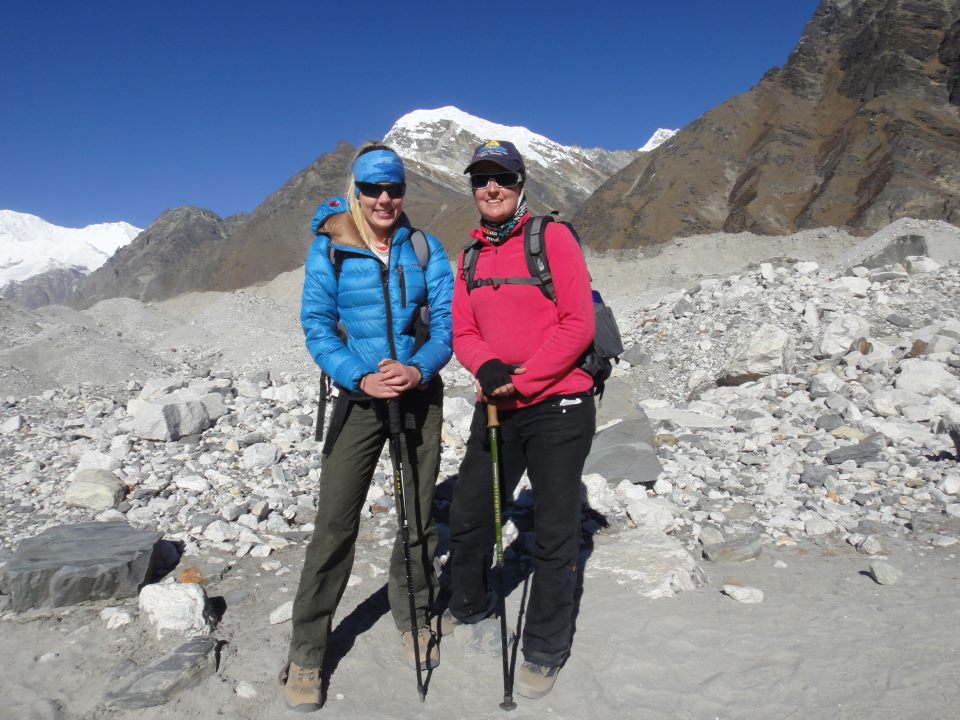
At this height, oxygen levels are approximately 50% of sea level, which is why it's important to come prepared for crossing Renjo La, not just on sightseeing trips. Being exposed along the ridgeline, wind funnels through the gap, often making the summit seem much colder than the surrounding lowlands, even in clear, sunny weather.
Those arriving from Gokyo usually take days to acclimatise to the pass via Namche Bazaar, Dole and Machhermo whilst those coming from the Thame side take a much harder route up from Lungden. Both lead to the same small peak up close, where the four highest summits of the world peek out all at once from a clear, unobstacled horizon.
What You See from the Top of Renjo La Pass
From the summit of Renjo La Pass, the view is worth any hard climb, with a 360 degree panorama that is not seen anywhere else in the Everest region. The mountain of Everest itself stands clearly as a prominent feature on the eastern horizon, flanked by Lhotse and Nuptse, and further away in the distance stands the pyramid shape of Makalu: all the mountains are clearly visible from one standing point.
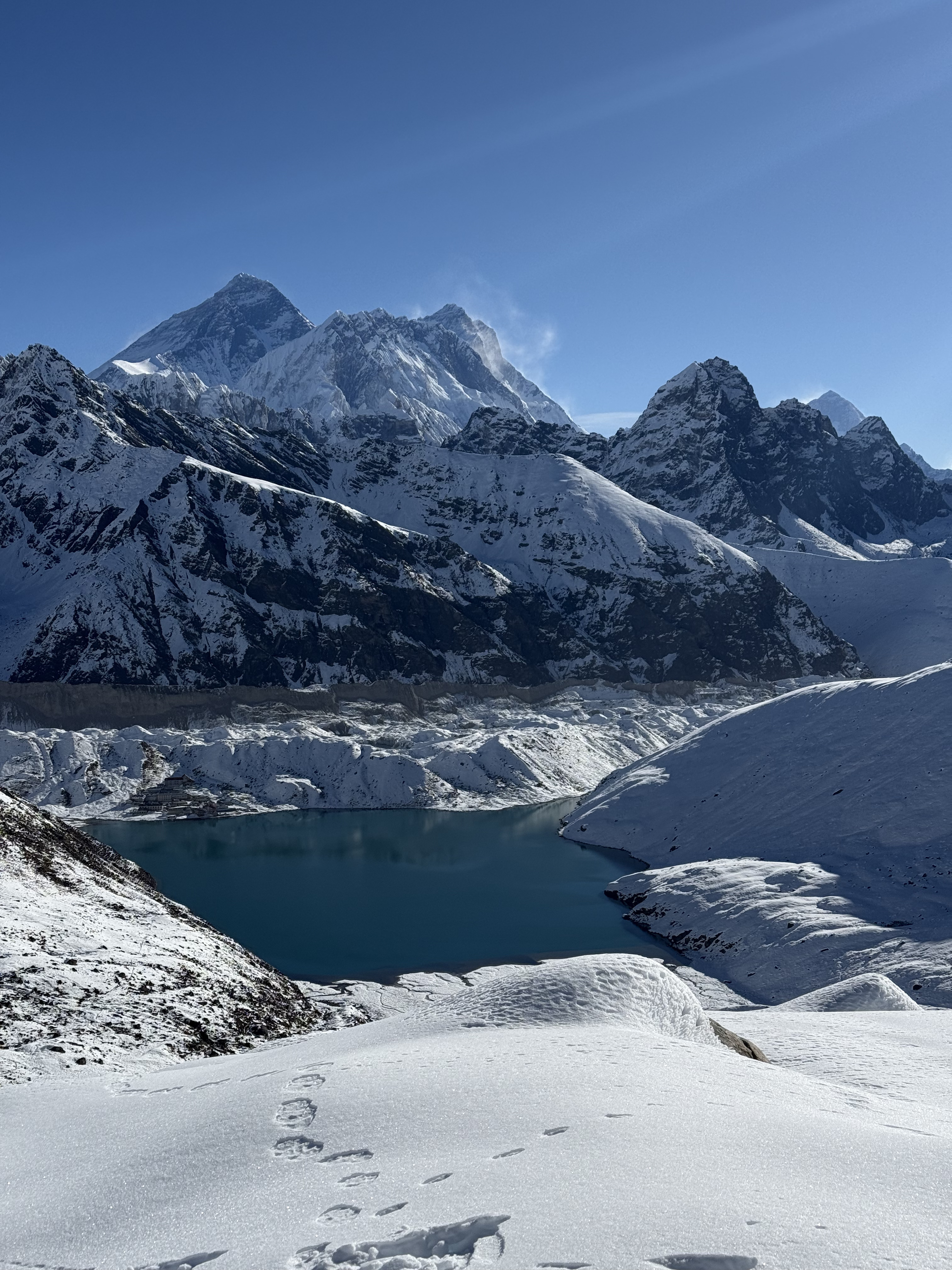
From the western side, it is possible to see the massive and glacier-clad Cho Oyu posing near the horizon, seemingly within reach in the midst of the world's fourteen tallest mountains. The steep, technical look of Kyajo Ri forms the backdrop to the area, a distant 6,186m peak that appeals to technical climbers looking for less activity than the busier trekking peaks in the area. To the north, the terrain rolls out toward the Tibetan plateau, a stark and arid contrast to the areas of green valley which you are leaving as you ascend.
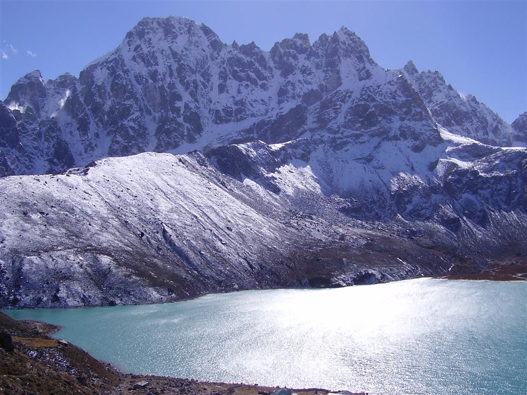
The Gokyo Lakes lie here like a sea of milky blue turquoise reflecting the light of the day over a dramatic landscape of the Ngozumpa glacier running along the valley floor. Then, as you turn to face Thame, the landscape changes in a dramatic way, showing you the more tranquil Bhote Koshi valley and the far distant rooftops of one of the oldest Sherpa settlements in the Khumbu, far down the valley from the ridge you are on.
Renjo La Pass Difficulty: What to Really Expect
The Renjo La Pass difficulty level is moderate to challenging and requires physical fitness and acclimatisation rather than technical climbing skills or mountaineering experience. At 5,360 meters, you are almost at sea level with Everest Base Camp, where you will find oxygen levels at about half what they are at sea level; thus, distance and technical terrain are not the greatest challenge; rather, it is the altitude.
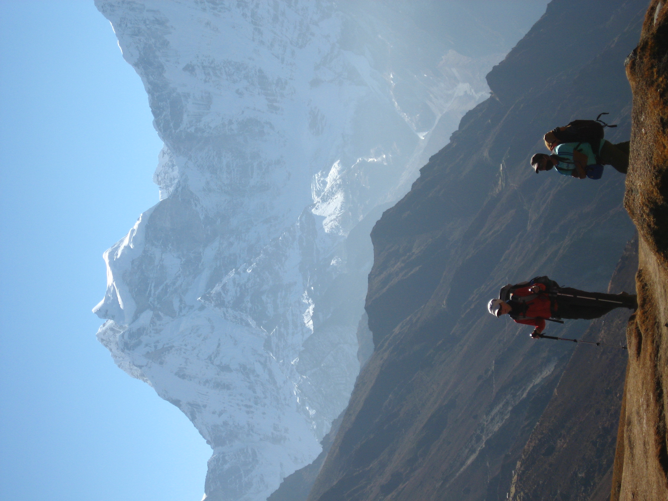
Your legs bear the physical weight of the climb itself, particularly on the last stretch from Lungden or Gokyo, where steep, rocky switchbacks challenge endurance already drained from days of high altitude trekking. There is always the risk of slippery footing near the summit from loose scree, and at times snow patches and sudden changes in the weather can make a clear morning turn into a windy, disorienting climb in hours, giving an element of reality to an already challenging day.
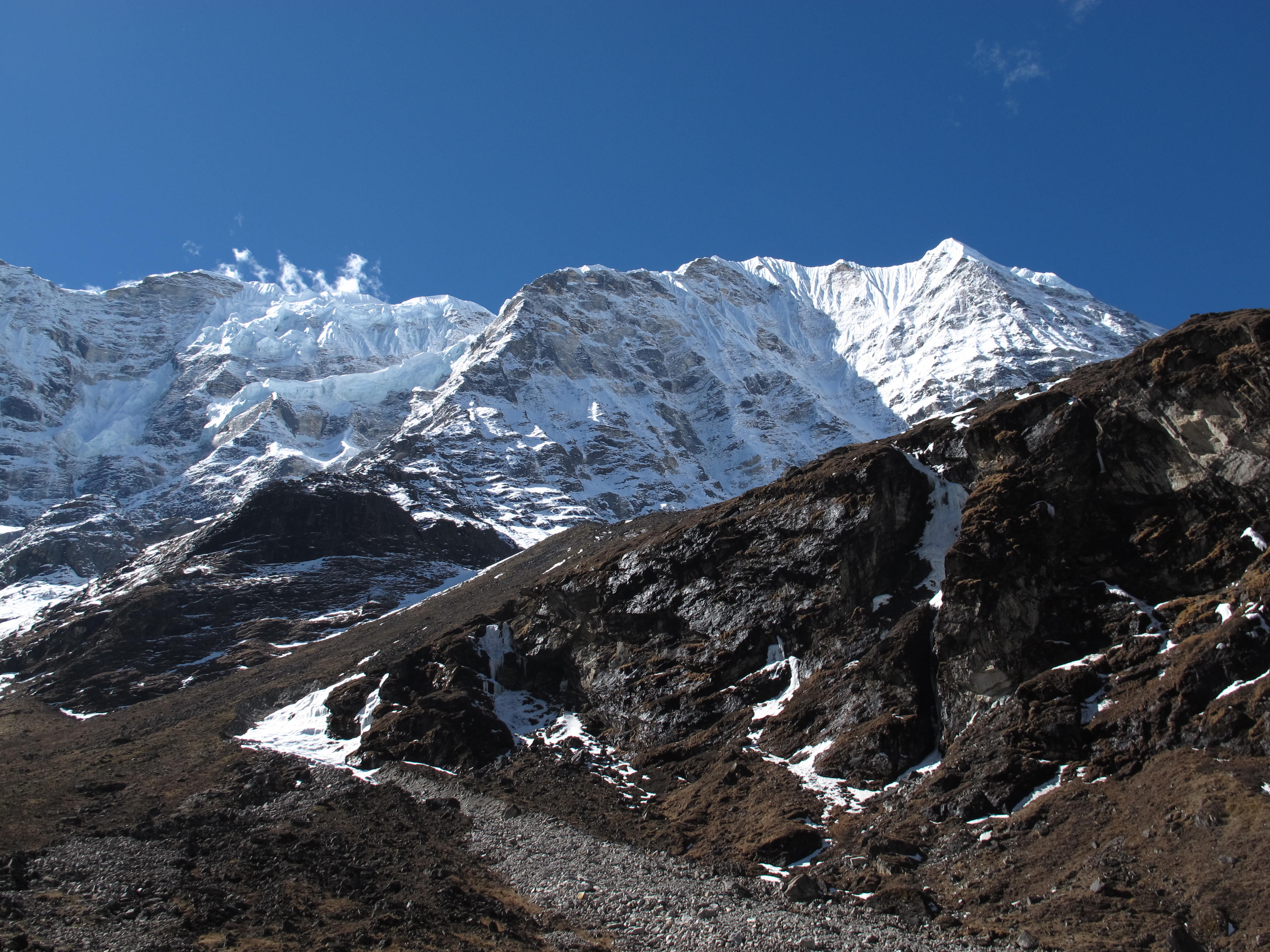
Renjo La is not the most technically demanding of the three high passes on Everest, as it is less exposed than Cho La and Kongma La, and its trail is less difficult. However, this is not simple, as crossing day is usually a five to seven-hour walk through the rugged mountain landscape involving some sustained efforts that may start before dawn to avoid afternoon wind and cloud cover near the summit.
It is as important to be mentally strong as it is physically strong in the face of the challenge of Renjo La. It is easy to get tired at this altitude, and if the trekker tries to reach such heights too quickly without devoting the necessary acclimatisation days in advance, he is liable to suffer from some of the following symptoms: mild headache; serious altitude sickness. But the best way to deal with the real physical challenge of the pass, while still enjoying the reward that awaits you at the top, is to travel with an experienced guide who keeps a close eye on pacing and symptoms.
There are few areas in the Himalayas that have as much visual pay-off at a single location. The bird's eye perspective of the mountain is breathtaking, especially for photographers and trekkers who can capture multiple peaks all at once, with prayer flags flapping at the summit and the sound of glaciers shifting echoing off the rock walls in silence, only to be interrupted by the occasional crack of glacial ice far below.
Renjo La from Both Directions: Gokyo Side vs Thame Side
The Renjo La from both sides is quite different as it links two very contrasting valleys in the Khumbu. The Gokyo side is the easier route to the pass as you acclimatise overnight by the turquoise lakes before the final climb up to the summit ridge.
If you're coming from Thame, it changes the game of the terrain quite a bit. The trek up from Lungden is longer and steeper, and into thinner air, and it is often not the same advantage gained by spending additional nights higher up in the mountains at Gokyo. This way is best for trekkers who want to make a full clockwise trip around the western valleys of the Khumbu, not for those looking for the easiest possible way.
After crossing over from the Gokyo route, you're on a different cultural journey as you descend into Thame. Before heading back up to Namche Bazaar on the main trail, Thame is one of the oldest Sherpa villages in the entire region, featuring a centuries old monastery, as well as the birthplace of several legendary Everest hikers.
Renjo La is sometimes traversed as part of a much more challenging expedition, such as the Great Himalayan Trail Trek and Everest Three Peaks Climbing, which includes attempts on the summit of Lobuche, Cho La, Kongma La, and a traversal of Renjo La, Cho La, and Kongma La.
Thame Side Itinerary (Standard Direction, 14 Days)
Day 1: Kathmandu Arrival (4,462 ft / 1,360 m)
Day 2: Kathmandu Sightseeing Tour (4,462 ft / 1,360 m)
Day 3: Fly to Lukla, Trek to Phakding (9,383 ft / 2,860 m to 8,701 ft / 2,652 m)
Day 4: Phakding to Namche Bazaar (11,286 ft / 3,440 m)
Day 5: Acclimatization Day in Namche Bazaar (11,286 ft / 3,440 m)
Day 6: Namche Bazaar to Thame (12,533 ft / 3,820 m)
Day 7: Thame to Lungden (14,764 ft / 4,500 m)
Day 8: Lungden to Renjo La Pass, Trek to Gokyo (17,585 ft / 5,360 m to 15,715 ft / 4,790 m)
Day 9: Explore Gokyo Ri (17,575 ft / 5,357 m)
Day 10: Gokyo to Machhermo, Trek to Dole (14,436 ft / 4,400 m to 15,387 ft / 4,690 m)
Day 11: Dole to Namche Bazaar (11,286 ft / 3,440 m)
Day 12: Namche Bazaar to Monjo, Trek to Lukla (9,383 ft / 2,860 m)
Day 13: Fly Lukla to Kathmandu (4,462 ft / 1,360 m)
Day 14: Kathmandu Final Departure
Gokyo Side Itinerary (Reverse Direction, 14 Days)
Day 1: Kathmandu Arrival (4,462 ft / 1,360 m)
Day 2: Kathmandu Sightseeing Tour (4,462 ft / 1,360 m)
Day 3: Fly to Lukla, Trek to Phakding (9,383 ft / 2,860 m to 8,701 ft / 2,652 m)
Day 4: Phakding to Namche Bazaar (11,286 ft / 3,440 m)
Day 5: Acclimatization Day in Namche Bazaar (11,286 ft / 3,440 m)
Day 6: Namche Bazaar to Dole (15,387 ft / 4,690 m)
Day 7: Dole to Machhermo (14,436 ft / 4,400 m)
Day 8: Machhermo to Gokyo (15,715 ft / 4,790 m)
Day 9: Explore Gokyo Ri (17,575 ft / 5,357 m)
Day 10: Gokyo to Renjo La Pass, Trek to Lungden (17,585 ft / 5,360 m to 14,764 ft / 4,500 m)
Day 11: Lungden to Thame (12,533 ft / 3,820 m)
Day 12: Thame to Namche Bazaar (11,286 ft / 3,440 m)
Day 13: Namche Bazaar to Monjo, Trek to Lukla (9,383 ft / 2,860 m)
Day 14: Fly Lukla to Kathmandu, Final Departure (4,462 ft / 1,360 m)
Choosing between the two comes down to acclimatization preference rather than difficulty alone. The Thame side climbs directly toward the pass after a shorter build-up, while the Gokyo side spends extra nights near the lakes beforehand, giving your body more time to adjust before the demanding crossing itself.
The Story Behind Renjo La Pass
Renjo La Pass has a history of more than 1000 years, before the time of trailers, that goes back to the prehistoric trade routes between Tibet and the Khumbu area of Nepal. Sitting near the historic Nangpa La Pass, a higher crossing at 5,806 meters once used extensively by Tibetan traders, Renjo La formed part of a broader corridor where yak caravans carried salt, wool, and grain between the two regions long before tourism ever reached these valleys.
The Sherpa communities themselves have followed the same migration route, arriving from Tibet in the Khumbu about 500 years ago, looking for more hospitable territory than the hard Tibetan plateau. Today, walking near Renjo La is a journey back to the past - not just for the Sherpas and Tibetan traders who walked that way for cultural exchange and survival but also for many generations of pilgrims who walked down that path to seek spiritual renewal.
For decades, this area of the Khumbu was largely restricted to visitors from outside and only began to be open to trekkers more recently due to the sensitivity of the border with Tibet. That distant history is the reason that Renjo La remains quiet and isolated even now, compared to the more frequented Everest Base Camp trail.
Now, perched on top of the pass, prayer flags and silence swirl with you; this place, once known for trade and migration, is now known instead for offering one of the most rewarding mountain panoramic views in the Himalayas.
Renjo La Pass vs Cho La Pass vs Kongma La: Comparing the Three High Passes
Renjo La Pass vs Cho La Pass vs Kongma La comes up constantly among trekkers deciding which high-altitude crossing suits their fitness level and travel goals within the Everest region. All three passes exceed 5,300 meters and form the legendary Everest Three Passes circuit, yet each carries distinct terrain, technical demands, and reward views, setting it apart from the other two.
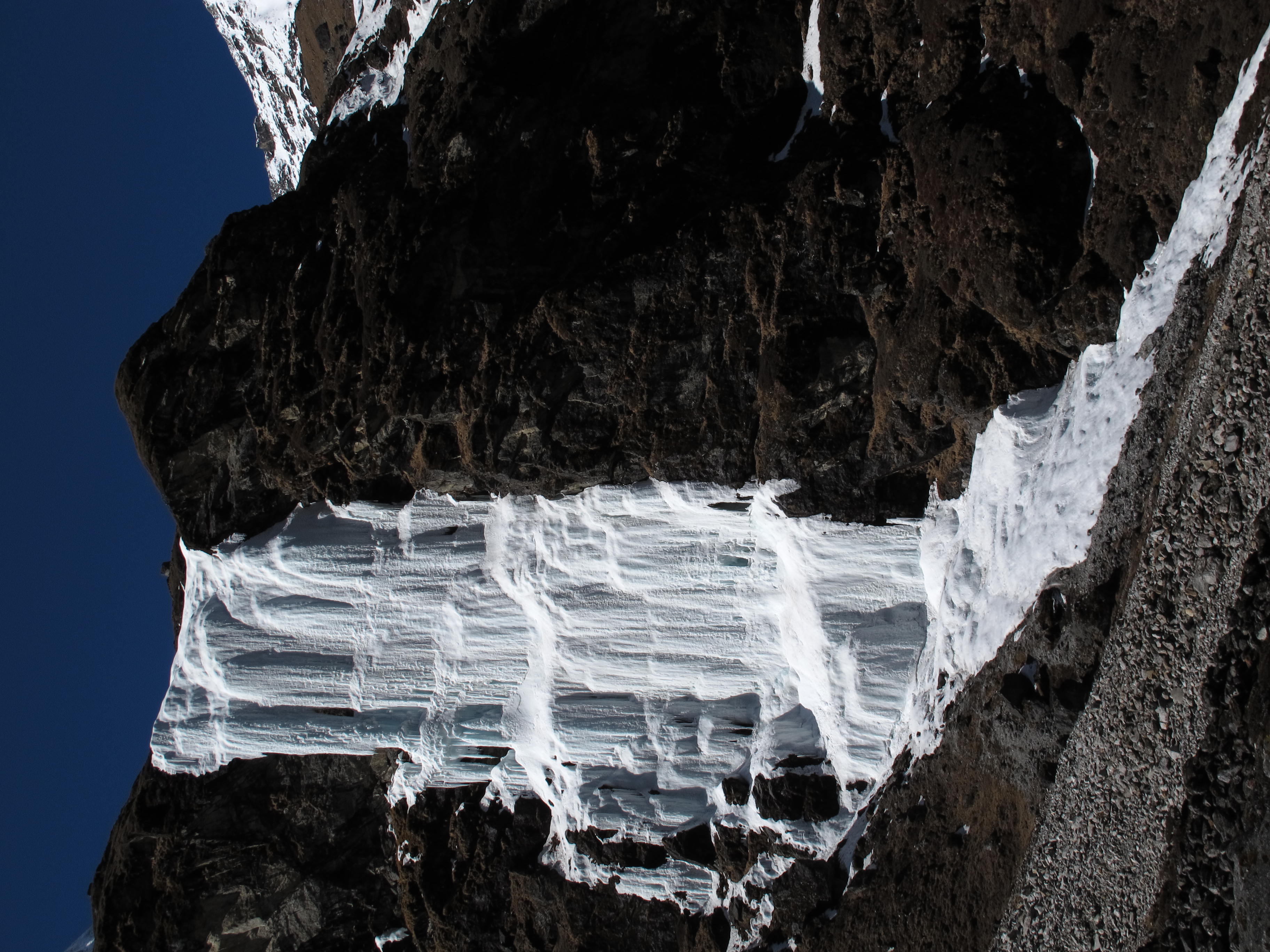
Renjo La stands as the least technical and quietest of the three, connecting Gokyo Valley with Thame across mostly rocky, non-glaciated terrain. Cho La sits in the middle, demanding a glacier crossing that sometimes requires microspikes depending on snow conditions, linking Dzongla with the Gokyo side of the region. Kongma La climbs highest of the three and carries the toughest reputation, given its steep boulder fields and demanding descent toward Lobuche near Everest Base Camp itself.
Feature | Renjo La Pass | Cho La Pass | Kongma La Pass |
|---|
Elevation | 5,360m (17,585 ft) | 5,420m (17,782 ft) | 5,535m (18,159 ft) |
Connects | Gokyo Valley to Thame | Dzongla to Thagnak/Gokyo | Chhukung to Lobuche |
Difficulty Level | Moderate | Moderately Technical | Most Challenging |
Terrain | Rocky, loose scree, occasional snow | Glacier crossing, sometimes icy, may need microspikes | Steep boulder fields, loose rock, steep descent |
Technical Skill Needed | Low | Moderate | Moderate to High |
Crowd Levels | Quietest of the three | Moderate | Moderate to busy (near EBC) |
Key Views | Everest, Lhotse, Makalu, Cho Oyu, Gokyo Lakes | Everest, Ama Dablam, Cholatse | Everest, Nuptse, Makalu, Amphu Lapcha |
Best For | Trekkers wanting the least technical, most scenic pass | Trekkers linking Gokyo Valley with EBC route | Trekkers completing the full Three Passes circuit |
Trekkers attempting all three passes in a single journey typically follow a counter-clockwise route, crossing Kongma La first, Cho La second, and Renjo La last, allowing progressive acclimatization before tackling the most remote and least crowded pass at the end of the circuit.
Best Time to Cross Renjo La Pass
The best time to cross Renjo La Pass falls within the same two primary trekking windows favored across the wider Khumbu region, spring and autumn, both offering the stability and visibility high-altitude pass crossings genuinely demand. Autumn, spanning September through November, generally delivers the clearest skies and most reliable weather of the entire year, making it the preferred season for trekkers prioritizing safe conditions atop an already remote, exposed pass.
Spring season, running March through May, offers a similarly favorable window, with gradually warming temperatures and increasingly stable weather patterns as the season progresses. Snow accumulation from winter months typically starts melting by mid-spring, though occasional late-season snowfall near the summit still demands proper gear and cautious pacing during early spring crossings.
Winter months between December and February transform Renjo La into a considerably harsher, more technical crossing, with sub-zero temperatures, frequent snow accumulation, and reduced teahouse availability along the approach routes through Gokyo and Lungden. Only highly experienced, well-prepared trekkers should attempt the pass during this window, given the added risk of ice underfoot and potential trail closures following heavier snowfall.
Monsoon season from June through August rules out crossing Renjo La almost entirely, given persistent rainfall, dense cloud cover obscuring visibility at the summit, and significantly increased risk of slippery, unstable terrain across exposed rocky sections. Trekkers planning their journey around Renjo La should prioritize autumn first for the most reliable conditions, followed closely by spring, while avoiding winter and monsoon unless specifically seeking a rare, high-risk solitude experience few trekkers ever attempt.
Common Mistakes Trekkers Make on Renjo La Pass
Many times trekkers will make mistakes at Renjo La Pass because they underestimate a crossing that may seem easier on paper than it feels underfoot. One of the most common mistakes is to rush the acclimatization period, such as when trekkers attempt to go straight to Lungden without taking rest days in Namche Bazaar, and then find that once they reach the thin air of 5,360m, their body is not ready for the climb.
Many well-equipped hikers get caught up in the wind and the cold at the top. At lower elevations, clear skies provide a false sense of security, and some hikers end up leaving behind heavier layers which, near the pass, make the crossing seem much tougher than the temperature indicates. The outer shell that protects from the wind and insulated gloves are more important here than anywhere else.
A late start of pass day is also a real issue. Clouds and afternoon winds form routinely over Renjo La, and hikers who depart Lungden after six or seven in the morning frequently find themselves in less ideal conditions as they approach the summit of the pass, when the weather is calmest and most conducive to hiking.
The loose scree and rocky switchbacks that line much of the ascent and descent make it unnecessarily difficult without proper footwear and without the use of trekking poles. A pair of worn-in, sturdy boots with good ankle support can make a significant difference, and trekking poles will aid significantly on the steep descent to Gokyo, where tired legs and loose footing can make for injuries.
Last but not least, many trekkers bring too few snacks and water for the long distance between Lungden and Gokyo, and fail to realize that there is no teahouse along the crossing itself. Energy bars, dried fruit, and a full water bottle are not optional items to add to your daypack before heading out every morning, since you will be in need of them mid-climb.
Frequently Asked Questions About Renjo La Pass
What permits do you need for Renjo La Pass?
Every trekker needs the Sagarmatha National Park entry permit, priced around $30 USD, alongside the Khumbu Pasang Lhamu Rural Municipality permit, costing approximately $20 USD. Both permits get checked along the route, though checkpoints differ slightly depending on whether you approach via Thame or the standard Gokyo trail.
How much does a Renjo La Pass trek cost?
A typical 14-day Gokyo Renjo La Pass trek with a licensed operator costs between $1,200 and $1,900 USD per person, covering flights, permits, guide and porter services, teahouse accommodation, and meals. Budget options run lower, while premium packages with better lodges and smaller group sizes sit toward the higher end.
What should you pack for crossing Renjo La?
Essential items include a windproof outer shell, insulated gloves, a warm hat, sturdy broken-in boots, trekking poles, and a headlamp for the pre-dawn start. A cold-rated sleeping bag matters considerably at Lungden and Gokyo, while sunglasses and high-SPF sunscreen protect against intense UV exposure at altitude. Crampons or microspikes generally aren't required under normal seasonal conditions, unlike Chola Pass.
Do you need a guide to cross Renjo La Pass?
Yes. Nepal's 2023 regulation requires every trekker entering the Everest region to hire a licensed guide, and this applies equally to Renjo La given its remote, weather-exposed terrain where quick, informed decisions matter considerably more than on busier trails.
Is Renjo La Pass suitable for first-time trekkers?
Yes, provided genuine cardiovascular fitness and a sensible acclimatization schedule. Renjo La stays non-technical compared to Chola Pass or Kongma La, making it a realistic first high-pass crossing for fit beginners willing to move at a deliberate pace.
How long does it take to cross Renjo La Pass on pass day itself?
Pass day typically runs six to nine hours of sustained walking from Lungden to Gokyo, including the steep ascent, summit time, and descent through scree and loose rock toward the valley floor.
Can you see Everest from Renjo La Pass?
Yes. The summit delivers a genuine, unobstructed view of Everest alongside Lhotse, Makalu, and Cho Oyu, all visible together from a single vantage point, making it one of the most rewarding panoramas in the entire Khumbu region.
What's the biggest risk when crossing Renjo La Pass?
Altitude sickness ranks as the primary concern given the pass's 5,360 meter elevation, followed closely by sudden weather changes and wind exposure near the summit. Proper acclimatization, an early start, and appropriate cold-weather gear address most of the genuine risks trekkers face.
Renjo La Pass: A Crossing Worth Every Step
Renjo La Pass now sits clearly mapped in your mind, from its exact location and elevation to the difficulty, seasons, and itineraries shaping every trekker's journey toward its summit. Standing at 5,360 meters, the pass rewards genuine preparation with one of the most complete Himalayan panoramas anywhere in the Khumbu, Everest, Lhotse, Makalu, and Cho Oyu rising together above turquoise lakes and centuries-old trade routes once walked by Sherpa and Tibetan traders long before trekkers ever arrived.
Whether you're drawn to the quieter Thame side, the gentler acclimatization offered by approaching through Gokyo first, or simply curious how Renjo La compares against Cho La and Kongma La, your path forward now feels considerably clearer than it did before reading this guide. Fit, well-prepared trekkers of nearly every experience level find their way across this pass each season, proving that genuine reward here comes from patience and proper pacing rather than raw ambition alone.
Nepal Nomad's experienced local guides handle every logistical detail of your journey, from permits and acclimatization scheduling to choosing the direction that best suits your fitness and travel goals. Reach out to Nepal Nomad and let your own crossing of Renjo La take shape, turning today's curiosity into tomorrow's genuine Himalayan achievement.