Where Kongma La Pass Sits and How High It Climbs
The significance of Kongma La Pass is apparent when one knows that it is the easternmost of the three great high passes of Everest, lying between the village of Chhukung to the south and Lobuche to the north. The pass is 5,535m high, higher than Cho La (5,420m) and Renjo La (5,360m): the highest of the three passes.
Geographically, Kongma La is located in the eastern part of Khumbu near the base of Island Peak, just in front of the impressive Amphu Lapcha ridge that separates the Chhukung valley from the remote Hongu valley further south. The route over Kongmaside (Kongma La) is not a glacier path, but a rugged, boulder strewn path, which is technically non-glacial, but requires a lot of effort because of its high elevation.
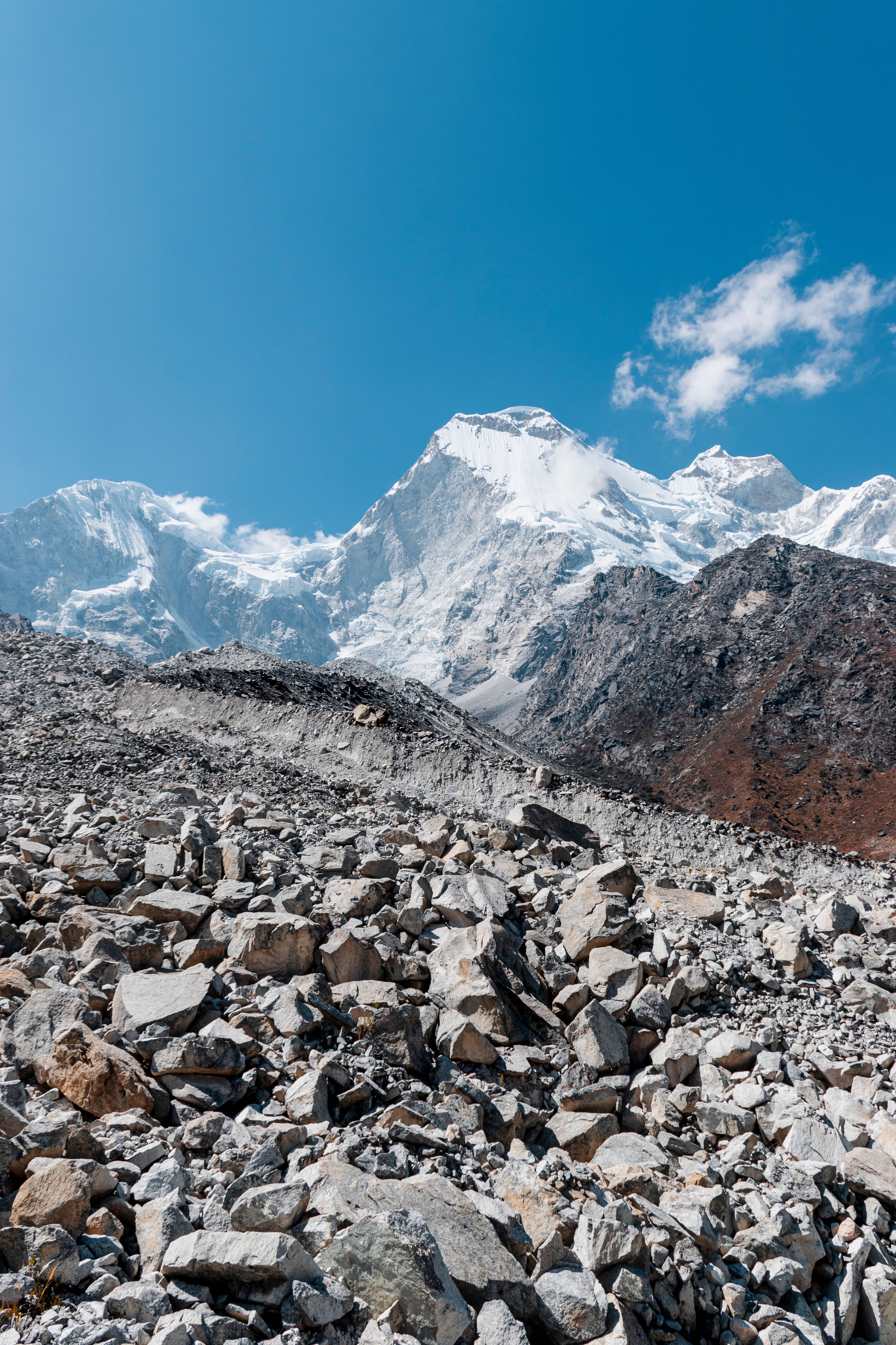
The side of the crossing that is approached from Chhukung is usually the steeper and more difficult side, with increasingly barren terrain until the summit cairn marking the crossing is reached. The descent to Lobuche soon brings the physical strain since there is loose scree and a long grueling downhill section that puts already tired legs to the test before reaching the relative comfort of teahouse accommodation.
The steep, rugged terrain of the pass is compounded by the fact that oxygen levels at this altitude are about 50% of those at sea level. Knowing exactly where Kongma La is and that it is the highest of the three legendary high-altitude crossings of Everest, as well as, and higher than Cho La and Renjo La, sets realistic expectations before trying the highest and most physically demanding of Everest's three, famous high-altitude crossings.
Why Kongma La Is Considered the Toughest of the Three Passes
So why is Kongma La the hardest of the three passes? The answer is the combination that few trekkers anticipate until they've reached the summit: no dramatic obstacle, only a steady and sustained difficulty on top of the highest elevation of the three major passes across Everest. Cho La's defined glacier section or Renjo La's steady, predictable ascent is in contrast to Kongma La, which demands a longer, more exhausting trek over loose boulders and unstable moraine, with little flat ground anywhere to rest before the next steep push.
Elevation is the distinguishing feature of Kongma La, which stands at 5,535 meters, while Cho La is at 5,420 and Renjo La at 5,360. While the difference in altitude may seem small, it makes all the difference in terms of the oxygen available, and that final approach is much harder than the data indicates.
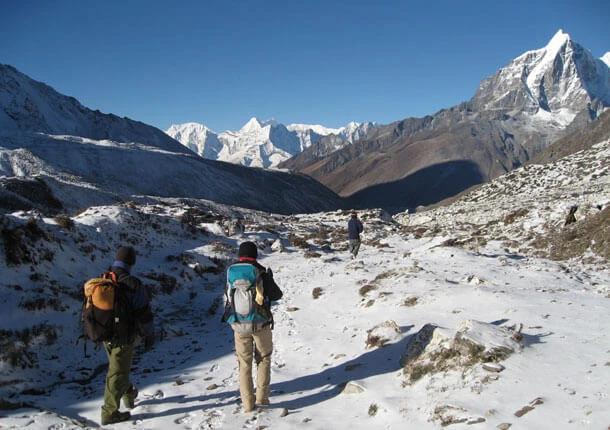
Terrain exacerbates the altitude challenge even more. Much of the route is through massive boulder fields, so a steady walking pace is not always the best approach but is instead a series of scrambles and careful foot placements, followed by another false crest, which tricked the weary walkers into thinking the route was over, only to encounter another scramble ahead. Even veteran hikers can be taken aback by this fake peak situation, further depleting morale just when it's most needed.
There is no respite, either, as it winds down toward Lobuche, a long, steep, and treacherous descent over stones that will test already tired legs and knees as much as the ascent did lungs and legs. This consistent physical demand: both elevation and terrain, and a deceptively long false-summit approach accounts for why trekkers who have made all three passes have rated Kongma La the most physically demanding of the three passes without a single technical glacier crossing to be responsible.
Chhukung vs Lobuche: Which Side Should You Approach From
Chhukung vs Lobuche comes down to travel direction and a genuinely important difficulty consideration, since the two sides of Kongma La offer noticeably different climbing experiences depending on which way you cross. The climb from Chhukung (usually combined with an ascent to Island Peak or clockwise around the full Three Passes route) is the steeper and more challenging route, as the trekker arrives in the more difficult terrain of the pass.
The approach from Lobuche, however, is the easier one because the ascent is longer and not quite as severe as the descent which is the steepest part of the mountain journey. When trekking in this direction, the physical demand is usually easier to handle as fresher legs on the more challenging ascents and a longer warm up period before the most difficult terrain.
Chhukung is more than just the terminus of one end of the pass. Many trekkers come through Chhukung specifically to attempt Island Peak, both before and after crossing Kongma La, which makes this side the natural intersection point between a summit of a trekking peak and the rest of the Three Passes trek.
The final decision on which one to choose will rely on the bigger picture of your travel plans and the direction that you plan to head in around the Khumbu. Trekkers on the classic Three Passes route naturally start from Chhukung and make it up to Kongma La at the start of the route as energy levels are the highest, while others who aim for a more relaxed introduction to the pass or start from Everest Base Camp often prefer to tackle the pass from Lobuche as a relatively easy first high pass of the route.
What You See from the Top of Kongma La Pass
Standing atop Kongma La after hours of scrambling over loose boulders, you're rewarded with a view that feels earned in a way few other summits in the Khumbu can match. Makalu rises unmistakably to the east, its massive pyramid shape cutting sharply against the sky, while Lhotse and Nuptse dominate the horizon to the north, close enough that you can trace individual ridgelines carved into their upper faces.
Turning south, you catch the dramatic silhouette of the Amphu Lapcha ridge, a remote, rarely crossed barrier separating the Chhukung valley from the isolated Hongu basin beyond. Very few trekkers ever venture into that hidden valley, and glimpsing it from Kongma La gives you a rare sense of just how vast and unexplored this stretch of the Himalayas remains, even after days spent walking through some of its more famous corners.
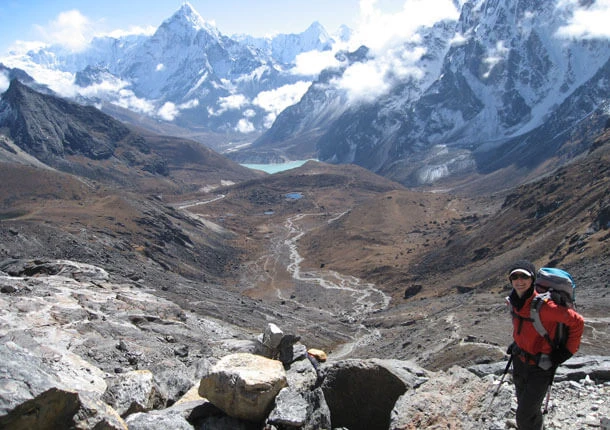
Below you, Chhukung and the Imja valley stretch out in miniature, tiny stone teahouses and yak pastures scattered across a landscape that feels impossibly far below after your steep climb. Behind you, if you approach from Lobuche, Kala Patthar and Pumori remain visible in the distance, quietly reminding you how close you actually are to Everest Base Camp despite standing on a completely different trail.
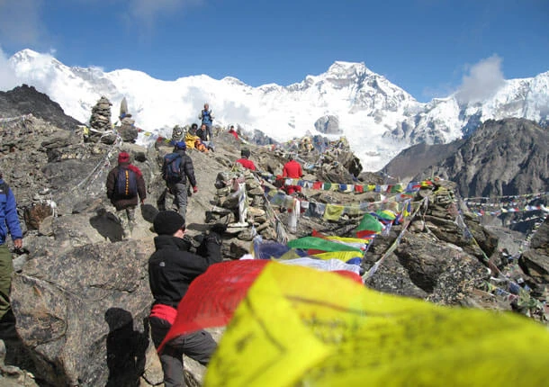
Wind cuts sharply across the summit cairn, prayer flags snapping violently against the thin mountain air, and for a moment, exhaustion gives way entirely to the sheer scale of what surrounds you. Unlike Renjo La's wide, open panorama or Cho La's glacier-framed views, Kongma La delivers something rawer, a view that feels less like a reward for a gentle climb and more like proof of what you just pushed your body through to get there.
The Long Climb Nobody Warns You About
What catches most trekkers off guard on Kongma La isn't one dramatic obstacle, it's how long the climb actually drags on. The ascent stretches gradually across loose boulders and faint, hard-to-follow trail sections, with ridgeline after ridgeline appearing ahead, each one looking like it might finally be the top. It rarely is. The genuine summit stays tucked slightly further than expected, and that repeated sense of almost arriving takes a real toll on morale during an already six to seven hour trekking day.
Route markings stay minimal across much of the climb, particularly in poor visibility, making the ascent feel more disorienting than either Cho La or Renjo La, where the path stays considerably more defined throughout. Trekkers who expect a single steep push followed by a clear summit often find themselves mentally drained well before physically exhausted, simply from not knowing how much further the trail actually continues.
Guides familiar with the route help enormously here, not just for navigation, but for managing expectations along the way, pacing the group and offering honest updates on remaining distance rather than letting exhaustion and uncertainty compound each other. Trekkers who go in expecting a long, gradually unfolding climb rather than one dramatic final push tend to handle Kongma La's psychological demands considerably better than those caught off guard by just how much longer the ascent stretches than it first appears.
The Right Season Matters More Here: Best Time to Cross Kongma La
The season also plays a crucial role here compared to the other two passes, because Kongma La has very little trail signage and loose moraines, and the combination of the three makes the pass genuinely dangerous under poor weather conditions. The best time to trek is during the autumn (late September to November), when the weather is stable and there are no clouds. At this time of year, the weak trail is strewn with boulders, and trekkers are able to navigate it much more confidently than they can in cloudier months.
Similarly, early spring (March to May) offers a similar favourable window, although at times the crossings will see snow that has not fully melted from the higher reaches near the summit, from the previous winter. Footing is usually firmer and more predictable later in the spring season, so April and May are a safer time of the year for trekkers looking for stability rather than rhododendron blooms further down the trail, on the moraine.
From December through February, Kongma La is a much more serious hike than in autumn or spring. The path often becomes completely covered by snow, losing all its easily discernible signs, and subzero temperatures at this elevation make the trek well beyond the scope of what most hikers would be able to endure in poor visibility. It is best left to the most experienced trekkers with a good guide and appropriate winter equipment to try the pass during this period.
From June through August, the monsoon climate dominates the area, making crossing Kongma La virtually impossible due to the rain, near zero visibility, and the extreme hazard of losing the path in the extremely low visibility conditions. Since this pass is so much more dependent on clear visibility and stable foot than its counterparts, for those who want to cross this pass, autumn should be on top of the list and before that, spring with winter and monsoon being avoided unless they are very familiar with extreme high altitude trekking.
The Paperwork Before the Toughest Pass
Two permits stand between you and Kongma La, both tied to the fact that this crossing sits entirely inside Sagarmatha National Park's protected boundaries. First comes the national park entry permit itself, running around $30 USD, money that goes directly toward preserving the fragile alpine terrain your boots will cross on the way up. Second is the Khumbu Pasang Lhamu Rural Municipality permit, roughly $20 USD, which took over from the old TIMS card system and now funds local infrastructure across the Sherpa villages you'll pass through before reaching Chhukung.
Checkpoints near Monjo verify both documents before you ever get close to the pass, so physical copies stay in your daypack rather than buried somewhere in your duffel. Beyond the standard paperwork, one regulation matters more here than almost anywhere else in the region: Nepal's 2023 rule requiring a licensed guide for every trekker. On most trails, that requirement feels like a formality. On Kongma La, with its faint markings and boulder-strewn approach, it's closer to a genuine safety net, since a guide's local, current knowledge of the route often makes the difference between a confident crossing and a disorienting one.
Sorting permits yourself in Kathmandu is possible, but most trekkers let their agency handle it instead, and for good reason. Nepal Nomad takes care of both documents before you even land in Lukla, one less thing competing for your attention on a trek that already asks plenty of your legs, lungs, and patience.
Common Mistakes Trekkers Make on Kongma La
Common mistakes trekkers make on Kongma La often come down to underestimating a pass that looks less intimidating on paper than it actually feels underfoot. Treating the crossing as just another trekking day ranks among the most frequent errors, since many trekkers arrive having already completed Everest Base Camp and assume their bodies are fully broken in, only to discover Kongma La's sustained climb and thin, faint trail demand a different kind of endurance entirely.
Underestimating trail-finding difficulty catches plenty of otherwise well-prepared hikers off guard. Route markings stay minimal across much of the ascent, and trekkers who assume the path will be as clear and well-trodden as the main Base Camp corridor often find themselves second-guessing direction in poor visibility, a mistake easily avoided by trekking closely with an experienced guide rather than pulling ahead of the group.
Starting too late in the day causes real problems given how long the crossing actually takes. Trekkers who leave Chhukung later than six or seven in the morning risk facing deteriorating weather and reduced visibility during the pass's longest, most exposed stretch, missing the calmer window most guides deliberately plan around.
Packing insufficient layers trips up trekkers who focus preparation entirely on Base Camp and treat Kongma La as an afterthought. Wind exposure across the boulder field increases considerably compared to more sheltered sections of the standard trail, making a proper windproof shell and insulated gloves essential rather than optional.
Finally, many trekkers underestimate the descent toward Lobuche, assuming the hardest part ends once they cross the summit cairn. In reality, the downhill stretch across loose scree and unstable moraine tests already-fatigued knees just as intensely as the climb tested lungs, and trekkers who rush this section without trekking poles or careful footing increase injury risk considerably during what should be the final, manageable stretch of a genuinely demanding day.
From Pass to Peak: Kongma La and Island Peak
From pass to peak describes the natural progression many climbers follow through Chhukung, since this small village sits at the crossroads between Kongma La and one of Nepal's most popular trekking peaks. Climbers attempting Island Peak often cross Kongma La first as part of a broader Three Passes itinerary, arriving in Chhukung already acclimatized to serious altitude before shifting focus from trekking pass to technical summit attempt.
This sequencing works to a climber's genuine advantage. Crossing Kongma La demands sustained effort above 5,500 meters, giving your body meaningful additional acclimatization before attempting Island Peak's 6,189 meter summit, a height requiring proper altitude adjustment beyond what a standard Base Camp trek alone typically provides. Climbers arriving at Chhukung after Kongma La generally find their Island Peak summit push noticeably more manageable than those approaching directly from the standard Base Camp route without the pass's added altitude exposure.
Order matters here more than some climbers initially assume. Crossing Kongma La before attempting Island Peak allows your body's natural acclimatization to compound gradually across both objectives, whereas reversing the sequence, summiting Island Peak first and crossing the pass afterward, sometimes leaves climbers pushing through Kongma La's demanding terrain on already-fatigued legs following a technical peak climb.
Trekkers and climbers building a longer, more ambitious itinerary through the Khumbu often find this combination genuinely rewarding, pairing Kongma La's raw trekking challenge with Island Peak's technical climbing demands within a single, well-sequenced journey. Chhukung's role as the meeting point between these two very different mountain objectives makes it one of the more strategically significant villages anywhere along the Everest Three Passes circuit.
Myths, Questions, and Everything In Between
Myth: Kongma La requires technical mountaineering skills.
Reality: No technical climbing or glacier travel is required. The pass demands serious physical fitness and stamina, not ropes, ice axes, or prior mountaineering experience.
Myth: Kongma La is basically the same difficulty as the other two passes, just at a slightly higher elevation.
Reality: Trekkers who've crossed all three consistently rank Kongma La as noticeably harder, given its longer, more sustained climb, faint trail markings, and demanding descent, rather than any single technical obstacle like Cho La's glacier.
Myth: Since it's the "easiest" side, approaching from Lobuche means an easy day.
Reality: Lobuche's side offers a gentler ascent, but the crossing overall still demands six to seven hours of sustained effort at extreme altitude, regardless of which direction you start from.
How difficult is Kongma La Pass compared to Everest Base Camp?
Considerably harder. The standard Base Camp trek stays on an established, well-marked trail throughout, while Kongma La demands scrambling over loose boulders, navigating faint markings, and sustaining effort above 5,500 meters.
Do you need a guide to cross Kongma La?
Yes. Nepal's mandatory guide regulation applies here with particular weight, given the pass's minimal trail markings and genuinely higher risk of losing the route in poor visibility.
What's the biggest risk when crossing Kongma La?
Altitude sickness ranks first given the pass's extreme elevation, followed closely by disorientation from faint trail markings and physical exhaustion from the unusually long, sustained climb and descent.
Can beginners attempt Kongma La Pass?
Fit beginners with proper prior acclimatization can complete the crossing, though it's generally considered a poor first high-altitude pass for someone with zero prior trekking experience, given how physically demanding the full day proves to be.
Is Kongma La worth crossing if you've already done Cho La or Renjo La?
Yes, according to most trekkers who complete all three. Kongma La's raw, remote terrain and dramatic views of Makalu, Lhotse, and the Amphu Lapcha ridge offer a genuinely different experience from either of the other two passes.
How long does crossing Kongma La actually take?
Most trekkers need six to seven hours from Chhukung to Lobuche, covering roughly 2,700 feet of elevation gain followed by 2,100 feet of elevation loss across a single demanding day.
Is Kongma La suitable for seniors?
Given its status as the most physically demanding of the three passes, Kongma La poses genuine challenges even for fit seniors. Trekkers in this category considering the Three Passes circuit often find Renjo La or Cho La a more realistic starting point before attempting Kongma La specifically.
The Hardest Climb, The Highest Reward: Kongma La Pass
Kongma La Pass now sits clearly mapped in your mind, from its exact location and elevation to the sustained climb, faint trail, and demanding descent that separate this crossing from anything else in the Khumbu. Standing at 5,535 meters, the highest of Everest's three legendary passes, Kongma La rewards genuine preparation with views of Makalu, Lhotse, and the remote Amphu Lapcha ridge that few trekkers ever witness, earning its reputation as the toughest test on the entire Three Passes circuit.
Whether you're drawn to Kongma La as the ultimate physical challenge before attempting Island Peak, curious how it compares against Cho La's glacier crossing or Renjo La's gentler ascent, or simply wanted an honest account of what the climb actually demands, your path forward now feels considerably clearer than it did before reading this guide. Fit, well-prepared trekkers who respect the pass's genuine physical demands find crossing it among the most rewarding, hard-earned achievements anywhere in the Everest region.
Nepal Nomad's experienced local guides handle every logistical detail of your journey, from permits and acclimatization pacing to real-time route finding across the pass's faint, boulder-strewn trail. Reach out to Nepal Nomad and let your own crossing of Kongma La take shape, turning today's curiosity into tomorrow's genuine Himalayan achievement.