Great Himalayan Trail TrekGreat Himalayan Trail Trek

Great Himalayan Trail Trek: A 150 Day Odyssey Through Nepal’s Hidden Himalayas

  • Duration148 Days
  • DestinationNepal
  • Difficulty Level Technical
  • Max Altitude 6200 m
  • Group Size 2 minimum
  • Starts Kathmandu
  • Ends Kathmandu
  • Activity Trekking, Climbing, Day Tour, Cultural Exploration
  • Best Season September to November and March to May

The Great Himalayan Trail Trek (GHT) is not your average journey. It is one of the most extreme and exhilarating adventures on the planet. It is a wild, untamed crossing of the whole spine of the Nepal Himalayas, where each step taken tests endurance, resilience and spirit. The journey is almost 1,700 kilometers, 1,056 miles long and takes you through some of the most isolated and inhospitable terrain on earth, from the storm-riddled ridges below Kanchenjunga trek Nepal in the east to the wild, windswept scenery of Humla remote trekking Nepal in the far west.

GHT is much more than a hike, it is a living, breathing highland odyssey that is considered as one of the longest trekking routes in Nepal and highest altitude treks in the Himalaya across a dramatic mosaic of remote regions commencing from the shadow of Kanchenjunga base camp trek, winding through the wild terrains of Makalu Barun trekking region and Everest region trekking Nepal, venturing into the hidden valleys of Rolwaling Valley trek and Langtang Valley trekking, then pushing westward across Manaslu circuit trekking route and Annapurna circuit long trek, into the stark, mystical landscapes of Upper Mustang trekking Nepal and Dolpo remote trekking region, finally reaching the far-flung wilderness of Humla Limi Valley trek in the west.

The journey may begin in the lush, subtropical greenery of Ilam, alive with tea gardens and rolling hills, before rising into the alpine wilderness of Langtang Valley and the stark, wind-carved plateaus of Mustang. Trekkers follow the thunder of rivers like the Arun River and Karnali River, only to find themselves later surrounded by the profound silence of glaciers such as the Ngozumpa Glacier. It is a landscape in constant motion shifting, evolving, and revealing a new face of the Himalayas with every step.
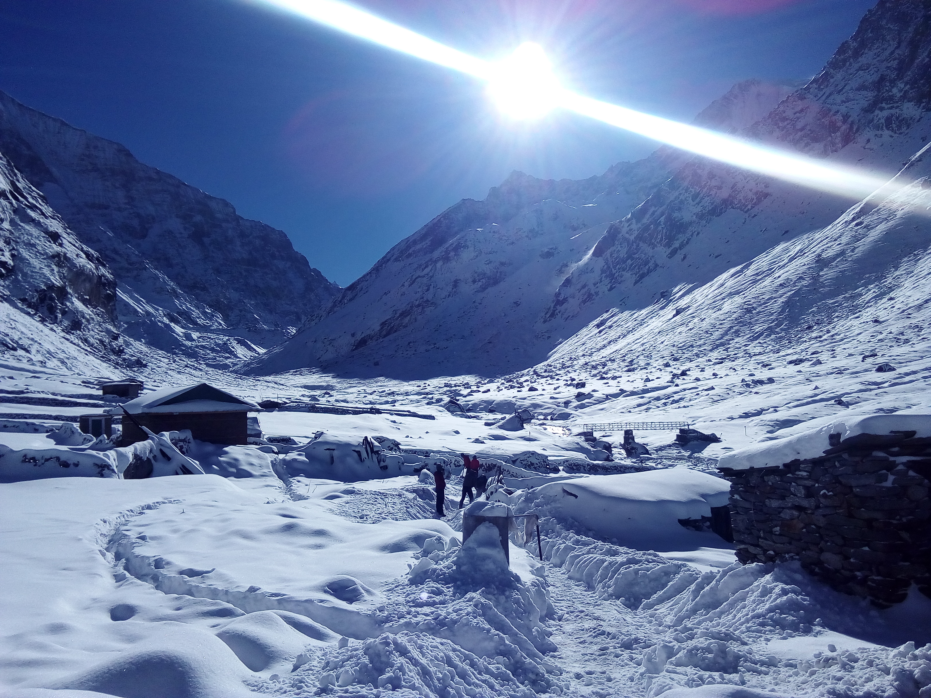
GHT

The highland demands not just strength, but unwavering patience and deep respect for the mountains. Over the course of many months trekkers face a relentless rhythm of ascent and descent, where the body is constantly adapting to dramatic altitude shifts from lower valleys to high passes like Sherpani Col and Thorong La.

The difficulty lies not in a single summit push, but in the accumulation of challenges. One week, you may be walking under warm skies through green hills; the next, you are navigating snow-covered passes where temperatures can drop below -20°C (-4°F). In regions like Makalu Barun National Park, sudden storms can blanket trails in snow within hours, while in Dolpo, dry winds and high-altitude exposure test your resilience. Crossing technical sections such as the Amphu Labtsa Pass often requires ropes and careful footing on icy terrain, turning trekking into true mountaineering.

It is this constant unpredictability. the shifting weather, the thin air, the long isolation that makes the journey so demanding. Yet, in return, it offers something profoundly rare: a complete Himalayan experience, raw and unfiltered, where every hardship becomes part of a transformation that stays with you long after the trail ends.

Over an adventure that can span five months or be shaped around your own pace even extended over years with breaks the Great Himalayan Trail adapts to your time, making it as suitable for seasoned adventurers as it is for retirees seeking a lifelong dream. In short, the journey of GHT goes down from the heights to the quiet, untouched parts of Nepal, where time seems to move differently. Trekkers walk through remote villages like Olangchun Gola, Phu Gaun, and the hidden valleys of Dolpo, where old ways of life, languages, and traditions are still very much alive. Each area has its own rhythm, or heartbeat, that not only lets you cross physical landscapes but also lets you deeply experience the living heritage of the Himalayas.

Explore all the hidden treasures upheld by the glorious Himalayan region of Nepal in one continuous trek

  • The Great Himalayan Trail (GHT) is one of the longest and most authentic hiking trails in the world. It goes from east to west through Nepal.
  • Depending on the route you choose, it can be anywhere from 1,700 km to 2,500 km (1,056 to 1,553 miles).
  • It has two parts: the High Route and the Cultural Route. The High Route is for people who want to go on extreme adventures, and the Cultural Route is for people who want to learn about other cultures.
  • The High Route goes over high mountain passes that are between 5,000 and 6,000 meters (16,404 and 19,685 feet) high.
  • The Cultural Route goes through heritage trails, valleys, and traditional villages.
  • It includes parts of the Himalayas like Kanchenjunga, Makalu, Everest, Rolwaling, Langtang, Manaslu, Annapurna, Dolpo, and Mustang.
  • The trail goes through a wide range of ecosystems, from subtropical jungles to icy glaciers.
  • Trekkers go through different climates, from hot lowlands to freezing alpine conditions.
  • It gives you a chance to learn about the cultures of ethnic groups like the Sherpa, Rai, Limbu, Tamang, Gurung, Magar, and Thakali.
  • Along the way, you can see old Buddhist monasteries and Hindu pilgrimage sites.
  • The trek goes through some of Nepal's most remote and least explored areas.
  • Because of the height, distance, and lack of people, it is thought to be one of the hardest treks.
  • The journey can take several months to years, depending on pace and breaks best for seasonal travelers as well as retirees.
  • The route is very quiet, with long stretches of wilderness that are far away from towns and cities.
  • It is a journey through the heart of the Himalayas that is both physically and spiritually challenging.

The Living Soul of the Trail: Culture, People & Festivals

The Great Himalayan Trail is not just a geographical crossing; it is a traverse through a living museum of human resilience and Himalayan people and culture. As you walk from the humid tea gardens in the East to the dry, windy plateaus in the West, you will see a cultural shift that is just as big as the change in altitude.

1. The Eastern Gateways: The Limbu, Rai, and Lhomi Cultures

The first three to thirty-five days of the Great Himalayan Trail Nepal take you deep into the ancestral lands of the Kiranti people, including the Limbu and Rai, as well as the very remote Walung and Lhomi communities. The Mundhum is an old oral tradition and religious text that guides the Kiranti way of life. It stresses a deep connection to nature, ancestors, and the nearby peaks. You can meet the Limbu people in the lower hills of Ilam and Taplejung. Their culture is visible in the architecture of their stone-and-mud houses and the pervasive cultivation of large cardamom, which fuels the local economy. The Walung people live higher up toward Olangchun Gola. They are a cultural bridge between the Kirat hills and Tibet. Their traditions are heavily influenced by Nyingma Buddhism, and the historic Diki Chholing Gompa, which is home to ancient artifacts and is the center of their high-altitude trade society.

The Lhomi also known as Kar Bhote are one of Nepal's most isolated and culturally distinct ethnic groups. You can find them deep in the secluded Arun Valley and the Barun reaches. The Lhomi live in villages like Thudam and Chyamtang, where they have a way of life that is almost completely separate from modern life. They are known for their unique "Semo" weaving patterns and a dialect that is very different from standard Tibetan. They are very communal in their social structure, and they are known for being able to navigate the dangerous, steep terrain of the eastern Great Gorges often associated with Lhomi culture Arun Valley Nepal.

The lively festivals of these eastern groups are the best way to see their spiritual lives. The Rai celebrate Sakela or Sakewa, a month-long festival that happens twice a year to honor Mother Nature and the earth's fertility. The Chandi Naach (drum dance) is part of Sakela. People do this dance to please the spirits by copying the movements of birds, animals, and the farming cycles. The Limbu people have a harvest festival called Chasok Tangnam, during which they give the first fruits of the season to the goddess Yuma Sammang before anyone else can eat them. Palam sings rhythmic, improvised songs that tell stories of love and history during this time.

The Lhomi and Walung, on the other hand, celebrate Lhosar (Tibetan New Year) in a unique way. The Semo Dance, a ritual performance with masked characters that represent the fight between protective gods and mountain demons, is often part of the celebration. For the first 35 days, you are not just a trekker; you are also a witness to a living archaeology of the Himalayas. Every village pass and every communal meal is a sign of a culture that has lived on for thousands of years in the shadow of the world's third-highest peak.

2. The High Himalayan Pulse: Sherpa and Buddhism

As Great Himalayan Trail Trek goes from the Barun Valley to the high-altitude heartlands of Everest (Khumbu) and Rolwaling (Days 36 to 64), the culture changes to the High Himalayan Pulse of the Sherpa people and Buddhism. The Sherpas don't just see the mountains as challenges to climb; they see them as the homes of gods. For example, Everest is Chomolungma, the Mother Goddess of the World, and Makalu is the home of Shankar, the protector god. This part of the trek is very spiritual. Every mountain pass has colorful prayer flags (Lunger) that send prayers on the wind, and every trail has Mani walls intricately carved stone tablets with the mantra "Om Mani Padme Hum" on them. As a sign of respect, trekkers always walk on the right side of these walls, as is the custom in the area. The Gompa (monastery) is the center of social and spiritual life. Some famous ones are Tengboche and the old, cliff-clinging monasteries of Rolwaling. These buildings, with their roofs topped with gold and colorful murals, are the centers of communities that live in Beyuls, which are sacred, hidden valleys that Guru Rinpoche (Padmasambhava) blessed as safe havens for the faithful.

The Yak and high-altitude survival are very important parts of the culture here. The seasonal movement of these tough animals is a big part of Sherpa life, and the Kharka (high pasture) culture is still an important part of their lives. People talk about the Sherpas not only because they are strong at high altitudes, but also because they are very friendly and helpful, often associated with Sherpa culture Everest region Nepal. In the stone-walled villages of Khumjung, Thame, and Beding, the monastic calendar sets the pace of life. Mani Rimdu, a nineteen-day festival held at the Tengboche and Thame monasteries, is one of the most important celebrations you might come across. It ends with three days of public celebrations during which monks perform Cham dances, which are sacred masked plays that show how Buddhism beat the ancient Bon demons of Tibet. The performers wear fancy silk brocades and scary masks to represent different protector deities. The event is a big social gathering for Sherpas from all over the region.

Dumji is another important festival that takes place in June or July to honor the birth of Guru Rinpoche. Every year, certain families are chosen to host the festival. This is a big responsibility for the community and a way to share wealth through food and ritual gifts. During Dumji, the long horns (dungchen) and the rhythmic clanging of cymbals fill the village Gompas. You might also see Saga Dawa, which celebrates the Buddha's enlightenment, and Parinirvana, when the air at high altitudes smells like burning juniper incense (sang). In these valleys with thin air, the combination of hard physical work and deep spiritual devotion creates a unique atmosphere of strength and peace. You can feel the pulse of the mountains through the chanting of monks and the distant sound of yak bells ringing across the glaciers.
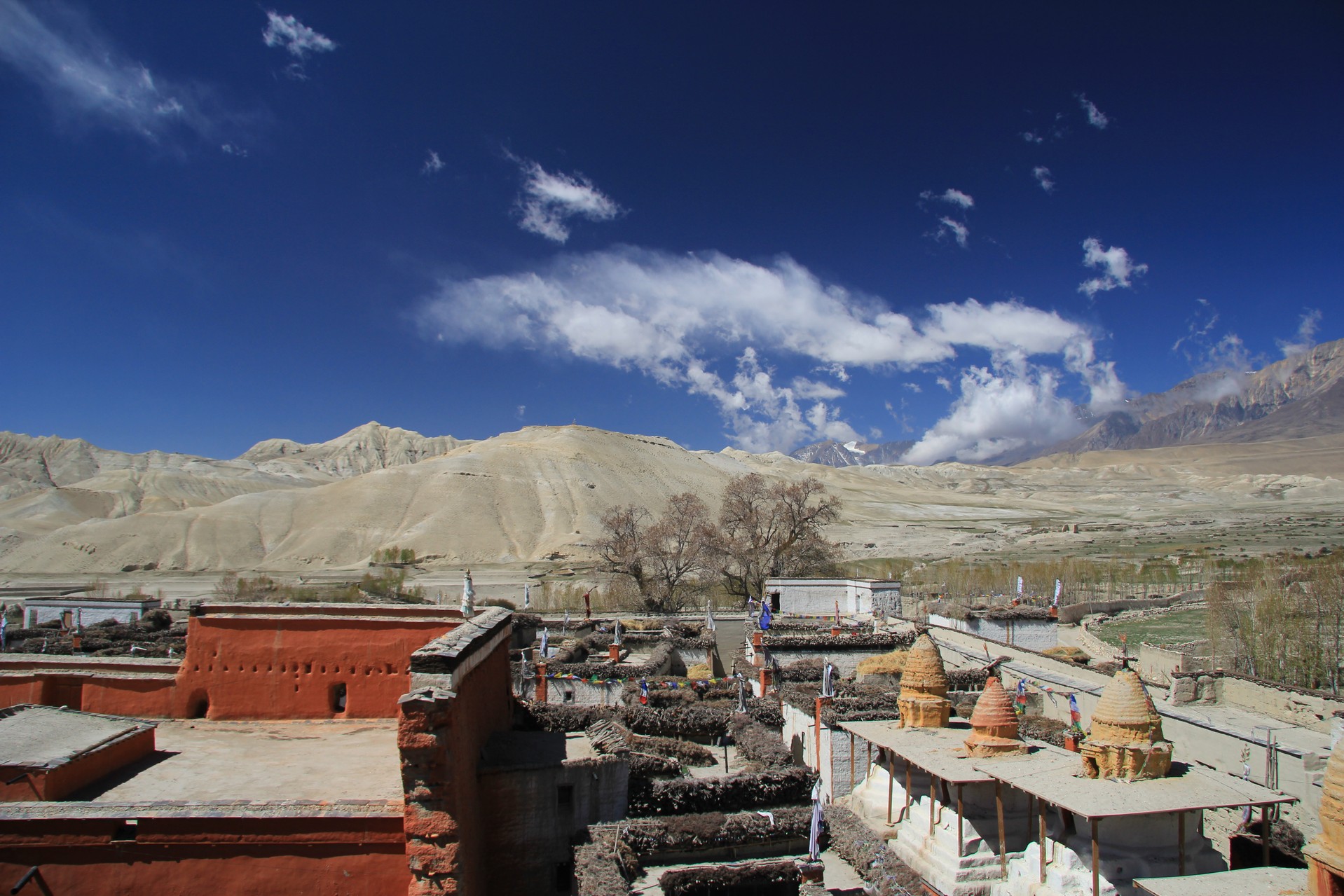
Manang_GHT

3. The Middle Hills: Tamang and Hyolmo Heritage

This GHT Nepal long trekking routes goes from the icy heights of the Tilman Pass to the lush ridges of Langtang, Helambu, and the Ganesh Himal (Days 65 to 89). This is the ancestral home of the Tamang and Hyolmo people. People often call this area the Middle Hills. It is a cultural buffer where Buddhist practices and ancient Shamanistic traditions mix well. The Tamang people, whose name means Horse Traders, are the biggest ethnic group in this area. The Damphu, a traditional round drum, is a well-known symbol of their culture. People say that the Damphu was made to cheer up a sad wife, and it is still the heart of Tamang music and dance today. You can find the "Black Village" in villages like Gatlang. The houses there are made of dry stone and dark wood shingles, which is a unique style of building. In the Helambu valley, you will meet the Hyolmo people. They are a separate group with strong spiritual connections to the Beyul Helambu, one of the sacred hidden valleys that Guru Rinpoche found. People know the Hyolmo for their peaceful, farming way of life and their beautiful monasteries, which are often surrounded by apple orchards and forests of rhododendrons.

The spiritual life of the Tamang and Hyolmo is interesting because it is made up of both Lamas and Dhamis (Shamans). The Lama leads religious ceremonies and funerals, while the Dhami/Jhakri is the community healer who uses trance and ritual to calm mountain spirits or "forest deities", often referred to in Tamang Hyolmo shamanic culture Nepal. Janai Purnima, the full moon in August, is when this spiritual fusion is most clearly seen, especially at Panch Pokhari (Days 71 to 75), which is on your itinerary. During this time, thousands of pilgrims and Shamans in white robes from all over Nepal come to these five holy lakes. The air shakes with the constant beating of drums and the chanting of mantras as Shamans take ritual baths to recharge their spiritual powers.

The area also celebrates Sonam Lhosar, the Tamang New Year, with great enthusiasm in addition to this shamanic show. During Tamba, elders sing traditional songs that tell the history and genealogy of their clans in rhythmic verse. People clean their homes, put up new colorful prayer flags, and get together to eat Alu Dum (spicy potatoes) and Sel Roti (rice bread). Saga Dawa is another important event that honors the life of the Buddha. The Hyolmo people do masked dances and walk around their village chortens during this time. During these 25 days, you get to see a greener side of life in the Himalayas, where the culture is shaped by the rhythm of the terrace farms, the sound of the shaman's drum, and a strong sense of pride in a heritage that has protected these middle ridges for hundreds of years.

4. The Forbidden Valleys: Bon Po and Ancient Tibet

The GHT Trek takes you through the high-altitude deserts of Manaslu, the hidden enclaves of Nar Phu, and the stark, wind-swept plateaus of Upper Dolpo (Days 90 to 123). These are known as the Forbidden Valleys, which were closed to the outside world for decades and preserved a way of life that has vanished elsewhere. Bon Po, the native, pre-Buddhist religion of Tibet that existed before the Dalai Lamas came, is the cultural center of this section. You can see the living practice of "Yungdrung Bon" (Eternal Bon) in villages like Chharka Bot and Ringmo. The most obvious difference for a trekker is the way that Bon practitioners do their Kora (circumambulation) of Chortens and Mani walls: they walk counter-clockwise, while Buddhists Walk clockwise. The Dolpo-pa people who live here are pure Tibetan and live in stone houses with flat roofs that look like fortresses and are built to last through the harsh winters of the Himalayas. Their society is based on transhumance, which is when animals move from one place to another during the year, and the Salt Trade, which is when caravans of yaks carry salt from Tibetan lakes over high passes to be traded for grain in the lower valleys.

The people in these valleys have been living together for a long time using old survival strategies, such as fraternal polyandry (where brothers share one wife to keep family land and livestock safe) and a strong reliance on the village Shaman and the Lama, often described through remote Himalayan valley culture Nepal traditions. There are Sky Burial sites all over the landscape, which shows that people believe that the body is just a vessel that should be returned to the elements. These valleys are not allowed to hold festivals, but when they do, they are rare, amazing, and very ritualistic. The Shey Shrub Festival takes place every 12 years (the Year of the Dragon) at the sacred Crystal Mountain in Upper Dolpo. Every year, however, the region celebrates the Shey Festival, where pilgrims walk around the mountain to gain spiritual merit.

In the nearby areas of Manaslu and Mustang, the Tiji Festival (Tenchi) is a highlight. It is a three-day "Chasing of the Demons" ritual in which monks wear masks and dance to honor a god's victory over a demon that caused a drought. In the middle of summer, you might also see the Yartung Festival, a high-energy horse race that people in the Tibetan-speaking world celebrate. During this event, men show off their strength and riding skills by picking up silk scarves from the ground while they are running. These 34 days are the most raw part of the odyssey, when time seems to have stood still for a thousand years and the spirit of humanity is written into the very dust of the high plateau.

5. The Far West: Khas Heritage and the Humli, Bhotia

The final leg of the Great Himalayan Trail Trek (Days 124 to 150) takes you into the Wild West of Nepal, which is the country's most remote, underdeveloped, and culturally different area. The Khas people live in the lower valleys of Jumla and Rara, while the Humli-Bhotia live in the high-altitude areas of Simikot and Hilsa. Jumla is known as the cradle of the Nepali language (Khas Kura) because it was where the roots of modern Nepali identity were first planted during the medieval Khas Empire. The Khas culture here is different from the mainstream Hinduism of the Kathmandu Valley. It is based on Masta Culture, a fascinating form of shamanistic Hinduism that focuses on the worship of the "Twelve Mastas," who are gods of the earth and sky. The Dhami (oracle) is the most important person in each village because they are a link between the gods and people. As you go further north into Humla, the land and people change into the Humli-Bhotia society. These groups are made up of people from Tibet and practice both Buddhism and Bon. Because it is so remote and has so little arable land, Humla is one of the last places on Earth where fraternal polyandry (brothers sharing a single wife) is still practiced as a way to keep family land and livestock from being split up.

The Deuda, a rhythmic circle dance and song where people link arms and have a battle of wits through improvised, poetic lyrics, is the best way to show the Far West's cultural identity. The Deuda is what holds the culture of the area together. It is done at every gathering and campfire for trekkers. Gaura Parva is the most important festival in this area. It celebrates the union of the goddess Gauri (Parvati) and Lord Shiva. Women fast and make Biruda, a mix of five grains, while men do the Deuda dance for days on end. The Lhosar (New Year) is the most important holiday in northern Humla, but it is often celebrated with the Kailash Pilgrimage culture. This is because many locals are the historic guardians of the trade route to Mount Kailash in Tibet.

You might also see the Masta Jatra, where the village Dhamis go into a trance and do amazing things like walking on fire or piercing their tongues to show how powerful the deity is. In these last 27 days, you will see a culture of amazing toughness. The people of the Far West live by the motto "toughness" and survive on red rice, buckwheat, and the rewards of the hard caravan trade. As you get to Hilsa and the end of this GHT Nepal long trekking routes, you leave behind a place where old rituals and a strong, independent spirit make it hard to tell the difference between people, gods, and mountains.

Crossing the Giants: Legendary High Passes of the Great Himalayan Trail

Crossing the Great Himalayan Trail is essentially a journey of "Pass Hopping" over the spine of the world. Your 150-day itinerary includes a mix of classic trekking passes, technical mountaineering cols, remote, rarely-visited gaps and high altitude passes Nepal.

Here are the most famous and challenging passes you will conquer, in order of your journey:

PASSES

REGION

EXPERIENCE

Nango La (4,776m, 15,669ft)

Kanchenjunga

This is your first major test. It marks the transition from the lush, populated valleys of the Kanchenjunga region into the wild, uninhabited terrain leading toward the Tibetan border. It offers spectacular views of Mt. Kanchenjunga (8,586m) and the rugged peaks of the East.

Lumba Sumba Pass (5,177 m, 16,985 ft)

Kanchenjunga

Remote wilderness crossing between two isolated valleys with raw, untouched landscapes

Sele La Pass (4,290 m, 14,075 ft)

Kanchenjunga

Scenic alpine traverse with multiple ridgelines and panoramic mountain views

The Great Technical Trio (The "Three Cols")

Sherpani Col (5,700m, 18,701ft)

A high-altitude glaciated pass that demands serious mountaineering skills. It is often considered one of the toughest passes in the Himalayas due to its sheer scale and the technical descent onto the Barun Glacier.


West Col (6,143m, 20,154ft)

Frequently crossed in conjunction with Sherpani Col, this is often the highest physical point of the GHT. The view from the top is a sea of 8,000m peaks, including Makalu and Everest.


Amphu Labsta Pass (5,845m, 19,177ft)

A notoriously steep and icy pass that connects the remote Honku Valley to the Everest (Khumbu) region. The descent involves a technical abseil (rappelling) down a vertical ice/rock wall.

Renjo La (5,360m, 17,585ft)

Everest (Khumbu)

One of the "Three Passes" of the Everest region. It provides what many consider the greatest view in the world: the turquoise Gokyo Lakes below, with Everest, Lhotse, and Makalu dominating the skyline.

Cho La Pass (5,420 m, 17,782 ft)

Everest (Khumbu)

Popular yet demanding icy pass linking Gokyo and Everest Base Camp treks

Kongma La Pass (5,535 m, 18,159 ft)

Everest (Khumbu)

High, rugged crossing with dramatic glacier and valley views

Tashi Lapcha (5,755m, 18,881ft)

Rolwaling (near your Days 59 to 61)

This pass is the gateway to the "hidden" Rolwaling Valley. It is a high, rocky notch that is often prone to rockfall and requires careful navigation over the Trakarding Glacier. It is steeped in legend, as this is the region where many "Yeti" sightings were historically reported.

Tilman Pass (5,308m, 17,415ft)

Between Panch Pokhari and Langtang (Days 78 to 79)

Named after the legendary explorer Bill Tilman, this pass is rugged, remote, and seldom trekked. It connects the sacred lakes of Panch Pokhari to the Langtang Valley. There is no permanent trail here; you move over loose scree and ancient glacial moraine.

Tilman Pass (5,308 m, 17,415 ft)

Langtang

Rarely used, technical route through remote glacial terrain

Ganja La Pass (5,122 m, 16,804 ft)

Langtang

Challenging and less-traveled pass with steep climbs

Laurebina La (4,610 m, 15,125 ft)

Langtang

Gradual ascent with sweeping views of Langtang Himal

Larkya La (5,106m, 16,752ft)

Manaslu (Day 98)

The crowning achievement of the Manaslu Circuit. It is a long, steady climb that rewards you with a panoramic view of Himlung Himal, Cheo Himal, and the massive Annapurna II. The descent into Bimtang is one of the most scenic walks in the Himalayas.

Thorong La (5,416m, 17,769ft)

Annapurna (Day 105)

The most famous trekking pass in the world. While not as technical as the Sherpani Col, its sheer altitude and the massive 1,600m descent to Muktinath make it a legendary test of endurance. It acts as the bridge between the lush Manang valley and the arid, Mustang-like landscape of Lower Mustang.

Kang La Pass (5,320 m, 17,454 ft)

Nar Phu (Annapurna)

Remote, culturally rich crossing into hidden valleys

Mesokanto La (5,099 m, 16,729 ft)

Annapurna

Off-the-beaten alternative with rugged, dry terrain

Jungben La (5,550m) and Niwas La (5,120m)

Hidden Himalayas / Dolpo (Days 108 to 111)

These passes take you into the "Hidden Land" of Dolpo. They are wild and windswept, marking the entry into the high-altitude desert.

Sela La (5,094 m, 16,713 ft)

Dolpo

Isolated and windswept crossing through barren landscapes

Nagdalo La (5,350 m, 17,552 ft)

Dolpo

Remote, physically demanding pass in far western Nepal

Nyalu La (4,940 m, 16,207 ft)

Humla

Gentle high pass with vast, open Himalayan scenery

Nara La (4,620 m, 15,157 ft)

Humla

Lower elevation crossing with cultural transitions into Tibetan-influenced regions

Numa La (5,309m) and Baga La (5,169m)

Upper Dolpo (Days 116 to 118)

These are the twin pillars of the Dolpo trek. Crossing them feels like traveling back in time. They offer views of the Dhaulagiri massif to the south and the desolate, beautiful Kanjirowa peaks to the west. The descent from Baga La leads you to the magical, turquoise Phoksundo Lake.

Kagmara La (5,115m, 16,781ft)

Dolpo to Jumla (Day 123)

This is your final 5,000m+ hurdle. It is a spectacular pass that looks down over the Kagmara Valley. Once crossed, you leave the high Tibetan plateaus behind and begin the long descent into the greener, forested hills of the Far West.


Here are the great threshold crossings of the Great Himalayan Trail (GHT) where the journey leaves behind populated valleys and enters a world shaped only by ice, wind and altitude. These are not simply high passes but real rites of passage on some of the most remote Himalayan trekking routes where endurance, skill and mountain awareness are continually challenged.

The Lumba Sumba La Pass (5,160 m, 16,929 ft) emerges in the far eastern Himalaya linking the wild corridors of the Kanchenjunga trekking region with the deep wilderness of Makalu. The approach breaks through long lonely valleys then climbs to moraine ridges and frozen silence. This is a classic high altitude remote trek pass where the experience is more defined by the changing weather, lack of infrastructure and absolute isolation than the path itself.

Sherpani Col (6,135 m, 20,128 ft) is one of the most difficult passes in the entire Himalayan belt, and provides an important link in the trekking circuit of the high route from Makalu to Everest. Here the terrain is severe and technical with steep ice faces, heavily crevassed glaciers and sustained exposure above 6,000 m, 19,685 ft. One of the most extreme alpine trekking passes in the Himalaya, it demands mountaineering-level preparation, precision and resilience every step of the way.

Amphu Lapcha Pass (5,845 m, 19,177 ft) is a stunning crossing between the Everest side valleys and the wild Hinku Valley. It is often considered one of the most technical trekking passes in the Everest region, with near-vertical sections of ice, rope-assisted ascents and exposed descents on unstable terrain. It is less a walking route than a controlled alpine passage through one of the most rugged sections of the high Himalaya.

These crossings together form the technical backbone of the Great Himalayan Trail high route experience, where trekking becomes expedition, navigation becomes instinct and the mountains reveal their most raw and uncompromising character.

The Himalayan Alchemy: A Five-Month Journey Through GHT

The Great Himalayan route is not just a long-distance trek. It is a 150-day transformation across the entire spine of the Himalayas and is often considered as one of the most demanding Great Himalayan Trail trekking routes in the Nepal Himalaya. The journey through remote valleys, high passes and isolated cultures is less about distance than inner change, a process shaped by altitude, silence and survival. For many trekkers it also represents a serious expedition-level commitment, with Great Himalayan Trail Cost Nepal varying widely depending on logistics, permits and level of support.

The journey starts in the humid, lush forests of the eastern Himalaya, particularly the Kanchenjunga trekking region, where heat, rain, leeches and dense jungle act as a natural calcination stripping away modern comfort and mental clutter. The terrain becomes more and more severe as the adventure climbs into the Makalu-Barun region and on to the Everest high route trekking corridors with massive peaks, glaciers and high passes testing both physical endurance and ego as altitude begins to dissolve mental rigidity in front of the 8,000-meter giants. By about halfway through Day 75, the body adjusts and movement becomes more natural and rhythmic, especially in the quiet Nar Phu Valley trekking area and remote landscapes of Upper Dolpo, where isolation brings a deeper self-reflection and awareness, a stage of internal fermentation.
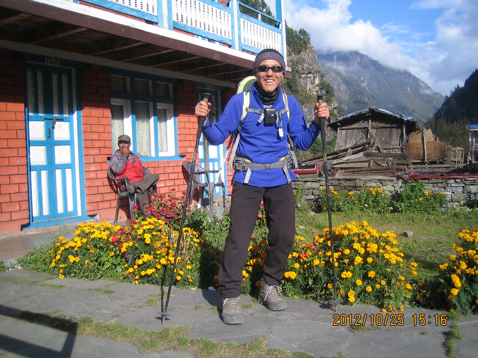
GHT Expedition

The pathways winds through the hardest parts of the Manaslu circuit trekking routes, the high deserts of Upper Mustang and the remote Himalayan valleys. It's a crucible of resilience where nights can plunge below -20°C, food is scarce and high passes demand total mental focus and acceptance of discomfort. Finally, the western stretch towards Rara Lake trekking region and the wild trails of Humla Limi Valley, the journey softens into stillness, the rhythm of walking becomes meditative and life feels stripped down to its purest form. It is at this last stage where change becomes permanent and the journey does not end as a triumph but as a metamorphosis of the self.

But by the time the journey reaches the far-western borderlands near Hilsa the traveler has changed. You can measure the cost of the Great Himalayan Trail in Nepal in time, effort and logistics, but the real value is in what is left behind comfort, urgency and ego and what is left instead clarity, patience and a deep, grounded connection to the Himalaya that lasts long after the trail has ended.

Nepal, Unfiltered: From Kanchenjunga to Humla on Foot

The GHT expedition takes you through Nepal, Unfiltered. It strips away the polished veneer of commercial tourism and shows you the raw, unvarnished truth of the mountains. The remote trekking in Nepal journey is the last place in the world where you can have an adventure that isn't planned or "instagrammed." This 150-day odyssey takes you far beyond the "apple pie trails" and Wi-Fi-connected tea houses that most people know about. There are no crowds, no paved paths, and no safety nets of luxury here. Instead, you feel a strong connection to the land. "Unfiltered" means facing the Himalayas on their own terms, from the leech-infested jungles of the East to the bone-dry, wind-scoured passes of the West. The weather is a physical force, the routes are often just whispers in the scree, and the silence is so deep it feels heavy.
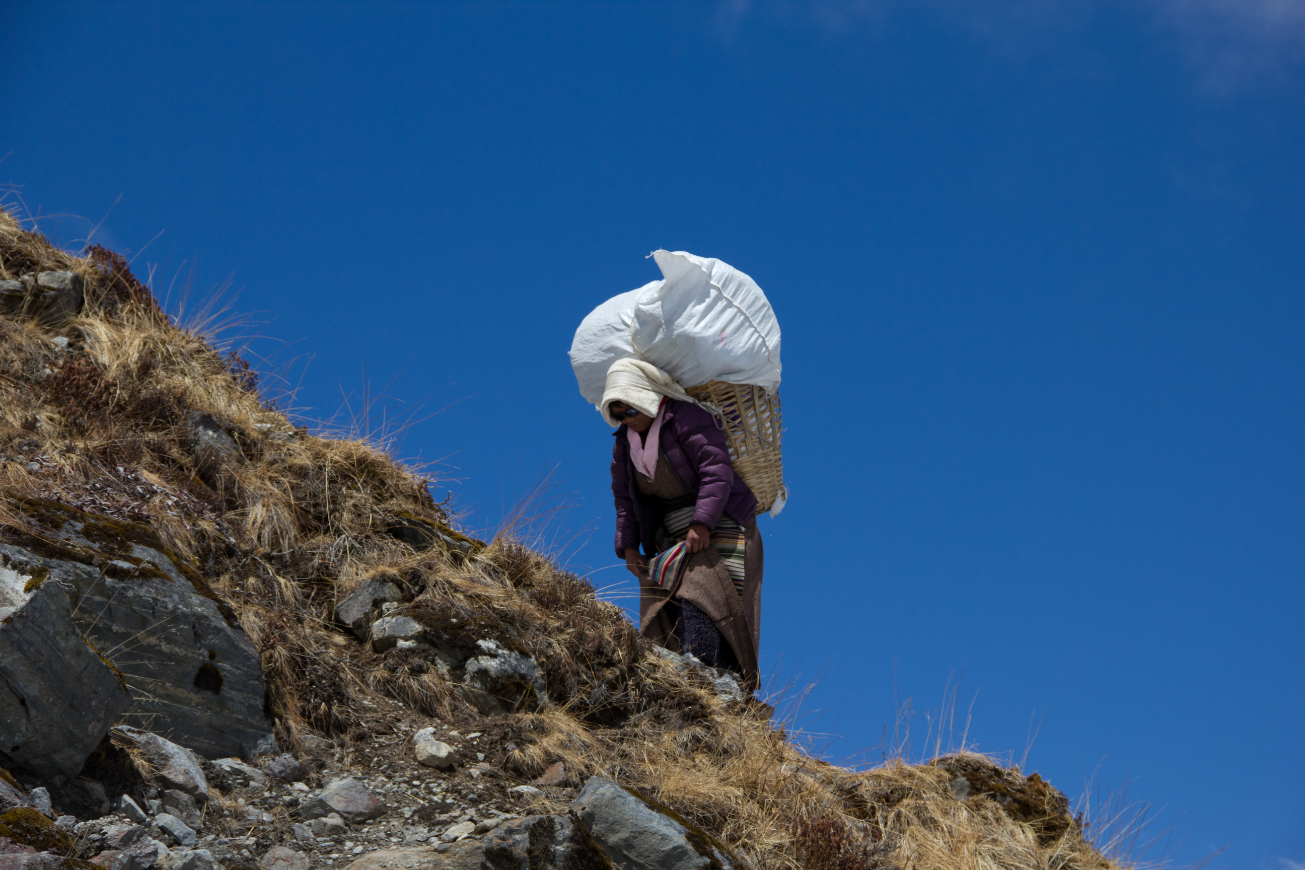
Remote Trekking in Nepal

This "unfiltered" reality applies to every part of the trip. Instead of choosing from a laminated tourist menu, culinary authenticity means eating what the locals eat. For example, sharing a bowl of sun-dried Gundruk (fermented greens) in a Lhomi hut or sipping salt-butter tea with a Dolpo-pa nomad. When you sleep in high-altitude camps where the only light comes from the stars and the only sound is the cracking of glacial ice, you are being environmentally authentic. In small towns like Thudam or Olangchun Gola, you are not a client going through a system; you are a rare guest in a world where hospitality is a sacred duty, not a business deal. You see the real Nepal: the hard work of the harvest, the dusty reality of the salt caravans, and the strong, happy people who have lived alone for generations.

In the end, "Nepal, Unfiltered" is a test for the modern soul. It makes the trekker be completely honest. There is no room for pride or ego when you are climbing the technical heights of the Sherpani Col or crossing the empty Kagmara La. You need to pay close attention to the trail, work hard, and be patient. It shows you the mountains in their most basic form: beautiful, scary, and indifferent. But if you can handle the unfiltered grit of the trip, you will get a unfiltered reward: a feeling of accomplishment that is real and hard-earned, and a memory of the Himalayas that is not a postcard but a living, breathing part of who you are. This is the Himalayas without "photoshop" rough, beautiful, and totally real.

Great Himalayan Trail Cost: The Price of a 150-Day Himalayan Odyssey

The cost of a standard package for a 150-day trek across the Great Himalayan Trail Trek ranges from $28,000 to $38,000 per person. This price is based on the huge logistical challenge of crossing the whole length of the Nepal Himalayas, almost like paying for a small expedition for five months. A big part of this investment goes toward a permit wall. The GHT needs a lot of expensive restricted area permits for places like Upper Dolpo, Manaslu, and Kanchenjunga, which can cost thousands of dollars on their own. The professional support team is the most expensive part. You are hiring a lead guide, assistant guides, and a rotating crew of porters for 150 days, which includes paying for their salaries, insurance, meals, and high-altitude gear.
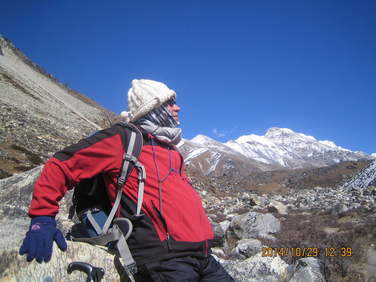
Great Himalayan Trail Trek

Also, since GHT Nepal long trekking routes goes almost half of the route through uninhabited wilderness where there are no lodges, a standard package must include full camping gear, good four-season tents, kitchen equipment, and a cook along with the complicated planning of supply drops. Every few weeks, the team gets fresh food, fuel, and equipment delivered by jeep or porter to remote mountain junctions. The Great Himalayan Trail Cost Nepal also includes several domestic flights to remote airstrips like Simikot and Bhadrapur, private ground transportation, and important safety gear like satellite phones for emergency communication, medical-grade oxygen, and technical gear like ropes and anchors for the glaciated passes. In the end, a standard package is worth the high price because it gives you the strong logistical support and safety net you need to finish the longest and highest trek in the world.

Why the Great Himalayan Trail is Perfect for Retirees?

Many people think of the Great Himalayan Trail as an extreme athletic feat, but for retirees who have the three things that most younger trekkers don't: time, perspective, and the mental strength that comes from living a good life, it may be the ultimate adventure for trekking in Nepal for seniors.

The calendar is one of the biggest obstacles to the GHT. Most people who work can't take five months off from their lives. Retirees are in a unique position to enjoy Slow Travel. Retirees can afford the 150-day pace instead of the 14-day pace of the Everest Base Camp trek. This lets the body adjust more naturally and deeply. Time is the best safety feature on the GHT. It lets you take extra rest days when you're tired and wait for the right weather at high passes.

A 25-year-old might be able to lift more weight, but the GHT is a marathon of the mind. It's about getting up on Day 80 and Day 120 with the same quiet determination. These timeless travelers frequently exhibit a steady-state mental resilience cultivated over decades of life's fluctuations. This maturity is important when you're alone in Upper Dolpo or when the weather in the Himalayas is unpredictable. Older trekkers are usually better at managing their energy levels for the long haul, being more patient with logistics, and respecting local customs, especially when planning complex expeditions where factors like Great Himalayan Trail Cost Nepal also require careful long-term budgeting and realistic preparation.
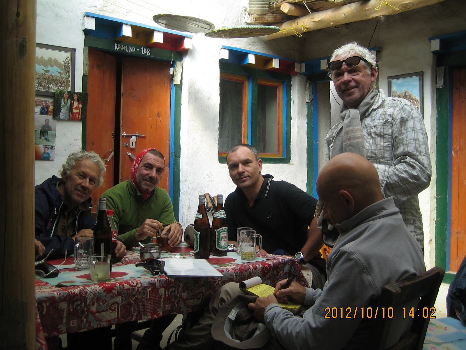
Great Himalayan Trail Lunch

One of the best things you can do for your aging body is to walk for 5 to 7 hours every day. Long-distance trekking is great for your heart and bones without the sudden shocks that can hurt you, unlike high-impact sports. The body goes through a biological recalibration during a 150-day trek. Many seniors say that by the third month, they feel more energetic, lean, and alive than they have in decades. The GHT becomes a "fountain of youth" when you move in a steady, rhythmic way.

For the Second-Chapter Explorers, the GHT is often more about the Living Museum than the height. Younger trekkers may be more interested in conquering passes, but retirees often find more satisfaction in spending time in a Sherpa kitchen or a Lhomi village. They often have a better understanding of the history, the old Bon customs, and the complicated tapestries of faith that can be found along the trail. The GHT gives retirees the mental and spiritual stimulation they need to keep growing instead of getting stuck.

Great Himalayan Trail Nepal is the "Mount Everest" of hiking. Completing the GHT is a powerful statement of ability and a great legacy to leave for one's family for someone who is entering their third act of life. It shows that the spirit of adventure never dies. It turns retirement into an adventure, turning a "rest period" into a time of world-class achievement that very few people on Earth will ever match.

Great Himalayan Trail Itinerary: Designed for Real-Life Schedules

People often think of the Great Himalayan Trail itinerary as a long, 150-day trip, but in reality, it is much more flexible. You can shape the trip around your life instead of the other way around. The highland trek doesn't require you to walk it all at once; instead, it lets you walk it in meaningful sections, so you can stop, go back, and continue when you have the time, energy, and inspiration to do so. This way, the GHT changes from a long hike into a series of connected adventures, each of which is its own story but also part of a larger one.

The adventure naturally splits into three main parts: Eastern, Central, and Western Nepal. Each part has its own unique experience and is easy to plan for. The Eastern Section, which runs from the Kanchenjunga Region through the wild corridors of Makalu Barun National Park to the Everest Region, is one of the most remote and exciting parts of the journey. It usually takes 40 to 50 days to complete all at once, but it can also be broken up into shorter treks of 2 to 3 weeks each. This part is great for people who want to be alone in the wild and for people who want to take on the hardest terrain in stages.

The Central Section goes west and connects the famous trekking areas of Nepal, from Everest through Langtang Valley, Manaslu, and into the Annapurna Region. This part is naturally easier to get to because it has established trails and infrastructure. You can do the whole thing in 50 to 60 days, or you can break it up into classic standalone treks like the Everest Base Camp, Manaslu Circuit, or Annapurna Circuit, which usually last 12 to 20 days. For a lot of people, this part is the best way to see the GHT: walking it in small parts over several visits without losing depth or authenticity.

The Western Section is a wild and rarely traveled area that goes through the magical landscapes of Dolpo and the far reaches of Humla. It is located further to the west. This part usually takes 40 to 50 days, but you can also do it in shorter trips that focus on areas like Upper Dolpo or Simikot–Hilsa. This is where the feeling of timelessness is strongest, and where it becomes not just useful but necessary to break the trip into stages.

The fact that this structure can change is what makes it so strong. Trekkers can make their own schedule by walking one section each year, coming back season after season, or even spreading the trip out over several years. This method is especially useful for people who have to balance work, family, or other obligations, as well as for experienced explorers who like to go at a slower, more immersive pace. Every time you go back to the pathway, it doesn't feel like you are starting over; it feels like you are continuing a deeply personal journey.

Nepal's expanding network of flights, roads, and route access points makes this modular approach possible. Lukla, Jomsom, and Simikot are important entry and exit points that let you start or finish parts of the traverse without having to do the whole thing at once. At the same time, it's still important to plan around the seasons because different parts of the GHT are best seen at different times of the year.

The Great Himalayan Trail Nepal doesn't have a set schedule; it is defined by freedom. The experience is just as deep whether you walk it all at once or in parts over the course of years. The mountains don't count your journey in days; they count it in steps. The trail will always be there, waiting for you to pick up where you left off.

The Elite 1%: Join the Handful of Humans to Ever Cross the Spine of Nepal

People who embark on the 150-day GHT Nepal long trekking routes are part of a small group of adventurers that is even rarer than people who have climbed Mount Everest. More than 10,000 people have climbed to the top of the world's tallest mountain, but fewer people have walked the entire length of the Great Himalayan Trail than have gone into space. This is the "Elite 1%" of the global trekking community extreme trekking in Nepal. These people want more than just a picture of a summit. This trip is a "Horizontal Everest," a 1,700-kilometer test of endurance that most modern travelers will never have to go through. When you commit to the full spine of Nepal, you become more than just a trekker; you become a modern explorer, joining a small group of people who have seen the whole Himalayan range in one breath.
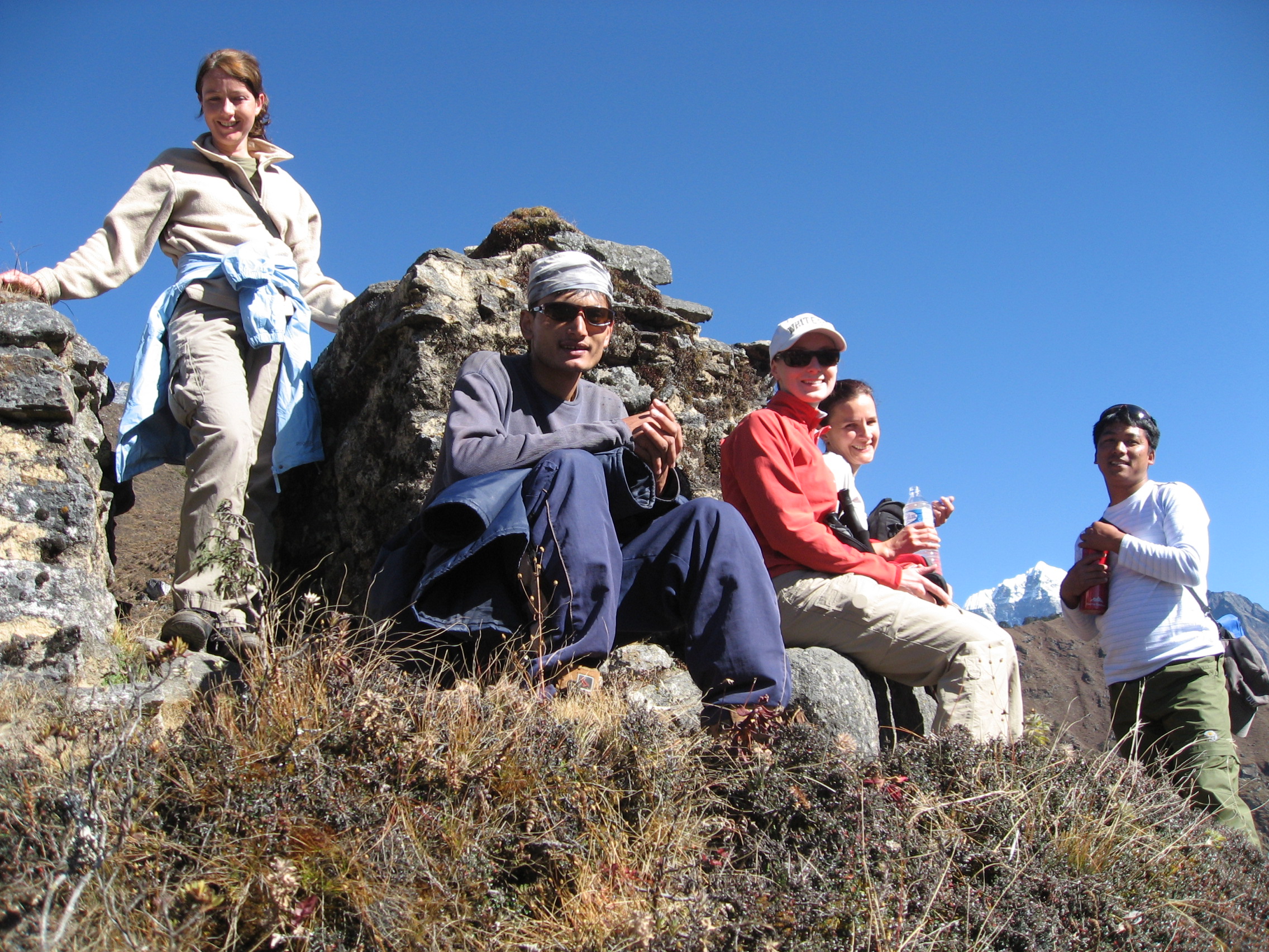
GHT Nepal Long Trekking

Being in this elite group means having the rare strength to get through 21 weeks of the toughest terrain on Earth. It is an accomplishment that is much more prestigious than the commercialized circuits of the Khumbu or Annapurna. You are choosing to walk the unmapped paths, cross technical glaciers that helicopters can't get to, and sleep in valleys that only see a few foreigners a year. The "Elite 1%" are those who value the whole experience, which includes seeing how the geology, languages, and gods change from the far eastern border of Kanchenjunga to the western edge of the Karnali River. You will leave your mark on the history of Himalayan exploration by finishing this trek. You come home not only with a lot of stories, but also with a quiet, unshakeable pride in having completed the longest and highest trekking route on Earth. Great Himalayan Trail Nepal is still one of the last great challenges in nature.

Itinerary

Expand AllClose All

You get to Kathmandu, the capital city which is the cultural and trekking gateway to Nepal. When you arrive at Tribhuvan International Airport, someone from Nepal Nomad will greet you and take you to your hotel.

This is a day to relax, heal, and get used to the new and very different part of the world, Kathmandu: modern yet deeply cultural, peaceful yet fierce, scarce in simplicity yet abundant in fulfillment. The city's energy, temples, and anticipation of the mountains quietly get you ready for the trip ahead.

  • Max. Altitude:Kathmandu (1,324 m, 4,344 ft)
  • Accommodation:Luxury Hotel
  • Meals:Dinner
  • Transport:Car / Jeep

Today is a mix of culture and preparation. You visit UNESCO World Heritage Sites like the Pashupatinath Temple, the Kathmandu Durbar Square, the Boudhanath Stupa, and the Swayambhunath Stupa.

In the afternoon, there is a briefing for the expedition and checks of the gear. This is where the trip goes from being a dream to being real. Everything is checked, packed, and mentally ready.

  • Max. Altitude:Kathmandu (1,324 m, 4,344 ft)
  • Accommodation:Hotel
  • Time:Full day
  • Meals:Breakfast, Dinner
  • Walking Distance:City exploration

A thrilling flight over the mountains takes you to Tenzing-Hillary Airport, one of the most famous airstrips in the world.

The trek starts off slowly through pine forests and on easy routes from Lukla. You go to Chutanga, where the wild slowly takes over civilization and the real trekking rhythm starts.

  • Max. Altitude:Lukla (2,860 m, 9,383 ft), Chutanga (3,050 m, 10,006 ft)
  • Accommodation:Teahouse
  • Time:3 to 4 hours trek
  • Meals:Breakfast, Lunch, Dinner
  • Walking Distance:3 to 4 km, 1.9 to 2.5 miles

The first high pass of the Great Himalayan Trail Nepal, Zatrwa La Pass, is reached by a steep climb. From the top, the Himalayas open dramatically. After you cross the pass, you descend into Thuli Kharka, a highland meadow with strong winds and beautiful alpine scenery.

  • Max. Altitude:Zatrwa La (4,610 m, 15,125 ft), Thuli Kharka (4,300 m, 14,108 ft)
  • Accommodation:Teahouse
  • Time:6 to 7 hours
  • Meals:Breakfast, Lunch, Dinner
  • Walking Distance:7 to 8 km, 4.3 to 5 miles

In this GHT Nepal long trekking routes the pathways now goes down into the green Hinku Valley. There are again forests of rhododendron and pine, as well as rivers, suspension bridges, and deep green silence. Kothe feels warmer, greener, and more protected, which is a nice change from the open ridges.

  • Max. Altitude:Thuli Kharka (4,300 m, 14,108 ft), Kothe (3,600 m, 11,811 ft)
  • Accommodation:Teahouse
  • Time:5 to 6 hours
  • Meals:Breakfast, Lunch, Dinner
  • Walking Distance:10 to 12 km, 6.2 to 7.5 miles

As you go deeper into the valley along the Hinku River, the landscape slowly changes to more alpine. Thagnag looks like a small village with stone walls, fields for grazing, and tall peaks all around it. This is your first real taste of being alone in the high Himalayas.

  • Max. Altitude:Kothe (3,600 m, 11,811 ft), Thagnag (4,250 m, 13,944 ft)
  • Accommodation:Teahouse
  • Time:4 to 5 hours
  • Meals:Breakfast, Lunch, Dinner
  • Walking Distance:6 to 7 km, 3.7 to 4.3 miles

The trail goes up into a cold, icy world. Moraine and ice formations take the place of trees. Khare is right below Mera Peak, which is the first real climbing base on the trip.

  • Max. Altitude:Thagnag (4,250 m, 13,944 ft), Khare (5,045 m, 16,552 ft)
  • Accommodation:Teahouse
  • Time:3 to 4 hours
  • Meals:Breakfast, Lunch, Dinner
  • Walking Distance:4 to 5 km, 2.5 to 3.1 miles

A very important day of preparation, acclimatization and training day. You learn how to use crampons, ice axes, ropes, and how to be safe on glaciers. This is where you start to feel confident about reaching the top.

  • Max. Altitude:Khare (5,045 m, 16,552 ft), Training up to 5,200 m (17,060 ft)
  • Accommodation:Teahouse
  • Time:3 to 5 hours
  • Meals:Breakfast, Lunch, Dinner
  • Walking Distance:2 to 3 km, 1.2 to 1.9 miles (training hikes)

You walk all the way onto glacier terrain for the first time. The path goes up slowly over snowfields to Mera La, a high pass with huge icy landscapes and endless Himalayan horizons all around it.

  • Max. Altitude:Khare (5,045 m, 16,552 ft), Mera La (5,415 m, 17,766 ft)
  • Accommodation:Tent Camp
  • Time:4 to 5 hours
  • Meals:Breakfast, Lunch, Dinner
  • Walking Distance:5 to 6 km, 3.1 to 3.7 miles

A demanding glacier ascent leads you to High Camp. Here, the world feels suspended above clouds. The summit of Mera Peak feels close yet powerful and intimidating. This is your final staging point before the summit push.

  • Max. Altitude:Khare (5,045 m, 16,552 ft), Mera High Camp (5,780 m, 18,963 ft)
  • Accommodation:Tent Camp
  • Time:5 to 7 hours
  • Meals:Breakfast, Lunch, Dinner
  • Walking Distance:6 to 7 km, 3.7 to 4.3 miles

A very important day in this 150 days Himalayan trek is the acclimatization in Ghunsa, a pretty Tibetan influenced village surrounded by pine forests and tall Himalayan peaks. You can go on short hikes, visit monasteries, or just relax. This day helps your body get used to the higher, harder terrain after this break.

  • Max. Altitude:Ghunsa (3,595 m, 11,794 ft)
  • Accommodation:Teahouse
  • Meals:Breakfast, Lunch and Dinner

The path goes up slowly through forests before opening up into a stunning glacial valley. As you gain high altitude, the landscape gets rougher and bigger, and the Jannu Himal mountains stand out against the sky.

  • Max. Altitude:Ghunsa (3,595 m, 11,794 ft), Kangpachen (4,050 m, 13,287 ft)
  • Accommodation:Teahouse
  • Time:6 to 7 hours
  • Meals:Breakfast, Lunch and Dinner
  • Walking Distance:9 to 11 km, 5.6 to 6.8 miles

Today's hike takes us further into a remote and harsh alpine area. The route goes along glacial moraines and wide open valleys, where the plants start to fade and raw scale of the Himalayas becomes overwhelming.

  • Max. Altitude:Kangpachen (4,050 m, 13,287 ft), Lhonak (4,780 m, 15,682 ft)
  • Accommodation:Teahouse
  • Time:6 to 7 hours
  • Meals:Breakfast, Lunch, Dinner
  • Walking Distance:8 to 10 km, 5 to 6.2 miles

When you get to the base of Kanchenjunga Base Camp, it's a very emotional and powerful day. Mount Kanchenjunga, the third highest peak in the world, looms over everything and makes the area feel almost spiritual.

  • Max. Altitude:Lhonak (4,780 m, 15,682 ft), Kanchenjunga Base Camp (5,143 m, 16,873 ft)
  • Accommodation:Teahouse, Camp
  • Time:7 hours
  • Meals:Breakfast, Lunch, Dinner
  • Walking Distance:7 to 8 km, 4.3 to 5 miles

A long descent retracing your path back to Ghunsa. The return feels faster, but equally rewarding as oxygen levels increase and the landscape gradually softens.

  • Max. Altitude:Kanchenjunga Base Camp (5,143 m, 16,873 ft), Ghunsa (3,595 m, 11,794 ft)
  • Accommodation:Teahouse
  • Time:7 to 8 hours
  • Meals:Breakfast, Lunch, Dinner
  • Walking Distance:15 to 18 km, 9.3 to 11.2 miles

Another day off to recover from the push at high altitude. This is very important before you go into the more remote parts of the Great Himalayan Trail.

  • Max. Altitude:Ghunsa (3,595 m, 11,794 ft)
  • Accommodation:Teahouse
  • Time:5 hours
  • Meals:Breakfast, Lunch and Dinner

The pathway steadily rises into a remote alpine area. As you get closer to the hard Nango La pass, forests give way to rocky slopes and glacial terrain.

  • Max. Altitude:Ghunsa (3,595 m, 11,794 ft), Nango La Camp (4,776 m, 15,669 ft)
  • Accommodation:Tent Camp
  • Time:5.5 hours
  • Meals:Breakfast, Lunch, Dinner
  • Walking Distance:7 to 9 km, 4.3 to 5.6 miles

Crossing Nango La is a highlight because it is remote, rough, and not often traveled. The drop into Yangma Kola makes the terrain noticeably greener and the altitude more comfortable.

  • Max. Altitude:Nango La Camp (4,776 m, 15,669 ft), Yangma Kola (3,440 m, 11,286 ft)
  • Accommodation:Teahouse
  • Time:5 hours
  • Meals:Breakfast, Lunch, Dinner
  • Walking Distance:8 to 10 km, 5 to 6.2 miles

A long but culturally rich day as you walk to Olangchun Gola, a traditional Tibetan village. Stone houses, prayer flags, and monasteries are all examples of deep-rooted Himalayan culture.

  • Max. Altitude:Yangma Kola (3,440 m, 11,286 ft), Olangchun Gola (3,191 m, 10,469 ft)
  • Accommodation:Teahouse
  • Time:8 hours
  • Meals:Breakfast, Lunch, Dinner
  • Walking Distance:12 to 14 km, 7.5 to 8.7 miles

A well-deserved day off in one of eastern Nepal's most culturally rich towns. Visit monasteries, talk to the locals, and get a feel for the slow pace of life in this remote Himalayan village.

  • Max. Altitude:Olangchun Gola (3,191 m, 10,469 ft)
  • Accommodation:Teahouse
  • Meals:Breakfast, Lunch, Dinner

The trail steadily climbs into a remote alpine wilderness after leaving Olangchun Gola in the 21st day of Kanchenjunga to Humla trek. The forests slowly get thinner and are replaced by open high-altitude land. As you get closer to Pass Camp, the air gets sharper and the feeling of being alone gets stronger.

  • Max. Altitude:Olangchun Gola (3,191 m, 10,469 ft), Pass Camp (4,453 m, 14,609 ft)
  • Accommodation:Tent Camp
  • Time:7 hours
  • Meals:Breakfast, Lunch, Dinner
  • Walking Distance:10 to 12 km, 6.2 to 7.5 miles

A shorter but crucial acclimatization climb. The ground gets rougher and more like a glacier, getting you ready for the high pass crossing. The landscape seems big, quiet, and untouched.

  • Max. Altitude:Pass Camp (4,453 m, 14,609 ft), Upper Langmale Camp (4,747 m, 15,574 ft)
  • Accommodation:Tent Camp
  • Time:6 hours
  • Meals:Breakfast, Lunch, Dinner
  • Walking Distance:7 to 9 km, 4.3 to 5.6 miles

A hard and faraway crossing over a high Himalayan pass. The day is defined by snowfields, ice, and rough ground. After one of the most remote parts of the route, the descent to Chaurikharka is a relief.

  • Max. Altitude:High Pass (5,000 m, 16,404 ft approx.), Chaurikharka (4,595 m, 15,075 ft)
  • Accommodation:Tent Camp
  • Time:7 to 8 hours
  • Meals:Breakfast, Lunch, Dinner
  • Walking Distance:10 to 12 km, 6.2 to 7.5 miles

A long descent into greener valleys. The landscape changes a lot, going from rough alpine land to forests and villages. After days of being in the wild, Thudam feels like coming back to human warmth.

  • Max. Altitude:Chaurikharka (4,595 m, 15,075 ft), Thudam (3,556 m, 11,667 ft)
  • Accommodation:Teahouse, Homestay
  • Time:7 hours
  • Meals:Breakfast, Lunch, Dinner
  • Walking Distance:12 to 14 km, 7.5 to 8.7 miles

The descent continues along river valleys and terraced hills. The air grows thicker, warmer, and more comfortable, and vegetation becomes lush once again.

  • Max. Altitude:Thudam (3,556 m, 11,667 ft), Chyamtang (2,187 m, 7,175 ft)
  • Accommodation:Teahouse, Homestay
  • Time:6 hours
  • Meals:Breakfast, Lunch, Dinner
  • Walking Distance:10 to 12 km, 6.2 to 7.5 miles

As you leave the lower valleys, the climb starts up again. The expedition route goes through forests and grazing areas, slowly bringing back the height.

  • Max. Altitude:Chyamtang (2,187 m, 7,175 ft), Kharka (2,800 m, 9,186 ft approx.)
  • Accommodation:Basic Lodge, Camp
  • Time:5 to 6 hours
  • Meals:Breakfast, Lunch, Dinner
  • Walking Distance:8 to 10 km, 5 to 6.2 miles

A culturally rich day as you arrive in Lomi, a remote village where the way of life in the Himalayas hasn't changed in hundreds of years. You can expect warm hospitality and a strong sense of simplicity.

  • Max. Altitude:Kharka (2,800 m, 9,186 ft), Lomi (3,000 m, 9,843 ft approx.)
  • Accommodation:Homestay
  • Time:5 to 6 hours
  • Meals:Breakfast, Lunch and Dinner
  • Walking Distance:7 to 9 km, 4.3 to 5.6 miles

The trekking corridor goes down slowly through forests and valleys along rivers. The trip feels more peaceful because there are more places to stop and the land is softer.

  • Max. Altitude:Lomi (3,000 m, 9,843 ft), Hongon (2,323 m, 7,621 ft)
  • Accommodation:Teahouse, Camp
  • Time:6 to 7 hours
  • Meals:Breakfast, Lunch, Dinner
  • Walking Distance:10 to 12 km, 6.2 to 7.5 miles

A steady climb through wooded ridges takes you to a high place where animals can graze. As you get farther away from the villages, the himalayan passage gets quieter again.

  • Max. Altitude:Hongon (2,323 m, 7,621 ft), Bakim Kharka / High Camp (3,020 m, 9,908 ft)
  • Accommodation:Camp
  • Time:6 hours
  • Meals:Breakfast, Lunch, Dinner
  • Walking Distance:9 to 11 km, 5.6 to 6.8 miles

The beautiful climb through the Alps takes you to Molun Pokhari, a sacred lake high in the mountains that is surrounded by open ridges and quiet wilderness. The place feels spiritual, far away, and very calm.

  • Max. Altitude:High Camp (3,020 m, 9,908 ft), Molun Pokhari (3,954 m, 12,972 ft)
  • Accommodation:Camp
  • Time:6 to 7 hours
  • Meals:Breakfast, Lunch, Dinner
  • Walking Distance:8 to 10 km, 5 to 6.2 miles

A month into the GHT Trek, the mountain route goes down from the holy stillness of Molun Pokhari into softer alpine terrain. The path goes through open ridges and grazing lands, bringing back plants and warmer air slowly.

  • Max. Altitude:Molun Pokhari (3,954 m, 12,972 ft), Dhunge Kharka (2,980 m, 9,777 ft)
  • Accommodation:Camp
  • Time:5 hours
  • Meals:Breakfast, Lunch, Dinner
  • Walking Distance:7 to 9 km, 4.3 to 5.6 miles

A steady climb through valleys and trails that go through forests. As it goes up, the path goes through both shaded woods and open clearings.

  • Max. Altitude:Dhunge Kharka (2,980 m, 9,777 ft), Khola Kharka (~3,500 m, 11,483 ft approx.)
  • Accommodation:Camp
  • Time:7 hours
  • Meals:Breakfast, Lunch and Dinner
  • Walking Distance:10 to 12 km, 6.2 to 7.5 miles

As you ascend, the land gets rougher. Cave Camp is a dramatic stop, usually near natural rock shelters and in the middle of the wild Alpine wilderness.

  • Max. Altitude:Khola Kharka (3,500 m, 11,483 ft), Cave Camp (4,200 m, 13,780 ft approx.)
  • Accommodation:Camp
  • Time:7 hours
  • Meals:Breakfast, Lunch, Dinner
  • Walking Distance:10 to 12 km, 6.2 to 7.5 miles

A trek at a high altitude through open ground leads to Kalo Pokhari, a sacred dark lake surrounded by barren ridges. The area feels far away, magical, and untouched.

  • Max. Altitude:Cave Camp (4,200 m, 13,780 ft), Kalo Pokhari (4,600 m, 15,092 ft approx.)
  • Accommodation:Camp
  • Time:6 hours
  • Meals:Breakfast, Lunch, Dinner
  • Walking Distance:8 to 10 km, 5 to 6.2 miles

A descent into grazing pastures where yaks roam freely. The hiking route softens slightly, offering a contrast to the harsh terrain of previous days.

  • Max. Altitude:Kalo Pokhari (4,600 m, 15,092 ft), Grazing Kharka (3,960 m, 12,992 ft)
  • Accommodation:Camp
  • Time:5 to 6 hours
  • Meals:Breakfast, Lunch, Dinner
  • Walking Distance:7 to 9 km, 4.3 to 5.6 miles

A long walk across valleys and ridgelines. The path goes up and down gently, giving you wide views of the Himalayas and the feeling of vast open wilderness.

  • Max. Altitude:Grazing Kharka (3,960 m, 12,992 ft), Yangla Kharka (3,557 m, 11,670 ft)
  • Accommodation:Camp
  • Time:7 hours
  • Meals:Breakfast, Lunch, Dinner
  • Walking Distance:10 to 12 km, 6.2 to 7.5 miles

The climb starts again toward the higher alpine zones. As you get closer to the Makalu region, the plants start to disappear and the ground gets more glacial and open.

  • Max. Altitude:Yangla Kharka (3,557 m, 11,670 ft), Langmale Kharka (4,400 m, 14,436 ft)
  • Accommodation:Camp
  • Time:5 hours
  • Meals:Breakfast, Lunch, Dinner
  • Walking Distance:6 to 8 km, 3.7 to 5 miles

A necessary rest day of getting used to the altitude before going higher. Your body will get used to thinner air after short hikes and rest.

  • Max. Altitude:Langmale Kharka (4,400 m, 14,436 ft)
  • Accommodation:Camp
  • Meals:Breakfast, Lunch, Dinner

A stunning way to get to Makalu Base Camp, which is surrounded by tall Himalayan peaks. Mount Makalu's huge presence stands out in the skyline.

  • Max. Altitude:Langmale Kharka (4,400 m, 14,436 ft), Makalu Base Camp (4,870 m, 15,978 ft)
  • Accommodation:Camp
  • Time:6 to 7 hours
  • Meals:Breakfast, Lunch, Dinner
  • Walking Distance:8 to 10 km, 5 to 6.2 miles

A well-deserved day off at one of Nepal's most remote and beautiful base camps. Visit nearby viewpoints, take a break, and take in the raw beauty of the high Himalayas.

  • Max. Altitude:Makalu Base Camp (4,870 m, 15,978 ft)
  • Accommodation:Camp
  • Meals:Breakfast, Lunch, Dinner

A slow but steady climb takes you deeper into the high glacial basin under Mount Makalu. The landscape changes to one with more ice and moraine, which means you're in a real expedition zone.

  • Max. Altitude:Makalu Base Camp (4,870 m, 15,978 ft), Swiss Base Camp (5,150 m, 16,896 ft)
  • Accommodation:Camp
  • Time:5 to 6 hours
  • Meals:Breakfast, Lunch, Dinner
  • Walking Distance:6 to 8 km, 3.7 to 5 miles

A very important day to get used to high altitude. Short hikes and breaks will help your body get ready for the alpine and difficult crossings that lie ahead.

  • Max. Altitude:Swiss Base Camp (5,150 m, 16,896 ft)
  • Accommodation:Camp
  • Meals:Breakfast, Lunch and Dinner

You go deeper into the glacial area, where there are tall peaks and ice fields all around you. As you get closer to the technical Sherpani Col base, the feeling of being alone grows stronger.

  • Max. Altitude:Swiss Base Camp (5,150 m, 16,896 ft), Sherpani Col Base Camp (5,700 m, 18,701 ft)
  • Accommodation:Camp
  • Time:6 to 7 hours
  • Meals:Breakfast, Lunch and Dinner
  • Walking Distance:7 to 9 km, 4.3 to 5.6 miles

One of the hardest days of the GHT. Crossing Sherpani Col means climbing steep hills, crossing ice, and using fixed ropes. The reward is entry into the dramatic Baruntse region.

  • Max. Altitude:Sherpani Col (6,100 m, 20,013 ft), Baruntse High Camp (6,100 m, 20,013 ft)
  • Accommodation:Camp
  • Time:6 to 7 hours
  • Meals:Breakfast, Lunch, Dinner
  • Walking Distance:6 to 8 km, 3.7 to 5 miles

Our trek begins its course early in the morning after we sufficiently have our breakfast. Then we will be heading for Amphu Labasta Base situated at the height of 5400m. We will find Amphu Labasta Base situated at the bottom of the ridge between two valleys known as Honku and Imja. We will be seeing some incredible sights of different peaks, one of which is Ama Dablam. Our camp will be set up in a favorable area where we will be staying for the night.

  • Max. Altitude:Baruntse High Camp (6,100 m, 20,013 ft), Honku Basin (5,000 m, 16,404 ft approx.)
  • Accommodation:Camp
  • Time:4 to 5 hours
  • Meals:Breakfast, Lunch, Dinner
  • Walking Distance:6 to 8 km, 3.7 to 5 miles

A steady climb over glacial terrain takes you to the base of the tough Amphu Labsta Pass, which is one of the most difficult parts of the whole traverse to cross.

  • Max. Altitude:Honku Basin (5,000 m, 16,404 ft), Amphu Labsta Base (5,400 m, 17,717 ft)
  • Accommodation:Camp
  • Time:5 hours
  • Meals:Breakfast, Lunch, Dinner
  • Walking Distance:6 to 7 km, 3.7 to 4.3 miles

A day of getting used to things and getting ready before crossing Amphu Labsta. Here, checking your gear and planning your route are very important.

  • Max. Altitude:Amphu Labsta Base (5,400 m, 17,717 ft)
  • Accommodation:Camp
  • Meals:Breakfast, Lunch and Dinner

Crossing over Amphu Labsta Pass is long and hard. The day before reaching the comfort of Chukung village is marked by steep sections and a technical descent.

  • Max. Altitude:Amphu Labsta (5,845 m, 19,177 ft), Chukung (4,730 m, 15,518 ft)
  • Accommodation:Teahouse
  • Time:10 to 12 hours
  • Meals:Breakfast, Lunch and Dinner
  • Walking Distance:10 to 12 km, 6.2 to 7.5 miles

A quick trip down to the famous Everest area. The himalayan passage joins up with well-known hiking trails and has better facilities.

  • Max. Altitude:Chukung (4,730 m, 15,518 ft), Dingboche (4,360 m, 14,304 ft)
  • Accommodation:Teahouse
  • Time:3 to 4 hours
  • Meals:Breakfast, Lunch, Dinner
  • Walking Distance:5 to 6 km, 3.1 to 3.7 miles

A slow climb through high alpine terrain to Dzongla. The terrain gets rougher again, and you can see glaciers and tall peaks along the way.

  • Max. Altitude:Dingboche (4,360 m, 14,304 ft), Dzongla (4,843 m, 15,889 ft)
  • Accommodation:Teahouse
  • Time:5 to 6 hours
  • Meals:Breakfast, Lunch, Dinner
  • Walking Distance:7 to 9 km, 4.3 to 5.6 miles

A beautiful crossing over glacial land takes you to the Gokyo Valley. The pathway goes by the huge Ngozumpa Glacier, which is the biggest glacier in Nepal, and then it goes to the sacred turquoise lakes of Gokyo.

  • Max. Altitude:Dzongla (4,843 m, 15,889 ft), Gokyo (4,759 m, 15,613 ft)
  • Accommodation:Teahouse
  • Time:6 to 7 hours
  • Meals:Breakfast, Lunch, Dinner
  • Walking Distance:9 to 11 km, 5.6 to 6.8 miles

A rewarding climb to Gokyo Ri, one of the best places to see the Himalayas. From the top, you can see Everest, Lhotse, Makalu, and Cho Oyu in a stunning view.

  • Max. Altitude:Gokyo (4,759 m, 15,613 ft), Gokyo Ri (5,483 m, 17,989 ft)
  • Accommodation:Teahouse
  • Time:4 to 5 hours
  • Meals:Breakfast, Lunch, Dinner
  • Walking Distance:4 to 5 km, 2.5 to 3.1 miles

A slow rise away from Gokyo takes you to the far off Renjo La area. As you get farther away from the main trekking routes, the passage gets quieter and less crowded.

  • Max. Altitude:Gokyo Ri (5,483 m, 17,989 ft), Renjo La High Camp (5,000 m, 16,404 ft approx.)
  • Accommodation:Camp
  • Time:4 hours
  • Meals:Breakfast, Lunch, Dinner
  • Walking Distance:6 to 8 km, 3.7 to 5 miles

Crossing Renjo La Pass offers stunning views before descending into a remote valley. Compared to the busier routes to Everest, this trail feels wild and untouched.

  • Max. Altitude:Renjo La (5,360 m, 17,585 ft), Taranga (4,368 m, 14,331 ft)
  • Accommodation:Camp
  • Time:7 hours
  • Meals:Breakfast, Lunch, Dinner
  • Walking Distance:10 to 12 km, 6.2 to 7.5 miles

A short and pleasant descent brings you to Thame, a traditional Sherpa village known for its rich culture and monastery heritage.

  • Max. Altitude:Taranga (4,368 m, 14,331 ft), Thame (3,820 m, 12,533 ft)
  • Accommodation:Teahouse
  • Time:3 hours
  • Meals:Breakfast, Lunch, Dinner
  • Walking Distance:5 to 6 km, 3.1 to 3.7 miles

The winding path goes up steadily into a remote valley, leaving behind small towns. You come back to high alpine lakes and glacial landscapes.

  • Max. Altitude:Thame (3,820 m, 12,533 ft), Parchemuche Tsho (4,780 m, 15,682 ft)
  • Accommodation:Camp
  • Time:6.5 hours
  • Meals:Breakfast, Lunch, Dinner
  • Walking Distance:9 to 11 km, 5.6 to 6.8 miles

Cave Camp is located near natural rock shelters and is reached by a steep climb into high-altitude terrain. The environment is harsh, exposed, and deeply remote.

  • Max. Altitude:Parchemuche Tsho (4,780 m, 15,682 ft), Cave Camp (5,665 m, 18,586 ft)
  • Accommodation:Camp
  • Time:5.5 hours
  • Meals:Breakfast, Lunch, Dinner
  • Walking Distance:7 to 9 km, 4.3 to 5.6 miles

A crucial acclimatization day before another technical crossing. Rest, hydrate, and prepare for the glacier traverse ahead.

  • Max. Altitude:Cave Camp (5,665 m, 18,586 ft)
  • Accommodation:Camp
  • Meals:Breakfast, Lunch, Dinner

A hard descent down a glacier over ice and moraine land. You need to be careful when you cross into another remote Himalayan basin.

  • Max. Altitude:Cave Camp (5,665 m, 18,586 ft), Trakarding Glacier (4,735 m, 15,535 ft)
  • Accommodation:Camp
  • Time:8 hours
  • Meals:Breakfast, Lunch, Dinner
  • Walking Distance:10 to 12 km, 6.2 to 7.5 miles

A shorter but steady hike over rough ground. The landscape is still wild and glacial, and there are tall peaks all around you.

  • Max. Altitude:Trakarding Glacier (4,735 m, 15,535 ft), Kabug (4,820 m, 15,814 ft)
  • Accommodation:Camp
  • Time:4.5 hours
  • Meals:Breakfast, Lunch, Dinner
  • Walking Distance:6 to 7 km, 3.7 to 4.3 miles

A steady drop will take you to the Rolwaling Valley. As you leave behind the icy landscapes, the ground becomes softer. You arrive at Beding, a beautiful Sherpa village at the foot of tall peaks.

  • Max. Altitude:Kabug (4,820 m, 15,814 ft), Beding (3,740 m, 12,270 ft)
  • Accommodation:Teahouse
  • Time:5 hours
  • Meals:Breakfast, Lunch, Dinner
  • Walking Distance:8 to 10 km, 5 to 6.2 miles

A crucial rest day for proper acclimatization. You can explore the village, visit monasteries, or go on short hikes while enjoying the valley's warm weather and rich culture.

  • Max. Altitude:Beding (3,740 m, 12,270 ft)
  • Accommodation:Teahouse
  • Meals:Breakfast, Lunch, Dinner

The ancient way goes down through valleys and wooded paths along the river. The air feels thicker and more comfortable, and the environment gets greener.

  • Max. Altitude:Beding (3,740 m, 12,270 ft), Dokhang (2,791 m, 9,157 ft)
  • Accommodation:Teahouse
  • Time:6 hours
  • Meals:Breakfast, Lunch, Dinner
  • Walking Distance:10 to 12 km, 6.2 to 7.5 miles

A gentle descent via terraced hills and into traditional villages. You reach Simigaon for a peaceful break and witness the hills and valleys around it.

  • Max. Altitude:Dokhang (2,791 m, 9,157 ft), Simigaon (2,036 m, 6,680 ft)|
  • Accommodation:Teahouse
  • Time:5 hours
  • Meals:Breakfast, Lunch, Dinner
  • Walking Distance:8 to 10 km, 5 to 6.2 miles

A climb leads you to Bigu Gompa, a sacred Buddhist monastery. The peaceful environment and spiritual atmosphere make this a unique cultural experience.

  • Max. Altitude:Simigaon (2,036 m, 6,680 ft), Bigu Gompa (2,516 m, 8,255 ft)
  • Accommodation:Teahouse
  • Time:5 to 6 hours
  • Meals:Breakfast, Lunch and Dinner
  • Walking Distance:7 to 9 km, 4.3 to 5.6 miles

Crossing Tinsang La Pass was be exhausting and difficult but the rewards will be worth it. The mountain passage goes down into Dolangsa after giving you wide views of the mountains, one of the most breathtaking sceneries in the entire trip.

  • Max. Altitude:Bigu Gompa (2,516 m, 8,255 ft), Tinsang La Pass (3,778 m, 12,395 ft), Dolangsa (2,489 m, 8,166 ft)
  • Accommodation:Basic Lodge
  • Time:7 hrs
  • Meals:Breakfast, Lunch, Dinner
  • Walking Distance:10 to 12 km, 6.2 to 7.5 miles

A long downhill trek into a valley in the subtropics. You get to The Last Resort, which is famous for its dramatic location on the Bhote Koshi River.

  • Max. Altitude:Dolangsa (2,489 m, 8,166 ft), The Last Resort (1,170 m, 3,839 ft)
  • Accommodation:Lodge
  • Time:6 hours
  • Meals:Breakfast, Lunch, Dinner
  • Walking Distance:10 to 12 km, 6.2 to 7.5 miles

The trail follows the upward route into the hills through forests and old villages. Sherpa Gaun is a great place to experience real culture and meet locals.

  • Max. Altitude:The Last Resort (1,170 m, 3,839 ft), Sherpa Gaun (2,500 m, 8,202 ft)
  • Accommodation:Homestay
  • Time:6 hours
  • Meals:Breakfast, Lunch, Dinner
  • Walking Distance:10 to 12 km, 6.2 to 7.5 miles

A long traverse across hills and valleys. The Himalayan pathways goes through remote rural areas where very few people hike, giving you a real off-the-beaten-path experience.

  • Max. Altitude:Sherpa Gaun (2,500 m, 8,202 ft), Kyangsing (2,475 m, 8,120 ft)
  • Accommodation:Homestay
  • Time:7 hours
  • Meals:Breakfast, Lunch, Dinner
  • Walking Distance:11 to 13 km, 6.8 to 8.1 miles

A beautiful path through forests and terraced fields leads to Tembathang, a quiet village surrounded by hills and old-fashioned farmland.

  • Max. Altitude:Kyangsing (2,475 m, 8,120 ft), Tembathang (2,180 m, 7,152 ft)
  • Accommodation:Homestay
  • Time:7 hours
  • Meals:Breakfast, Lunch, Dinner
  • Walking Distance:11 to 13 km, 6.8 to 8.1 miles

As you leave the lower valleys behind, a steady climb begins. The expedition path goes up through thick forests and quiet ridgelines, slowly getting back into higher alpine terrain.

  • Max. Altitude:Tembathang (2,180 m, 7,152 ft), Nosyampati (3,600 m, 11,811 ft)
  • Accommodation:Camp
  • Time:6 hours
  • Meals:Breakfast, Lunch, Dinner
  • Walking Distance:10 to 12 km, 6.2 to 7.5 miles

The holy lakes of Panch Pokhari can be reached by a shorter but beautiful climb. The area is peaceful and spiritual, with wide views of the Himalayas and open alpine landscapes all around.

  • Max. Altitude:Nosyampati (3,600 m, 11,811 ft), Panch Pokhari (4,074 m, 13,366 ft)
  • Accommodation:Camp
  • Time:3 to 4 hours
  • Meals:Breakfast, Lunch, Dinner
  • Walking Distance:5 to 6 km, 3.1 to 3.7 miles

An essemtial acclimatization day. Explore the sacred lakes, rest, and prepare for higher altitude crossings ahead.

  • Max. Altitude:Panch Pokhari (4,074 m, 13,366 ft)
  • Accommodation:Camp
  • Meals:Breakfast, Lunch, Dinner

The passage goes through remote alpine areas where there are fewer signs of people. As you get closer to Tin Pokhari, the land gets rougher and more open.

  • Max. Altitude:Panch Pokhari (4,074 m, 13,366 ft), Tin Pokhari (4,255 m, 13,960 ft)
  • Accommodation:Camp
  • Time:6 hours
  • Meals:Breakfast, Lunch and Dinner
  • Walking Distance:8 to 10 km, 5 to 6.2 miles

Another necessary rest and acclimatization day before the demanding Tilman Pass crossing. The silence here feels deep and untouched.

  • Max. Altitude:Tin Pokhari (4,255 m, 13,960 ft)
  • Accommodation:Camp
  • Meals:Breakfast, Lunch, Dinner

A hard upward hike to Tilman Pass, which is one of the hardest and most remote crossings in the Himalayas. The day is defined by snow, ice, and exposure.

  • Max. Altitude:Tin Pokhari (4,255 m, 13,960 ft), Tilman Pass (5,308 m, 17,414 ft)
  • Accommodation:Camp
  • Time:6 hours
  • Meals:Breakfast, Lunch, Dinner
  • Walking Distance:6 to 8 km, 3.7 to 5 miles

A careful descent from the pass over icy ground. You need to pay attention as you walk along the ice slopes and moraine fields.

  • Max. Altitude:Tilman Pass (5,308 m, 17,414 ft), North High Camp (4,720 m, 15,485 ft)
  • Accommodation:Camp
  • Time:7 hours
  • Meals:Breakfast, Lunch, Dinner
  • Walking Distance:8 to 10 km, 5 to 6.2 miles

A long and tiring downhill trek into the Langtang Valley. After being alone for days, Kyangjin Gompa feels like a warm place to be, with lodges, monasteries, and beautiful views of the mountains.

  • Max. Altitude:10 to 12 km, 6.2 to 7.5 miles
  • Accommodation:Teahouse
  • Time:7 hours
  • Meals:Breakfast, Lunch, Dinner
  • Walking Distance:North High Camp (4,720 m, 15,485 ft), Kyangjin Gompa (3,830 m, 12,566 ft)

After carefully crossing the remote and difficult Tilman Pass, the downhill journey begins over rough moraine terrain and ice slopes. Some parts of the routes are technical, so you need to pay attention and keep your balance. After one of the most isolated parts of the journey, getting to North High Camp is a relief.

  • Max. Altitude:Tilman Pass (5,308 m, 17,414 ft), North High Camp (4,720 m, 15,485 ft)
  • Accommodation:Camp
  • Time:7 hours
  • Meals:Breakfast, Lunch, Dinner
  • Walking Distance:8 to 10 km, 5 to 6.2 miles

You go down a long hill to get to the beautiful Langtang Valley. After days of being very far away, Kyangjin Gompa feels like home again, with its monasteries, yak pastures, and teahouse comfort.

  • Max. Altitude:North High Camp (4,720 m, 15,485 ft), Kyangjin Gompa (3,830 m, 12,566 ft)
  • Accommodation:Teahouse
  • Time:7 hours
  • Meals:Breakfast, Lunch, Dinner
  • Walking Distance:10 to 12 km, 6.2 to 7.5 miles

A downward journey through the Langtang Valley. The pathways goes back through forests, suspension bridges, and river paths, slowly leaving behind the alpine scenery.

  • Max. Altitude:Kyangjin Gompa (3,830 m, 12,566 ft), Lama Hotel (3,030 m, 9,941 ft)
  • Accommodation:Teahouse
  • Time:6 to 7 hours
  • Meals:Breakfast, Lunch, Dinner
  • Walking Distance:12 to 14 km, 7.5 to 8.7 miles

A slow drop into hills that are warmer and greener. Syabru Besi is a return to the lower valleys, where there are villages, terraced fields, and roads.

  • Max. Altitude:Lama Hotel (3,030 m, 9,941 ft), Syabru Besi (1,503 m, 4,931 ft)
  • Accommodation:Teahouse
  • Time:6 hours
  • Meals:Breakfast, Lunch, Dinner
  • Walking Distance:10 to 12 km, 6.2 to 7.5 miles

The trip goes to the Ganesh Himal area. The climb to Gatlang takes you through traditional Tamang villages and cultural landscapes.

  • Max. Altitude:Syabru Besi (1,503 m, 4,931 ft), Gatlang (2,238 m, 7,343 ft)
  • Accommodation:Teahouse
  • Time:4 hours
  • Meals:Breakfast, Lunch, Dinner
  • Walking Distance:8 to 10 km, 5 to 6.2 miles

A steady hike into the mountains far away. Somdang is a quiet valley high up in the mountains, surrounded by forests and old mining trails.

  • Max. Altitude:Gatlang (2,238 m, 7,343 ft), Somdang (3,258 m, 10,688 ft)
  • Accommodation:Basic Lodge
  • Time:6 hours
  • Meals:Breakfast, Lunch, Dinner
  • Walking Distance:10 to 12 km, 6.2 to 7.5 miles

A long descent through forested ridges and scattered settlements. Tipling offers cultural diversity and warm village hospitality.

  • Max. Altitude:Somdang (3,258 m, 10,688 ft), Tipling (1,890 m, 6,201 ft)
  • Accommodation:Teahouse
  • Time:7 hours
  • Meals:Breakfast, Lunch, Dinner
  • Walking Distance:12 to 14 km, 7.5 to 8.7 miles

The trail goes deeper into the valleys of the rivers. As you go down toward Lapa Khola, the air gets warmer and the forests get more humid.

  • Max. Altitude:Tipling (1,890 m, 6,201 ft), Lapa Khola (1,258 m, 4,127 ft)
  • Accommodation:Camp
  • Time:6 hours
  • Meals:Breakfast, Lunch, Dinner
  • Walking Distance:10 to 12 km, 6.2 to 7.5 miles

A strong uphill section starts again, this time going into higher grazing areas. The passage gets harder to get to and harder on the body.

  • Max. Altitude:Lapa Khola (1,258 m, 4,127 ft), Nauban Kharka (2,750 m, 9,022 ft)
  • Accommodation:Camp
  • Time:7 hours
  • Meals:Breakfast, Lunch, Dinner
  • Walking Distance:11 to 13 km, 6.8 to 8.1 miles

A long and varied day spent walking along ridgelines, through forests, and through village paths. Kerauja is a Gurung settlement with a lot of cultural diversity.


  • Max. Altitude:Nauban Kharka (2,750 m, 9,022 ft), Kerauja (2,074 m, 6,804 ft)
  • Accommodation:Teahouse
  • Time:8 hours
  • Meals:Breakfast, Lunch, Dinner
  • Walking Distance:12 to 14 km, 7.5 to 8.7 miles

As you are descending toward the lower Marshyangdi valley, the landscape gets warmer and more tropical, with rivers and terraced farmland.

  • Max. Altitude:Kerauja (2,074 m, 6,804 ft), Khorla Besi (1,000 to 1,200 m approx.)
  • Accommodation:Teahouse
  • Time:8 hours
  • Meals:Breakfast, Lunch, Dinner
  • Walking Distance:10 to 12 km, 6.2 to 7.5 miles

The final section reaches Jagat, reconnecting with the Annapurna Circuit route. Stone villages, rivers, and paths signal the nearing completion of this long Himalayan traverse.

  • Max. Altitude:Khorla Besi (1,000 to 1,200 m), Jagat (1,340 m, 4,396 ft)
  • Accommodation:Teahouse
  • Time:5 to 6 hours
  • Meals:Breakfast, Lunch, Dinner
  • Walking Distance:8 to 10 km, 5 to 6.2 miles

The 150 days Himalayan trek continues along the Budhi Gandaki valley, where it crosses rivers and passes through stone villages. Philim greets you with terraced fields and the way people used to live in villages.

  • Max. Altitude:Jagat (1,340 m, 4,396 ft), Philim (1,570 m, 5,151 ft)
  • Accommodation:Teahouse
  • Time:4 hours
  • Meals:Breakfast, Lunch, Dinner
  • Walking Distance:10 to 12 km, 6.2 to 7.5 miles

A slow climb into tighter gorges and bamboo forests. As you go deeper into the Manaslu area, the adventure feels more isolated.

  • Max. Altitude:Philim (1,570 m, 5,151 ft), Deng (1,860 m, 6,102 ft)
  • Accommodation:Teahouse
  • Time:5 to 6 hours
  • Meals:Breakfast, Lunch, Dinner
  • Walking Distance:12 to 14 km, 7.5 to 8.7 miles

A long and rewarding climb through forests, waterfalls, and villages with Tibetan influences. Namrung is the gateway to a more culturally rich part of the Himalayas.

  • Max. Altitude:Deng (1,860 m, 6,102 ft), Namrung (2,630 m, 8,629 ft)
  • Accommodation:Teahouse
  • Time:7 to 8 hours
  • Meals:Breakfast, Lunch, Dinner
  • Walking Distance:15 to 17 km, 9.3 to 10.6 miles

The mountain passage opens up dramatically, giving you a great view of Manaslu and the peaks around it. Shyala is one of the most beautiful villages in the Himalayas.

  • Max. Altitude:Namrung (2,630 m, 8,629 ft), Shyala (3,520 m, 11,549 ft)
  • Accommodation:Teahouse
  • Time:5 to 6 hours
  • Meals:Breakfast, Lunch, Dinner
  • Walking Distance:8 to 10 km, 5 to 6.2 miles

A high-altitude trek through wide valleys and glacial terrain. Samdo lies close to the Tibetan border, reflecting strong cultural influences.

  • Max. Altitude:Shyala (3,520 m, 11,549 ft), Samdo (3,875 m, 12,713 ft)
  • Accommodation:Teahouse
  • Time:5 to 6 hours
  • Meals:Breakfast, Lunch, Dinner
  • Walking Distance:9 to 11 km, 5.6 to 6.8 miles

A very important day to get used to things before crossing Larkya La. Short hikes and breaks get the body ready for the high altitude ahead.

  • Max. Altitude:Samdo (3,875 m, 12,713 ft)
  • Accommodation:Teahouse
  • Meals:Breakfast, Lunch and Dinner

A short but steep climb up to a high-altitude area with no trees or plants. As you get closer to the pass, the weather gets colder and more open.

  • Max. Altitude:Samdo (3,875 m, 12,713 ft), Larkya Base Camp (4,460 m, 14,633 ft)
  • Accommodation:Camp
  • Time:4 hours
  • Meals:Breakfast, Lunch, Dinner
  • Walking Distance:6 to 8 km, 3.7 to 5 miles

Crossing Larkya La Pass was one of the best parts of the whole GHT. The way down to Bimtang shows off huge Himalayan views and dramatic glacier valleys.

  • Max. Altitude:Larkya La (5,106 m, 16,752 ft), Bimtang (3,590 m, 11,778 ft)
  • Accommodation:Teahouse
  • Time:8 to 10 hours
  • Meals:Breakfast, Lunch, Dinner
  • Walking Distance:15 to 18 km, 9.3 to 11.2 miles

A long descent through villages, rivers, and pine forests. Dharapani is where you can reconnect with the Annapurna Circuit trail network.

  • Max. Altitude:Bimtang (3,590 m, 11,778 ft), Dharapani (1,865 m, 6,118 ft)
  • Accommodation:Teahouse
  • Time:7 hours
  • Meals:Breakfast, Lunch and Dinner
  • Walking Distance:18 to 20 km, 11.2 to 12.4 miles

A final ascent into quieter hills and terraced landscapes. Khodo feels peaceful and reflective, perfect for the closing phase of this epic Himalayan journey.

  • Max. Altitude:Dharapani (1,865 m, 6,118 ft), Khodo (2,675 m, 8,776 ft)
  • Accommodation:Teahouse
  • Time:6 hours
  • Meals:Breakfast, Lunch, Dinner
  • Walking Distance:10 to 12 km, 6.2 to 7.5 miles

Walking through some steep ascents, we reach Manang after about four hours. We will be leaving Pisan after an early morning breakfast and head towards Manang which is situated at an elevation of 3540 meters. Our camping point is about forty minutes away from Manang’s airstrip at Hongde. We will be spending our night at Manang.

  • Max. Altitude:3540m
  • Accommodation:Tent
  • Time:4 hours
  • Meals:Breakfast, Lunch and Dinner with coffee/tea

This day is likely to be one of the most memorable days on this trek. We will get to see wondrous views of Gangapurna peak and Annapurna three on our way to yak Kharka. It will take us about six hours to reach Yak Kharka which is our camping destination for the day.

  • Max. Altitude:4050m
  • Accommodation:Tent
  • Time:6 hours
  • Meals:Breakfast, Lunch and Dinner with coffee/tea

From Yak Kharka, we will head towards Thorong High Camp which is likely to take us about six hours. It will involve a short trek but it is a challenging one. We will be crossing Jorsang Khola through a small bridge above the waters and make our way to the foot of Throng La pass where we will find some tea houses. We will be camping for the night at Thorong High Camp before making our way towards Muktinath.

  • Max. Altitude:4700m
  • Accommodation:Tent
  • Time:6 hours
  • Meals:Breakfast, Lunch and Dinner with coffee/tea

We will be moving towards Muktinath by crossing Thorong La pass. We will be leaving Thorong High Camp very early in the morning after having our breakfast. It is likely to take us about nine hours of walking to reach Muktinath. We will be making our way through various steep uphill as well as some downhill trails decorated by prayer flags. We will stay overnight at Muktinath.

  • Accommodation:Tent
  • Time:9 hours
  • Meals:Breakfast, Lunch and Dinner with coffee/tea

To be prepared for the upcoming challenges, a day has been separated for resting purposes. So we will be spending another day at Muktinath exploring its unspoiled beauty before resuming our trek.

  • Accommodation:Tent
  • Meals:Breakfast, Lunch and Dinner with coffee/tea

After taking enough rest at Muktinath, we will be heading towards Goat Kharka which is likely to take us about six hours of walk. After reaching the valley of Kaligandaki, we will be taking a shorter route which will lead our way to Goat Kharka. We will be going through small villages where we will get to observe the existence of Old Gompas and the amazing remains of some ancient forts. We will be following the main trail leading to Kharka after proceeding through a suspension bridge that crosses our way, as we reach Kagbeni. We will be camping at goat Kharka for the night.

  • Max. Altitude:2810m
  • Accommodation:Tent
  • Time:6 hours
  • Meals:Breakfast, Lunch and Dinner with coffee/tea

From Goat Kharka, we will be making our way to Santa which stands at an altitude of 3778 meters taking us about seven hours to reach the destination. This day can prove to be a little challenging as we will be going through two passes, one of which is Bhima Lojun la pass (4460m). We will be crossing various gullies and making our way through the caves. A descent will follow us after crossing our second pass taking us into a large ravine and then to a scree slope leading us finally to Santa. We will be camping for the night at Santa.

  • Max. Altitude:3778m
  • Accommodation:Tent
  • Time:7 hours
  • Meals:Breakfast, Lunch and Dinner with coffee/tea

Today, we will be heading towards Ghalden Ghuldun Khola which is situated at an altitude of 4247 meters. It will take us about six hours to reach the destination which will be our camping point for the day. We will be crossing through various gullies along the way. Similarly, we will be reaching our campsite after crossing a steep gully. We will be camping in the Juniper forest as we get to Ghalden Ghuldun Khola.

  • Max. Altitude:4247m
  • Accommodation:Tent
  • Time:6 hours
  • Meals:Breakfast, Lunch and Dinner with coffee/tea

On the hundred-sixth day of our marvelous trek, we will be heading for Lalinawar Khola which will be taking us about four hours of walk. It is a short trek but it can be a little challenging with some ups and downs along the trails. We will be camping at Lalinawar Khola for the night before heading towards Nulungsunda Kharka.

  • Max. Altitude:4800m
  • Accommodation:Tent
  • Time:4 hours
  • Meals:Breakfast, Lunch and Dinner with coffee/tea

Today, we will be following the trails to Nulungsunda Kharka which will take us through two passes above 5000 meters. One is Jungben La and the other is Niwas la. We will be rewarded with magnificent views of the hidden valley in the south and the Dhaulagiri peak from the top of Jungben La pass. Then a descent will take us to Nulungsunda Kharka where we'll be camping for the night.

  • Max. Altitude:4987m
  • Accommodation:Tent
  • Time:7 hours
  • Meals:Breakfast, Lunch and Dinner with coffee/tea

From Nulungsunda Kharka, we will be extending our steps towards Chharka Bot which will approximately take us about six hours. Our trek to the fortified village is comparatively easier than our previous trek. We will be camping here at the Village of Chharka Bot for the night.

  • Max. Altitude:4302m
  • Accommodation:Tent
  • Time:6 hours
  • Meals:Breakfast, Lunch and Dinner with coffee/tea

This day is separated as a resting day in order to give some time for our muscles to relax from all the tiring treks it has undertaken. We will be spending another beautiful night at Chharka Bot before heading towards Chap Chu.

  • Max. Altitude:4302m
  • Accommodation:Tent
  • Meals:Breakfast, Lunch and Dinner with coffee/tea

After an energizing rest at Chharka Bot, we will be heading for Chap Chu which is situated at an elevation of 4320 meters. After heading west from Chharka Bot, it is likely to take us about seven hours to reach Chap Chu. Crossing some small Tributaries and some stepping stones, we will make our way towards Chap Chu. We will be camping for the night at Chap Chu.

  • Max. Altitude:4320m
  • Accommodation:Tent
  • Time:7 hours
  • Meals:Breakfast, Lunch and Dinner with coffee/tea

We will be moving towards Maran after having a lovely breakfast at Chap Chu. We will cross the Chan la pass(538m) on our way to Maran. Crossing the pass is not that strenuous, so we will easily be able to get through it. We will be blessed with the gorgeous scenarios of the Himalayas from the top. We will be ascending through some ridges making our way to Chortens which will then lead us to Tarpi Khola valley. Finally, after stepping on Maran, we will be settling our camp for the night.

  • Max. Altitude:4350m
  • Accommodation:Tent
  • Time:8 hours
  • Meals:Breakfast, Lunch and Dinner with coffee/tea

Nungmala Base Camp will be our destination for the day. We will be leaving Maran after an early morning breakfast to reach an altitude of 4440 meters which will take us about six hours of walk. The path can be a little tiring but equally worth it as we reach Nungmala base Camp. We will be surrounded by the glorious views of snowcapped mountain peaks which will definitely leave us stunned. We will settle our camp in the most suitable area around the Base camp.

  • Max. Altitude:4440m
  • Accommodation:Tent
  • Time:6 hours
  • Meals:Breakfast, Lunch and Dinner with coffee/tea

We extend our great trek towards Bagala base camp situated at an altitude of 4400 meters. We will have to walk for about six hours to reach our camping destination for the day. There will be some steep climbs as well some downhill paths. We will be camping for the night around the campsite of Bagala Base Camp, at the bottom of Bagala Pass.

  • Max. Altitude:4400m
  • Accommodation:Tent
  • Time:6 hours
  • Meals:Breakfast, Lunch and Dinner with coffee/tea

Today, we will be descending to Temche after crossing the Baga la pass situated at an altitude of 5190 meters. We will be provided with a stunning view of the landscapes and the Himalayas from the top of Baga La pass. Similarly, Temche is a kind of grassland where animals are often found to be grazing. Situated at an elevation of 3900 meters, Temche will be our camping destination for the day.

  • Max. Altitude:3900m
  • Accommodation:Tent
  • Time:7 hours
  • Meals:Breakfast, Lunch and Dinner with coffee/tea

On the one hundred ninetieth day of our trek, we will be making our way towards Ringo. It will approximately take us about four hours to reach there. We will be covering various pine forests along the way. We will form our camp at Ringmo for the night.

  • Max. Altitude:3641m
  • Accommodation:Tent
  • Time:4 hours
  • Meals:Breakfast, Lunch and Dinner with coffee/tea

We will be preparing ourselves for the extreme change in altitude as we will be heading towards Kharka on the following day. We will take time to acclimatize ourselves and get ready for any challenges which are yet to come our way.

  • Max. Altitude:3641m
  • Accommodation:Tent
  • Meals:Breakfast, Lunch and Dinner with coffee/tea

From Ringmo, we will be making our way towards the Far Western region of the country and within a week, we will be connecting to the Humla section of GHT. Kharka will be our camping destination which is likely to take us about six hours to reach. We will be staying overnight at Kharka.

  • Max. Altitude:4300m
  • Accommodation:Tent
  • Time:6 hours
  • Meals:Breakfast, Lunch and Dinner with coffee/tea

Today we will be heading for Kagmara High camp which is situated at an altitude of 5070 meters. We will be splitting away from the main trail, heading deeper into the far-western region. A shorter way will carry us to Rara leading the way to our High Camp destination where we will be camping for the night.

  • Max. Altitude:5070m
  • Accommodation:Tent
  • Time:4-5 hours
  • Meals:Breakfast, Lunch and Dinner with coffee/tea

After early morning breakfast, we will be making our way towards Kagmara pass. It is exactly on the opposite side of Kagmara High camp which will take us about six to seven hours to reach. On our way to the camping site at Kangmara pass, we will be crossing Kangmara La at an elevation of 5115 meters. As we climb our way to the top of Kangmara la, we will be rewarded with stunning scenarios of landscapes, valleys, and the Kanjirowa Himalayan range. We will be settling our camp for the night at Kagmara La Pass.

  • Max. Altitude:4200m
  • Accommodation:Tent
  • Time:6-7 hours
  • Meals:Breakfast, Lunch and Dinner with coffee/tea

On the one hundred twenty days of our great trek, we will be heading towards Hurikot. We will approximately be walking for about eight hours to reach an elevation of 3010 meters. Hurikot is our camping spot for the day where we will be spending our night.

  • Max. Altitude:3010m
  • Accommodation:Tent
  • Time:8 hours
  • Meals:Breakfast, Lunch and Dinner with coffee/tea

As we get nearer to our final stages of GHT which is just 25 days away, we head towards Nauli Ghot on our hundred and twenty-one day of our trek. Situated at an elevation of 3400 meters, it is likely to take us about eight hours to reach Nauli Ghot. We will be camping for the night at Nauli Ghot.

  • Max. Altitude:3400m
  • Accommodation:Tent
  • Time:8 hours
  • Meals:Breakfast, Lunch and Dinner with coffee/tea

On our way to Kudigaon, we will be walking through various side valleys. It will approximately take us about eight hours to reach Kudigaon from Nauli Ghot. We will be following the trails to Rara national park and traversing our way through the beautiful wilderness.

  • Max. Altitude:3300m
  • Accommodation:Tent
  • Time:8 hours
  • Meals:Breakfast, Lunch and Dinner with coffee/tea

Finally, on the one hundred twenty-three days of our extraordinary trek, we will be heading towards Jumla. We will be leaving Kudigaon after an early morning breakfast, making our way to the remote beauty of Jumla. It is likely to take us about seven hours to reach there. We will be camping at Jumla for the night.

  • Accommodation:Tent
  • Time:7 hours
  • Meals:Breakfast, Lunch and Dinner with coffee/tea

Before moving to Khaligaon, we will be taking our day off from the trek and resting at Jumla. After a long continuous walk for days, it is a much-needed rest for us. We will be spending our night at Jumla.

  • Accommodation:Tent
  • Meals:Breakfast, Lunch and Dinner with coffee/tea

As we get nearer to the end of our great GHT trek, we will be very close to the arrival of monsoon season. So, we need to be prepared for rainfalls and slippery paths. Today, we will be heading towards Khaligaon from Jumla which will take us about eight hours of walk. We will pass through some ups and downs on our way to Khaligaon and settle our camp at Khaligaon for the night.

  • Accommodation:Tent
  • Time:8 hours
  • Meals:Breakfast, Lunch and Dinner with coffee/tea

After having a warm breakfast at Khaligaon, we will be heading for Bulbule which is likely to take us about eight hours of walk. We will ascend through the forests of pine and rhododendrons and make our way through beautiful villages that fall under the trail. As we reach Bulbule, we will settle our camp there and stay for the night.

  • Accommodation:Tent
  • Time:8 hours
  • Meals:Breakfast, Lunch and Dinner with coffee/tea

Today will prove to be one of the most beautiful days of the trek as we make our way towards the biggest lake of Nepal known as Rara Lake. The shining blue waters of Rara Lake will leave us stunned with its magnificent beauty. The lake falls under Rara national park and is surrounded by beautiful trees. If we are lucky, we will closely get to observe the wildlife in the region like musk deer, snow leopard, Ghoral. We will be camping around the skirts of Rara Lake for the night at an elevation of 3010 meters.

  • Max. Altitude:3010m
  • Accommodation:Tent
  • Meals:Breakfast, Lunch and Dinner with coffee/tea

We will be heading for Karnali Riverside Camp after spending a peaceful night at Rara lake followed by a beautiful breakfast. It is likely to take us about four hours to reach Karnali Riverside Camp. We will be descending to Gamgadhi and make our way through the Bazaar leading to Karnali Bridge. Finally, after reaching Karnali Riverside Camp, we will settle our camp for the night.

  • Accommodation:Tent
  • Time:4 hours
  • Meals:Breakfast, Lunch and Dinner with coffee/tea

From Karnali Riverside Camp we head towards bam which will take us about five to six hours of walk. Situated at an elevation of 2700 meters, the trail to Bam takes us through the suspension bridge from Karnali leading to a rocky path filled with a steep ascent. We will be descending to a small river and make our way through pine forests before reaching Bam. Then we will be camping at Bam for our overnight stay.

  • Max. Altitude:2700m
  • Accommodation:Tent
  • Time:5-6 hours
  • Meals:Breakfast, Lunch and Dinner with coffee/tea

Jogimara is going to be our camping destination for the day. We will be heading for an elevation of 3005 meters where Jogimara is situated, taking us about six hours of walk. We will be traversing around hillsides making our way to Ghachaur. We will find a tea shop before reaching Jogimara. We will stay overnight at Jogimara.

  • Max. Altitude:3005m
  • Accommodation:Tent
  • Time:6 hours
  • Meals:Breakfast, Lunch and Dinner with coffee/tea

Today, we will be on our way to Piplan which is likely to take us about seven hours of walk. Firstly, we will be ascending from Jogimara to a ridge followed by a descent of 500 meters to the stream. On our way to Piplan, we can certainly enjoy the view of Rimi village and some valleys. We will be passing through different villages and schools before finally reaching Piplan. We will cam to Piplan for our overnight stay.

  • Max. Altitude:1700m
  • Accommodation:Tent
  • Time:7 hours
  • Meals:Breakfast, Lunch and Dinner with coffee/tea

Apsia Lekh will be our final destination for the day where we will be settling our camp. It is likely to take us about seven to eight hours to reach there from Piplan. We will be moving through the beautiful traditional villages of Korka and Nimagaon. Following various ups and downs, we will be climbing through Puma village before getting through pine forests finally reaching Apsia Lekh. We will be camping here for our overnight stay.

  • Max. Altitude:3200m
  • Accommodation:Tent
  • Time:7-8 hours
  • Meals:Breakfast, Lunch and Dinner with coffee/tea

Today we will be extending our trek towards Punkha Khola which will approximately take us about six hours of walk from Apsia Lekh. We will be facing many ups and downs as we make our way through a ridge to Rodikot Khola. Along the way, we will get amazing views of Saipal peak and some beautiful valleys. We will be spending our night at Punkha Khola before heading towards River Camp.

  • Accommodation:Tent
  • Time:6 hours
  • Meals:Breakfast, Lunch and Dinner with coffee/tea

After walking for about six hours from Punkha Khola, we will reach River camp. We will be climbing through steep paths leading to a Kharka. We are likely to get the views of Simikot in the distant north on our way to River Camp. We will probably be climbing more than four thousand meters today which will then be followed by a downhill descent to Yanchu Khola. We will be staying at the River Camp for the night.

  • Accommodation:Tent
  • Time:6 hours
  • Meals:Breakfast, Lunch and Dinner with coffee/tea

Simikot is our camping point for the day. We will be moving towards Simikot after early morning breakfast at River Camp. It is likely to take us about six and a half hours to reach an elevation of 2900 meters. We will be climbing up to Dhurpa village and descending our way down to Kharpunath. Kudila Kola valley will fall on the way as we further head towards Simikot. We find some tea shops and a bridge made of metal on our way to Simikot. We will stay here at Simikot for the night.

  • Max. Altitude:2900m
  • Accommodation:Tent
  • Time:6.5 hours
  • Meals:Breakfast, Lunch and Dinner with coffee/tea

From Simikot, we will be heading towards Kermu after a wonderful breakfast. It is likely to take us about six hours to reach our camping point for the day. We will be climbing some ridges, make our way through various fields of potatoes, wheat. and go through some beautiful villages while on our way to Kermu. We will be camping at Kermu for the night.

  • Max. Altitude:2300m
  • Accommodation:Tent
  • Time:6 hours
  • Meals:Breakfast, Lunch and Dinner with coffee/tea

Today we will be heading for Shinjungma which will be taking us about six to seven hours of walk from Kernu. We get off the main trail following the remote path towards Shinjungma. We will be camping at Shinjungma for our overnight stay.

  • Accommodation:Tent
  • Time:6-7 hours
  • Meals:Breakfast, Lunch and Dinner with coffee/tea

After having early morning breakfast at Shinjungma, we will be making our way towards Talung which is situated at an elevation of 4380 meters. It will take us about six to seven hours of walking from Shinjungma. We will be extending our steps towards the Tibetan border in order to reach Talung. It will be our camping destination for the day.

  • Max. Altitude:4380m
  • Accommodation:Tent
  • Time:6-7 hours
  • Meals:Breakfast, Lunch and Dinner with coffee/tea

Today, we will be walking for about six to seven hours to reach Jang from Tulung. We will have our energizing breakfast at Talung and leave for an elevation of 3990 meters. Along the way, we will be rewarded with glimpses of some peaks above 5000 meters. We will stay at Jang for the night.

  • Max. Altitude:3990m
  • Accommodation:Tent
  • Time:6-7 hours
  • Meals:Breakfast, Lunch and Dinner with coffee/tea

On the one hundred fortieth days of our great trek, we will be doing a return trek to Hilsa. It indeed marks the upcoming end of this amazing adventure. We will follow the trails down the border to reach our destination. We have an overnight stay at Hilsa. 

  • Max. Altitude:2300m
  • Accommodation:Tent
  • Meals:Breakfast, Lunch and Dinner with coffee/tea

We will take some time to rest at Hilsa and enjoy the feeling of attempting a huge adventure. We will be staying here at Hilsa for another night.

  • Max. Altitude:2300m
  • Accommodation:Tent
  • Meals:Breakfast, Lunch and Dinner with coffee/tea

This will be our final trek of the Great Himalayan Trail traverse. We will be trekking across the endpoint of the Great Himalayan trails.

  • Accommodation:Logde
  • Meals:Breakfast, Lunch and Dinner with coffee/tea

After a long trek, we finally hop into a jeep to reach our next destination. Kernu will be our final destination for the day situated at an elevation of 2300 meters. We will stay overnight at Kernu.

  • Max. Altitude:2300m
  • Accommodation:Logde
  • Meals:Breakfast, Lunch and Dinner with coffee/tea

From Kernu, we will be heading towards Simikot. After reaching there, we will certainly be celebrating your huge achievement with some delicious dinner while sharing the stories of this incredible adventure.

  • Accommodation:Logde
  • Meals:Breakfast, Lunch and Dinner with coffee/tea

Finally, we catch our flight to Nepalgunj from Simikot and on the same day, we will be catching our flight to Kathmandu from Nepalgunj. It is surely going to be a flight filled with pride as we fly over the beautiful forests while enjoying the scenarios created by magnificent peaks. We will be having our dinner in Kathmandu and celebrating the accomplishment of this great adventure.

  • Max. Altitude:1300m
  • Accommodation:Hotel
  • Meals:Breakfast, Lunch and Dinner with coffee/tea

You fly back to Kathmandu over Nepalgunj in a beautiful mountain flight biding an emotional goodbye to all the mountains who were you companions for many weeks. The trip ends where it began, in the valley city, with the memory of the whole Himalayan arc inside you.

  • Max. Altitude:Kathmandu (1,330 m, 4,363 ft)
  • Accommodation:Hotel
  • Meals:Breakfast

The trip ends where it started, but you are not the same person anymore. From the far eastern horizons to the hidden western valleys, from icy passes to quiet villages, the 150 days Himalayan trek becomes more than a path; it becomes a memory etched into breath and silence. Very few people in the world ever finish this traverse. Even fewer people really get what it teaches: how to be patient in storms, strong when you're alone, and humble in front of the mountains. Nepal shows itself slowly. It's both modern and old, peaceful and fierce, and it has a lot of spirit.

You came to hike. You take something deeper with you. A knowledge of cultures, landscapes, and resilience that can't be learned in a classroom. And when the plane rises above the valley, it doesn't feel like the Himalayas are behind. They feel like they're inside of you.

  • Max. Altitude:Kathmandu (1,330 m, 4,363 ft)
  • Meals:Breakfast
What's Included
  •  
  • Licensed trekking guide for the entire route or selected sections
  • Assistant guide (for larger groups or remote sections)
  • Porters to carry group equipment and main luggage
  • Support crew in camping or remote areas (cook and kitchen staff where required)
  • Teahouse accommodation in trekking regions where available
  • Camping arrangements in remote sections (tents, sleeping setup, kitchen tents)
  • Basic lodging during village stays on the route
  • Three meals per day during trekking (breakfast, lunch, dinner)
  • Local and basic trekking food such as Dal Bhat, noodles, soups, and seasonal vegetables
  • Tea or coffee during meal times
  • Assistance with trekking permits and restricted area permits
  • National park and conservation area entry permits
  • TIMS card (where required)
  • Documentation support for route access
  • Basic first aid support from guide/crew
  • Emergency evacuation coordination assistance (insurance-covered)
  • Route planning and navigation support
  • Communication support in remote areas (satellite phone in some expeditions)
  • Tents and camping gear
  • Cooking equipment
  • Dining setup for camping sections
  • Ropes or technical gear (if required for high passes)
What's not Included
  •  
  • International flights to and from Nepal
  • Domestic flights (e.g., Kathmandu to remote trailheads)
  • Private transport unless specified in the package
  • Hotel stays in Kathmandu or other cities before/after the trek
  • Extra nights due to delays (weather, flight cancellation, etc.)
  • Bottled water, soft drinks, alcohol, snacks outside meals
  • Charging devices, Wi-Fi, hot showers in teahouses
  • Laundry services
  • Trekking equipment (boots, jackets, sleeping bag, backpack, etc.)
  • Personal clothing and technical gear
  • Personal medical supplies or medications
  • Travel insurance (mandatory but not included)
  • High-altitude evacuation coverage
  • Medical and emergency rescue costs
  • Extra permit fees for itinerary changes or side trips not in original plan
  • Additional restricted area permit costs if route is modified
  • Tips for guides, porters, and support staff
  • Personal shopping or souvenirs
  • Unexpected expenses due to delays or route changes
Good to Know

Seasons of the Great Himalayan Trail: Where Time Shapes the Journey

Mastering climatic choreography is necessary to get through the Great Himalayan Trail Trek because the 150-day journey will cross multiple seasons, each of which will affect different parts of the trail in its own way. Most people think that the best way to do a continuous thru hike is to start in the spring (late February to early March). The Eastern and Central regions, especially Kanchenjunga, Makalu, and the Khumbu, are at their most colorful in the spring (March to May) when the rhododendron forests bloom and the weather gets warmer. This window is the Gold Standard for the technical heart of the GHT. The glaciated passes like Sherpani Col and Amphu Labsta are safest in late April and May, when the winter snow has settled and the extreme cold has eased, but the summer melt hasn't yet made the ice unstable.

The GHT has a unique advantage that no other trekking route has: the Rain Shadow Sanctuary. This is because the calendar changes from June to August, which is the Summer/Monsoon season. The high-altitude deserts of Upper Mustang and Upper Dolpo stay dry and open, even though the rest of Nepal is getting a lot of rain. This is because the huge Himalayan wall keeps the monsoon clouds from getting to them. The Dolpo and Mustang parts of your trip are best done in the summer, when the landscape turns a rare, bright green and the high passes are clear of deep snow.

In contrast, the fall season (September to November) is the best time to see clearly across the Central Himalayas. The air is washed clean after the monsoon, offering the sharpest views of Everest, Manaslu, and the Annapurnas. But if you're going on a 150-day trek, starting in the fall is dangerous because it will take you into the winter season (December to February) in the Far West. In the winter, places like Humla and the high passes of Dolpo get dangerously cold, with temperatures dropping below -25°C and heavy snow often blocking the pathways completely, making the West almost impossible to get to.

To sum up, the best way to see all of the GHT is to follow the sun from east to west. Use the spring months to see the technical glaciers and blooming forests of the east, and the monsoon and summer months to see the Forbidden Valleys of the west when they are dry and beautiful. By starting in late February, you can "outrun" the winter and "outmaneuver" the monsoon, making sure that you see each of the five chapters of your journey in the best light.

Test of Limits: Understanding GHT Difficulty And Physical Readiness

The Great Himalayan Trail is widely regarded as the ultimate test of human endurance. It's not just one hard moment; it's five months of nonstop challenges. The difficulty lies in its diversity. For example, the lowlands have jungles that are humid and full of leeches, and the high passes have glaciers that are -20°C and don't have enough oxygen. The Three Cols (Sherpani, West, and Amphu Labsta) are not just trekking; they are also mountaineering, which means you need to know how to use fixed ropes, ice axes, and crampons on vertical ice and rock.

The mental tax is huge, in addition to the physical terrain. You have to stay strong through 150 days of being alone, eating simple high-altitude foods, and the "yo-yo" effect of going down 2,000 meters into a valley and then climbing it back up the next day. It is a Vertical Marathon, and the thin air makes every step feel like three. The 1,700-kilometer distance is so long that it takes a level of grit that few other adventures on Earth require.

At least six to nine months before leaving, you need to start getting your body ready for such a journey. You should focus on building a "bulletproof" cardiovascular base and functional leg strength. Specificity is the best way to train. For example, walking for 5 to 7 hours on uneven ground with a weighted pack (10 to 15 kg) will prepare your joints, tendons, and muscles for the stress of the expedition. To get your lungs and quadriceps ready for the thousands of meters of climbing, you need to include stair-climbing or hill repeats in your workouts. To keep your posture while carrying a pack, strength training should focus on your core, glutes, and lower back.

You should also do balance exercises to avoid getting hurt on unstable glacial moraines. Pre-habilitation, which includes stretching, yoga, and mobility work to keep the body flexible and strong against the wear and tear of 21 weeks of movement, is probably the most overlooked part of getting ready. In the end, your training should make an 8-hour walking day feel "normal," so that your body can recover quickly and you can wake up and do it again every day for 150 days.

The Five-Zone Wardrobe: Gear And Clothing

On a 150-day GHT odyssey, your clothes are more than just gear; they are your home and the main thing that keeps you alive. As you travel along the spine of Nepal, you'll see a range of climates, from the heat of the jungle to the emptiness of the Arctic. To succeed, your wardrobe must undergo a metamorphosis, adapting to the Five Zones of the GHT.

Zone 1: The East and Lower Hills, where the humidity is subtropical

The trip starts in the tea gardens of Ilam and the lower Kanchenjunga foothills, which are green and humid. The problem here is keeping moisture under control and safe. Your clothes are made of ultra-lightweight, moisture-wicking linens and synthetic fabrics that can handle 30°C (86°F) heat. Long-sleeved sun-hoodies with UPF protection are a must to protect you from the harsh low-altitude sun. Treated leech-proof socks and gaiters are your main defense against the wet forest floor. In this area, you want to stay dry from both the tropical rains and your own sweat.

Zone 2: The Temperate Mist (The Middle Ridges and Rhododendron Forests)

As you go up into the middle hills of Langtang and Manaslu, the air gets cooler and less humid. This is where the Active Layer lives. Your clothes change to mid-weight trekking pants and breathable merino wool base layers that naturally fight odors, which is very important for a five-month trip. A flexible softshell jacket will be very useful for blocking the mountain mists and light winds. A lightweight fleece vest will keep you warm in the morning without making you too hot on the steep Himalayan flats (uphill/downhill) stretches.

Zone 3: The Alpine Void, which is where the high base camps are.

The landscape becomes bare between 4,000 and 5,000 meters, and the difference in temperature between sun and shade becomes very large. In this case, insulation is the most important thing. You will show off your Heavy Artillery, a high-quality down jacket with 800 fill power that you should wear as soon as you get to camp. The closet now has thermal long-johns, thick wool socks, and gloves that keep your hands warm. Sun protection goes from being a luxury to a need. To protect against the thinning atmosphere's UV radiation, you need Category 4 mountain sunglasses and wide-brimmed hats.

Zone 4: The Arctic Frontier (The Technical Glaciers and Passes)

To cross the Sherpani Col, Amphu Labsta, and Tilman Pass, you need Technical Armor. In this area, the temperature can drop to -20°C (-4°F) with very strong wind chills. Your clothes must be waterproof and windproof. High-performance Gore-Tex Pro hardshells are what you wear to protect yourself from spindrift and ice. You will trade in your trekking boots for "B3" rated mountaineering boots that can take crampons. The only thing between you and the weather are specialized gear, like liner gloves under heavy mittens and buffs to protect your lungs from the Khumbu cough that comes from cold, dry air.

Zone 5: The Desert with Wind-Scoured Sand (Mustang and Upper Dolpo)

Finally, you reach the Rain Shadow, a desert in the mountains where the air is dry and the wind never stops. Dust and wind-burn are the problems here. Your clothes change back to lighter layers that block the wind and desert-style neck gaiters to keep your face safe. The nights are very cold and the midday sun is very hot because there isn't much humidity to hold the heat. As you make your way through the ochre canyons of the West, a windbreaker that can be used for many things and a special lip and skin apothecary become the most important things in your pack.

NOTE: Over the course of 150 days, gear faces lot of wear and tear. The Supply Drop Refresh is a special part of Nepal Nomad's Standard Package. It helps you replace worn-out boots or frayed layers at important points, making sure your Five-Zone Wardrobe stays as strong as your spirit from the first mile to the last.

The Art of Supply: Food and Logistics on the GHT

It is impossible to solve the logistical puzzle of a 150-day GHT trek with just one backpack. You are crossing huge areas where there are no markets and roads are hundreds of miles away, which make it almost impossible to travel on your own. To get around this, you are suggested to use the concept called "Logistical Sorcery." This is a planned, secret dance of supply drops and regional rotations that make sure you are never more than a few weeks away from new food, fuel, and equipment. This invisible backbone of the trip includes a complicated relay of jeeps and high-altitude porters that meet you at key points along the 1,700-kilometer spine, from the remote Barun Valley to the high-desert junctions of Mustang and Dolpo.

These supply drops are timed to the second to let your gear change as you move through different climate zones. At certain points, the Nepal Nomad team helps you switch out your heavy mountaineering boots, fixed ropes, and ice axes for lighter trekking gear as you go down into the middle hills. This flexibility in logistics means that you never have to carry extra weight in the lowlands and are never in danger when you are in the high-altitude void, where the weather is like the Arctic. It is a system that is meant to keep a delicate balance between speed, mobility, and total safety for five months of constant movement.

Nutrition on the GHT is also meant to change with the landscape, making your diet a sensory map of the Nepal Himalayas. In the East, you eat spicy fermented greens and local red rice to fuel your climb. On the high glaciers, focus on high-calorie, easy-to-digest pastas and porridges made for the thin air. When you get to the Tibetan-influenced West, you can eat high-energy desert foods like Tsampa (roasted barley) and yak butter to fill up your drops. The agency even use runners to bring fresh fruits and vegetables to remote camps as the mental boost of a fresh apple after two weeks on a glacier is just as important as the calories themselves.

In the end, these logistical nodes are a crucial expedition reset for both your gear and your spirits. Every time you get new supplies, your support team can do technical maintenance, like checking the boot treads for wear and cleaning grit from the tent zippers to keep them from breaking in the windy West. When a supply team arrives, they bring news from the outside world and a new burst of energy to the camp. This reminds you that you are part of a world-class support network. This standard package takes care of the hard how of your 150-day survival, freeing you from the mental burden of planning so you can fully enjoy the life-changing experience of the expedition.

Food on the Great Himalayan Trail Nepal: Region-wise Overview

REGION

ALTITUDE RANGE

TYPICAL FOOD

CHARACTERISTICS

Lowlands and Foothills (East Nepal, lower hills)

500 to 2,000 m (1,640 to 6,561 ft)

Dal Bhat, millet roti, vegetables, pickles, local grains

Fresh, locally grown, diverse meals; rich in vegetables and traditional flavors

Mid-Hills and Popular Trekking Regions (Everest, Annapurna)

2,000 to 4,000 m (6,561 to 13,123 ft)

Dal Bhat, Momo, Thukpa, noodles, pasta, pancakes

Teahouse menus; mix of local and basic Western food; designed for trekkers

High Himalaya and Remote Regions (Dolpo, Upper Mustang, high passes)

4,000 m+ (13,123 ft+)

Tsampa (barley flour), potatoes, simple soups, yak products, butter tea

Limited variety; minimal fresh food; survival-based, high-calorie essentials

Trail Snacks (All Regions)

All altitudes

Energy bars, nuts, dried fruits, biscuits, chocolate

Personal fuel; lightweight, high-energy, essential for long trekking days


The Biological Recalibration (Health And Altitude)

The Great Himalayan Highland adventure tests more than just your endurance; it also changes your body's biology. Your body changes a lot on a cellular level over the course of five months as it gets used to the constant demands of living at high altitudes. In the first few weeks, your bone marrow starts to work harder to make more red blood cells, which helps move oxygen through your veins more quickly. This is called erythropoiesis. Your heart becomes a more disciplined engine, your lungs get bigger so they can pull every molecule out of the thin air, and your metabolism changes to a high-efficiency slow-burn state. By the time you reach the halfway point of the hike, the hard work that once felt like a lot of work becomes rhythmic and meditative. You are no longer just visiting the mountains; your body has become a part of them.

The standard package uses a "Slow-Burn" acclimatization philosophy to help you handle this change safely. Nepal Nomad recognizes that the GHT is a marathon, not a sprint, so the agency has carefully planned the itinerary with built-in rest days and gradual elevation gains to help your body keep up with the changing landscape. The lead guides are like your biological monitors. They check your health every day with pulse-oximeters, which measure your blood oxygen saturation and heart rate. This proactive approach lets everyone spot the first signs of altitude-related stress long before they turn into symptoms. This way, every climber has a safety net of data and knowledge as they move through the Thin Air. You not only get the first-aid kit but a full medical plan that includes emergency oxygen tanks and a satellite phone line to high-altitude medical experts.

In the quiet of the high places, there is a deep Neurological Recalibration that goes beyond the physical. Walking for five to seven hours a day in a steady, rhythmic way is like a moving meditation that lowers cortisol levels and calms the noise of the modern world. In the remote valleys of Dolpo and the enormous glaciers of the East, the absence of digital distractions heightens the senses; you become acutely aware of the subtle change in wind direction, the scent of impending snow, and the distant cry of a Himalayan griffon. This mental decluttering is just as important as the physical strengthening. It puts you in a state of Mountain Zen, where you can only focus on one thing at a time and the present moment is the only reality.

In the end, the Great Himalayan Trail will permanently improve your body and mind. The recalibration doesn't stop when the journey ends; it stays with you in the form of a lower resting heart rate, a stronger body, and a calm mind that never wavers. When you get to the Tibetan border in Hilsa, you are not just a survivor of a long walk; you are a more focused, efficient, and alive version of yourself. The GHT is like a fountain of youth through hard work. The hard parts of the adventure are what make you stronger and able to stand comfortably on top of the world.

Digital Detox and Satellite Whispers

The Kanchenjunga to Humla trek gives you the chance to do something that very few people can do these days: completely unplug. For 150 days, the constant noise of notifications and the bright glare of screens are replaced by the vast, meditative silence of the high Himalayas. In Dolpo's Forbidden Valleys and the old corridors of the Far West, the digital world just doesn't exist. There are no cell towers that block the view of a 7,000-meter peak, and there is no high-speed data that takes your mind off of a conversation in a Sherpa kitchen. This forced disconnection is a great gift because it lets the mind leave the always-on state of modern life and settle into a deeper, more natural clamness. The "Himalayan Soundtrack" takes the place of digital noise. It includes the crackle of glacial ice, the low whistle of the wind through the pines, and the distant, melodic chanting of monks.

But just because you're off the grid doesn't mean you can't be reached. Satellite Whispers keep the expedition connected even though the internet is down. A complex set of communication technologies that work around the limitations of the earth support the journey along the 1,700-kilometer spine to make sure it is completely safe. The expedition uses devices for real-time GPS tracking and two-way satellite messaging. This lets headquarters in Kathmandu and family members back home see where they are on a digital map. Iridium satellite phones, which are the best way to communicate in polar and high-altitude areas, are always on hand for important coordination or emergency medical consultations. These tools are like a lifeline to the outside world, making sure that help is always just a satellite signal away, no matter how deep the valleys or how high the passes are.

It's an art to control power in these faraway wild areas. Since the GHT often takes weeks to get to a wall socket, the trek needs portable solar harvesting systems. Every camp has high-efficiency solar arrays that charge communication devices, medical equipment, and personal cameras. The trekker literally becomes a Sun Worshipper on a 150-day journey, using energy at the same time as the sun moves across the sky in the Himalayas. This sustainable power cycle strengthens the bond with the environment; people now appreciate how much energy it takes to send a message home or take a picture of the Milky Way over the Kanchenjunga massif.

In the end, the "Digital Detox and Satellite Whispers" framework strikes the right balance between being there and being safe. Trekkers can fully enjoy the trail's natural beauty without worrying about getting lost. During the day, the journey is an exploration of a world that hasn't changed in a thousand years. At night, a quiet signal reaches out to make sure everyone is safe all the time. This creates a one-of-a-kind mental state: being completely in the moment, paying attention to the rock underfoot and the air in your lungs, and being completely protected by a global safety net. The Great Himalayan Trail is a way to reset your mind and rediscover the joy of living without filters, all while knowing that you have world-class expedition support.

The Unwritten Etiquette of the Spine (Culture And Respect)

Walking the Great Himalayan Trail is to be a guest in a 1,700-kilometre long house without break. There’s Unwritten Etiquette that guides this journey, and keeps the pathways a sanctuary for both the people who inhabit these heights and the adventurers who pass through. It is a code of conduct based on a profound respect for the sacred geometry of the landscape and the ancient traditions of the many ethnic groups encountered along the spine of the world. To navigate the living heart of the Himalayas in harmony, it is crucial to understand these unspoken laws.

One of the most important rules is the rule of Clockwise Respect. Always pass Mani walls, stones carved with sacred mantras or Chortens and Stupas on the right. This clockwise walking is a tribute to the Buddhist and Hindu traditions which define the Eastern and Central Himalaya. Cultural awareness is a hallmark of the GHT. However in the Bon Po regions of the West this etiquette is reversed and practitioners circumambulate shrines counter clockwise. To be a respectful traveler, the first step is to walk these spiritual thresholds sensitively.

Communication on the GHT is a bridge between worlds and the Unwritten Etiquette is how that bridge is crossed. A “Namaste” in the lower hills or a “Tashi Delek” in the high Tibetan-influenced plateaus is more than a greeting; it is an acknowledgment of common humanity. When you are photographing people or religious ceremonies, use discretion. Always ask for permission, and respect a “no” without question. Moreover, a Quiet Presence is expected in Gompas (monasteries) and during communal meals in the houses of the village. The traveler who listens more than he speaks gets a better feel of a world where time and tradition run to a different rhythm.

The last pillar of this conduct is called Ghost Trekking, which is all about environmental stewardship. The goal is to walk across the landscape, erasing all trace of passage. This includes not using chemical soaps in sacred glacial lakes or rivers, and the careful management of all waste. The trekker is a guardian in a Living Museum that’s more vulnerable to environmental change. The goal is to take only photographs and a fresh perspective and leave only positive economic impacts to remote villages.

The unwritten code of the spine transforms an adventurer from a mere tourist into a cultural ambassador. It’s a way of walking that puts the dignity of the mountains and their inhabitants before personal convenience. If the 150-day journey is undertaken following these unspoken rules, it will be a harmonious exchange and the traveler will be rewarded with the wisdom and hospitality of the Himalayas for being mindful, humble and deeply respectful.

Great Himalayan Trail Insurance And Permits: The Rules That Let You Walk the Edge of Nepal

On a journey as big and challenging as the 150 days Himalayan trek, preparation is much more than just physical strength. Before you even step your boots on the pathways, two essential pillars quietly lay the groundwork for your entire adventure: insurance and permits. At first glance they can look like paperwork but in reality they are what turns an ambitious idea into a safe legal and achievable Himalayan crossing.

Travel insurance on the GHT Trek is not a luxury; it is a vital safety net, in one of the most remote trekking environments on the planet. As the Himalayan passage climbs above 5,000 m, 16,404 ft and crosses remote valleys where roads disappear and communication is difficult, even a minor injury or altitude sickness can quickly become serious. In many parts of high altitude, your only realistic way out is a helicopter rescue, which can cost thousands of dollars if you’re paying for it yourself; a huge dent in your Great Himalayan Trail Cost Nepal plan. So a good insurance policy should cover high-altitude trekking (preferably up to 6,000 m, 19,685 ft), as well as emergency helicopter evacuation, medical treatment and trip cancellation. Trekkers in Nepal typically use providers such as World Nomads, Global Rescue and IMG Global but the most important step is to read the policy details thoroughly. Insurance in the Himalaya is not just paper; it is your lifeline when things get difficult and help is far away.

Permits, however, are what open up this immense and culturally rich landscape to you. The GHT Trek is not a single controlled route; rather, it is a network of paths that traverses a range of regions, each with its own regulations and conservation initiatives. At the most basic level, trekkers are usually required to carry a TIMS (Trekkers’ Information Management System) card to assist authorities to monitor movement and ensure safety. As you move forward you will be entering into protected areas such as Sagarmatha National Park, Annapurna Conservation Area and Langtang National Park and each of these areas require their own entry permit. These permits help conservation and local communities, ensuring that tourism supports the preservation of the very landscapes you have come to experience.

It’s more complicated in the more remote parts you need Restricted Area Permits (RAPs). Places like Upper Mustang, Dolpo and Nar Phu are considered sensitive because of their geography, culture and closeness to international borders. Access to these areas is tightly controlled, with permits to be arranged through a registered trekking agency like Nepal Nomad, and with a requirement to travel with at least one other person and to pay fees that are often calculated on a weekly basis. The rules are not designed to constrain exploration, but to protect fragile ecosystems and ancient ways of life which have remained unchanged for centuries. Having the permit is both permission and responsibility and it is a privilege to walk these roads.

Insurance and permits are the invisible infrastructure. One guards your life. The other guards the land and her people. Without them, the path is murky legally, physically, and morally. With them you travel not just as a traveler but as a responsible participant in one of the world's most extraordinary long distance treks.

Walking Gently: Protecting Birds, Animals and Flora on the GHT

The Kanchenjunga to Humla trek is not just a trail through mountains, it is a trail through one of the richest biological corridors in the world. From subtropical forest to alpine desert, the journey crosses a living world where every step crosses unseen boundaries of fragile ecosystems. In this place, nature is not the backdrop of your expedition. Nature is the journey. Walking the GHT opens a space where respect is an imperative, not an option.

At lower elevations the forest is thick and alive. The distant call of the Himalayan monal, Nepal’s national bird, flashes brilliant colours between the trees. Troops of langurs move silently through the canopy and if you are lucky you may get a glimpse of shy animals such as the Himalayan musk deer moving through the undergrowth. They also contain innumerable varieties of plants, with vast areas of rhododendron blooming in red, pink and white in spring, turning entire hillsides into living tapestry. But these ecosystems are fragile. One careless act, loud noise, littering or stepping off route, disturbs wildlife that depends on quiet and continuity for survival.

As you go up in elevation, the landscape starts to change, and so does the character of life in it. The air becomes thin, the vegetation sparse, and survival harder. But here too life lives on. Living high in the silent windswept terrain, the elusive snow leopard embodies the raw and untamed spirit of the Himalaya. Rarely seen, its presence is felt in the stillness. Blue sheep leap across cliff edges, yaks graze in broad pastures and tough alpine flowers poke through the rocky earth in the short summer months. In these surroundings, the margin for survival is razor thin. Even accidental disturbance can have long-lasting effects.

To walk softly on the GHT is to know your place in this world. This means respect for animals, no feeding of wild animals and quiet observation without interference. That means sticking to established trails to prevent erosion and protect plant life that may take years to grow in harsh conditions. It means doing everything you bring in because waste does not disappear in the mountains. It remains long after you have moved on. Even picking a flower, which is a small thing, takes away a piece of an ecosystem that survives against all odds.

The philosophy is not just about wildlife but landscapes as well. Rivers, forests and high altitude meadows are all connected in a balance that has been for centuries. Local communities have lived in these environments, attuned to seasonal cycles and natural limits. As a trekker you are part of that system, even if just for a short while. Your task is not to pass through, But to pass through without leaving a trace.

On this 150 days Himalayan trek, you experience the rare and irreplaceable: forests that breathe with life, mountains that hold silence like a secret, and species that exist nowhere else on Earth. It’s not a rule to protect this, it’s a privilege. Because after all, the GHT is not just about crossing to the other side of Nepal. It is about learning to move through the world with awareness, humility and care. One gentle step at a time.

Finding Your Path: Navigation, Guides & Route Strategy on the GHT

The Great Himalayan Trail Nepal is often envisioned as one line slicing cleanly through the country, but on the ground it doesn’t feel like a set route. This is not a defined pathways but a journey through a shifting network of ancient trade routes, yak trails, seasonal tracks and high mountain crossings. There is no one map you can follow step by step from east to west. Rather, the GHT calls for something deeper: the ability to read the landscape, to adapt decisions and to navigate a terrain that is ever-changing with weather, altitude and time.


When you travel through regions, you find that there is more than one way to make the trip. Some routes take the high line, staying close to the Himalayan spine and crossing passes in thinner air where the terrain is raw and exposed. Other sections fall down to lower valleys, winding through villages, forests and cultivated land. Most long-distance hikers naturally combine these options, selecting paths based on conditions, permits, and personal stamina. This flexibility is not a tradeoff; it is the heart of the GHT, where the “route” is as much something you craft as something you follow.

It’s much more than looking at a map to navigate here. In many remote areas particularly in the far east and far west there are no definite passage markers, no signs and sometimes no trail. Instead, you rely on a system of layers: topographical maps that tell you where the ground is, but may be out of date; GPS units and offline navigation apps that tell you where to go, but need battery life; and the unassuming tongue of the land itself. Rivers dictate your path, ridgelines your motion, and scattered cairns small piles of rocks offer the comfort of knowing others have walked this route before. Sometimes, because of landslides, snow cover or no use the road disappears altogether and you must stop, reassess and choose your next step carefully. Navigation feels instinctive, almost intuitive, born of watching rather than knowing.

In this environment the human element is as important as any tool you carry. A well-organized team is often the backbone of a successful GHT expedition. Basically you'll need a licensed trekking guide, particularly in restricted areas where it's legally required. They also interpret weather patterns, communicate with local communities, handle permits and make critical decisions when plans change, on top of guiding the route. Often there is an assistant guide to support them, which is particularly useful for large groups or long expeditions, helping to control the pace and safety over varied terrain. You will spend a lot of energy on a 150 day journey. Porters help conserve energy by carrying some of your load. Porters also have invaluable knowledge of the local routes and conditions. In more remote or logistically challenging areas, teams may also include a cook and kitchen staff, especially in areas without teahouses, so that nutrition is consistent in areas where food choices are limited. If you are crossing a high altitude or technically demanding pass you may need an experienced climbing guide, especially if there is snow on the passes or you will be travelling on glacier. This team is your navigational system, your safety net, your link to the landscape and together they are more than support.

Technology is another layer of confidence, but never a replacement for experience. GPS watches, satellite communicators and mobile apps can help confirm your location, track your progress and provide backup in low visibility situations. But in the Himalaya, batteries die quickly in the cold, signals can be patchy and digital maps may not have been updated with changes to the terrain. The best thing to do is always redundancy: use digital tools, physical maps, and best of all, human knowledge. This combination is what helps you to keep on when one system fails.

Route finding on the GHT is a constant and often unpredictable challenge. You may encounter unmarked junctions with several paths leading off in different directions with no indication, rivers to be crossed without bridges or high passes where the snow has obliterated all signs of a trail above 5,000 m (16,404 ft). Landslides can wipe out entire sections of road, causing long detours, and sudden weather shifts can reduce visibility to zero, demanding immediate course adjustments. These moments are not only a test of your navigation skills but also of your patience and judgment. Sometimes the best decision is to wait, re-route or even turn around, rather than push forward.

At the end of the day, the adventure is not about drawing a perfect line from one end of Nepal to the other. It’s about learning to navigate uncertainty with awareness and adaptability. Every choice, every tweak, every step is on the path. The trail is not just there in front of you, it is what you make, built from your choices, your team, and your growing understanding of the mountains.

Great Himalayan Trail Trek: A 150 Day Odyssey Through Nepal’s Hidden Himalayas FAQs

  • Depending on your route, pace, acclimatization schedule and weather conditions, the entire trek usually takes 120 to 150 days to complete.

  • The GHT is a very challenging trek with long trekking days, remote terrain and several high passes above 5,000 m, 16,404 ft. Excellent fitness and previous experience are required.

  • The best time is spring (March to May) and autumn (September to November) when weather is stable, skies clear and high-passes are safer to cross.

  • Yes, a guide is needed in restricted areas and highly recommended throughout the GHT for navigation, safety and logistics support.

  • Yes, the GHT can be done in stages over several trips, so it's more accessible to those who don't have 150 days in a row.

  • The total Great Himalayan Trail Cost Nepal can range from $8,000 to $25,000 or more, depending on the permits, logistics, support team, and duration.

  • Trekkers need a TIMS card and national park permits and Restricted Area Permits (RAPs) for places like Upper Mustang and Dolpo.

  • Food is a mix of local dishes and simple high altitude diets. The most common and reliable is Dal Bhat.

  • Above 3,000 m (9,843 ft) there is a serious risk of altitude sickness so proper acclimatization and slow ascent are important.

  • Yes, you need insurance that covers high altitude trekking and helicopter evacuation. Emergencies can happen in remote areas.

  • Teahouses do exist in the more popular regions, but in remote areas trekkers usually camp or stay in simple homestays.

  • You need to be able to endure long periods of time trekking at high altitude and be fit enough to handle the demanding physical terrain.

  • The GHT is generally safe if planned carefully Risks include altitude weather and remoteness and require preparation and support.

  • Depending on the route, many high passes exceed 5,000 m, 16,404 ft, particularly on the High Route sections.

  • What makes the GHT so special is that it passes through the entire length of Nepal, taking in a variety of different landscapes and cultures and extreme Himalayan terrain all in one journey.